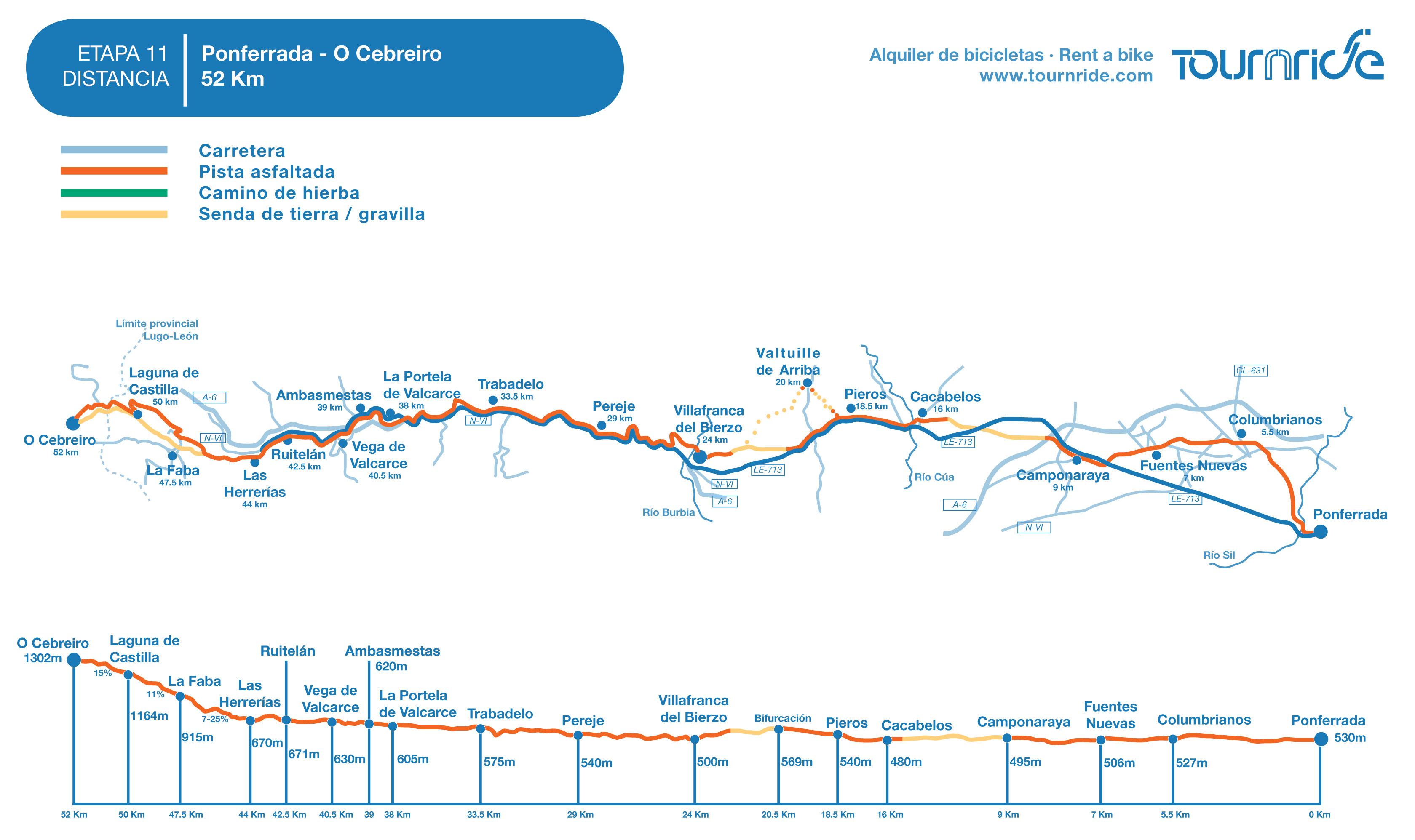
STAGE 11: FROM PONFERRADA TO O CEBREIRO
Erea FabeiroFRENCH WAY BY BIKE
- Distance to Santiago: 202 km
- Distance for stage: 52 km
- Estimated time: 5 – 7 hours
- Minimum height: 480 m
- Maximum height: 1302 m
- Route difficulty: Muy alta
- Places of public interest: Cacabelos, Villafranca del Bierzo, O Cebreiro
- Itinerary map: To see the whole journey on Google Maps click here
This stage has two very different parts. The first one includes from Ponferrada’s exit to Las Herrerías (km 44) and here the pedestrian route can be perfectly travelled on bike. We cross el valle del Bierzo by wide land paths, regional highways or concrete paths. We can also travel by highway, by the LE-713 until Villafranca del Bierzo and then by the N-VI and the NA-006A until Las Herrerías.
The second part begins in Las Herrerías, we have to shift our gears For those who didn’t go across the Pyrinnees, the descent by bike to O Cebreiro will be, without doubt, the hardest slope part you will have to deal with during the entire French Way. There are different signs for cyclists because of how hard some paths can turn. The only time when we recommend going on the traditional way is if you’re an experimented cyclist. In general, it’s much better to do the whole journey on the road, firstly by the CV-125/1 until La Laguna and later by a asphalt track that crosses the border by a higher height than the pedestrian way.
Let’s shift gears and take it easy… Today we cross los Ancares!
PROFILE AND STAGE’S MAIN ROUTE
The exit at Ponferrada can turn a little bit long, like it tends to happen in cities. That’s why in Tournride, we propose a simpler variation on the road. Simply, we must cross el puente del Castillo (Castillo Bridge) and take the second exit in the Plaza Portales roundabout. Following the Asturias Avenue straightly, we will cross five roundabouts more and we will pass under the N-VI. In the roundabout, after the lower pass we turn left and that’s how we will get to Columbrianos. If you prefer going by the traditional Jacobean way, you must follow the green trace in our stage map.
Once we are in Columbrianos, we must turn to the left by a street that goes out obliquely right before the pedestrian pass crossing the highway in the midpoint of town.
We keep on moving forward by asphalt tracks until we get to Camponaraya (km 7). Moving straight by the highway that traverses the town, we will pass by some industrial ships and, after crossing a roundabout placed there; we must take a concrete way to the left, leading to the end of the highway, next to the location of a wine cellar.
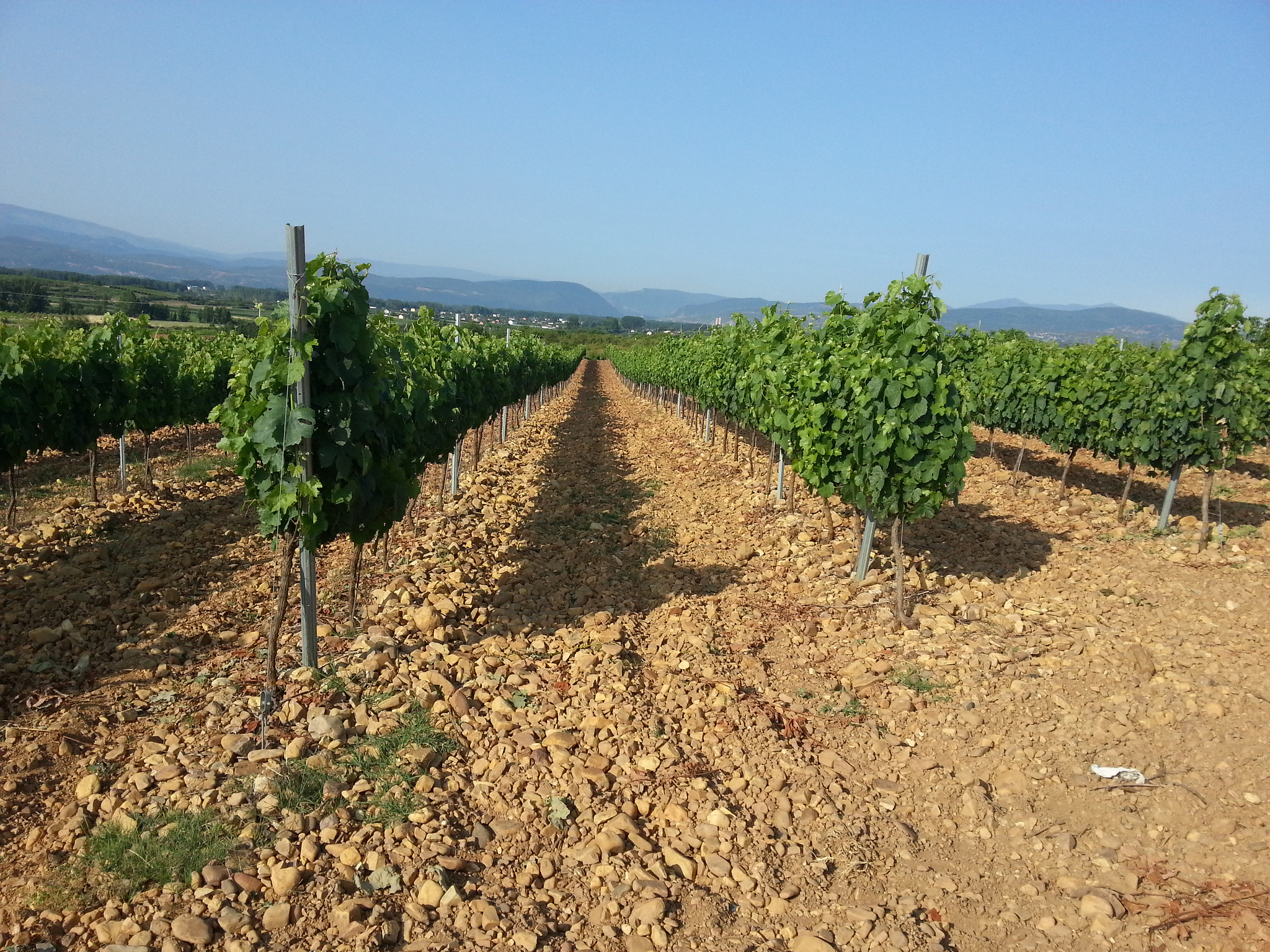
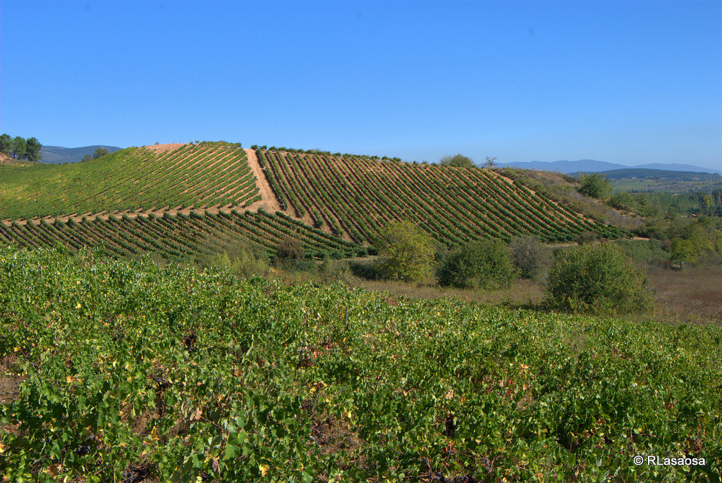
In a really light slope we continue moving through that concrete way, leaving a resting area behind to our left. We cross the A-6 by an upper pass and, after we go through a nice stretch of nearly 3 km by a wide land track between vineyards.
That’s how we arrive to Cacabelos (km 16), that we cross from East to West in order to go out by the stone bridge over the Cúa River. The bridge takes us directly to the LE-713, which we will follow in a light slope until getting to Pieros, small town located at the right of the highway.
We continue going by the LE-713 after exiting Pieros and in about 2 km, the road is filled up with mixed signs. Some of them actually indicate there’s a fork to our right and the others suggest us to go straight. They are two different options to get to Villafranca del Bierzo:
- If we continue going to our right we keep on moving in a slope by a asphalt way during 300 meters, so we can change later to a wide land path to the left. This profile is quite stretched out, with some little “jumps” though we arrive to Valtuille de Arriba and, from there, we go back in a southwest direction by land and gravel paths until arriving to Villafranca del Bierzo.
- If we go straight we will go through the LE-713 during 2 km in a negative slope, until arriving to a detour exiting to the right in a path form (pay attention in order to see it, it has no indication sign!). After 1, 5 km by this path we will get to the junction point of both ways that enter to Villafranca del Bierzo.
Both options can totally be travelled on bike. The first one changes the highway to a more natural landscape, but the profile is not that homogenous and it has a land surface. By highway, we make 2 km in a tick until the detour, due to how low is the height we don’t even have to pedal that much.
In Villafranca del Bierzo (km 24) the stage’s dynamic changes a lot. The profile continues on being very reasonable until getting to Las Herrerías (km 44) but we don’t go through secondary ways or paths anymore, except we go through the N-VI. The pedestrian way goes by a small path to the left of the asphalt road, but we can go by the shoulder. The N-VI doesn’t have much traffic nowadays, because the A-6 is the most circulated way..
In fact, the A-6 also will join us during the entire journey until the ascent of Los Ancares. We will cross it several times underneath its huge viaduct. We pass by four populations on our road by the N-VI: Pereje (km 29), Trabadelo (33,5) and La Portela de Valcarce (38). After passing by the big service station of La Portela de Valcarce we take the detour exiting to the left of the N-VI which indicates the location of “Vega de Valcarce”. We leave to our right the national highway and we take the regional one (N-006A) that passes by right at the edge of the Valcarce River.
Following the N-006A we pass by Ambasmestas (km 39) and Vega de Valcarce (40,5). The regional highway flows into the N-VI again and it’s there where we enter to Ruitelán (42,5). After crossing Ruitelán we continue moving for 200 meters more by the national highway, but after a couple of curves we can see already the signs indicating the detour to the left by the CV-125/1, where we can enter to Las Herrerías.
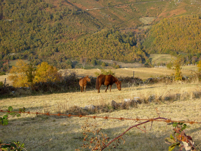
Let the good part begins! Let’s put up our biggest pinion and the smallest chain rings and we prepare ourselves to deal with the hardest part of the French Way, along with el cruce de los Pirineos (Los Pirineos crossroad). One thing is certain, the whole landscape of the stage will be forever in your memory, it’s a natural environment that shows off different shades in each time of the year.
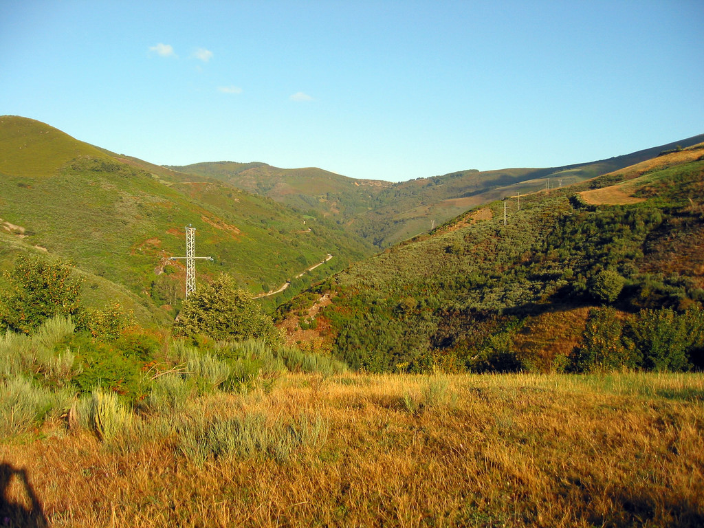
By the CV-125/1, a good asphalt track, we start ascending from Las Herrerías with slopes around 10%. In 2 km we will arrive to a point where we will see a painted track indicating the different signs for pedestrians and cyclists. We must keep on going straight without taking the land path. Our journey is longer but with better surface and, you may not believe it, but it has less pronounced slopes than the pedestrian one.
Following the highway, with slopes between 7 and 25%, we get to a point where the highway forks. Here we must choose if we want to keep forward by entering to La Faba (km 47,5) or changing course to the right in order to go directly to La Laguna (km 50). Keep on mind that if we decide to go to La Faba later we must use the pedestrian path to get to La Laguna, it’s more bicycle than the first one but narrower, with a stony surface and mid slopes of an average of 15%. Only icons like John Tomac can go up the entire road without getting off the bike!
Once we are in La Laguna de Castilla we say goodbye to Castilla and León, since this is the last town we will visit in this community. Maybe that’s why they have marked it on its toponymy!
At the exit of La Laguna the Jacobean signs indicate that we must follow a path going out to the left of the asphalt track. Pedestrians go through the last 900 ascending meters by this track until getting to the provincial border with Galicia, marked by a big milestone with the Way’s insignia. As far as it goes, the path is really wide, but the surface is complicated. It’s way easier for the itinerary to keep straight by the asphalt track. If we want to see the border’s milestone we can leave our bikes and use a small 100 meters road to descend the path and actually get to see it, and going up again right after.
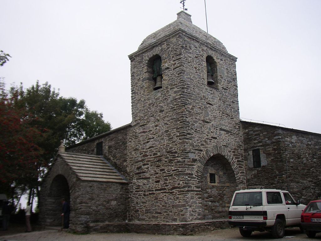
After passing this point, we are at only 1 km away from the end of our stage: O Cebreiro. This lovely and traditional town welcomes us by offering the best reconstructive soup in the world. If Popeye would have known about the “caldo gallego” he would have never tried spinach, ever!
PRACTICAL ADVICES
- Ponferrada is the starting point of the way for many cyclists; it’s the minimal distance to cover to get the Compostela! If you decide starting your way in Ponferrada, we help you getting there:
- Bus: Ponferrada is pass point of the A-6; the freeway connects Galicia with Madrid. It’s a very important point of vehicular traffic, so we won’t have any trouble on going by bus. To see all Ponferrada’s connections you can look up Checkmybus, although the company that offers more schedules and itineraries is Alsa.
- Train: Train: There are several train connections, because it’s a very important railway junction. If we want a higher speed we have to go to León, but you won’t have any trouble on finding a good route. The best thing to do is look up Renfe webpage.
There isn’t any airport in Ponferrada, the nearest one is located in León, Do not forget you can also use companies such as Blablacar
to share a car.
Besides, you already know that in Tournride we leave your bikes, the previous day at the beginning of your trip, in your lodging back in Ponferrada (or in the SEUR office, it’s here here but you must remember it’s close during weekends). We can also take your left bagage so it will be waiting for you at the end of your way, so you won’t have to carry with extra weight!
- The pedestrian exit of Ponferrada can be a little complicated (green route in our Tournride map). We recommend following the itinerary we have designed in order to make it simpler and that we have included in the red route.
- A Jacobean path starts in Ponferrada and that has been officially declared El Camino de Invierno (The Winter Way) in 2016.. Due to how hard the weather conditions are in the area of Os Ancares and de Lugo, this itinerary is an option to enter to Galicia when it’s really snowing. It goes in a south direction and enters by Ourense, going through the wonderful area of la Ribeira Sacra. It connects with the Vía de la Plata (that starts in Sevilla) in A Laxe, very close from Santiago de Compostela.
- If you do this route in summer, keep on mind that from Las Herrerías you won’t find any type of service until arriving to La Laguna de Castilla, because probably you won’t pass by La Faba. It’s very important to take water with you during the ascent!
- This stage is travelled the majority of time by national or regional highways. This helps us to keep a good speed without any type of danger, because they don’t have that much vehicular traffic. Even though, we always recommend taking the appropriate safety signs and taking the preventive measures needed.
- Here’s a summary of the recommendations to climb up the O Cebreiro on bike: 1) 1) Pay attention to the itinerary for cyclists that we have marked on the mapwhich it’s different from the pedestrian one.
You must ascend really slowly; there isn’t a steep slope where we can go slow so if we force it too much at the beginning, the end may turn really agonizing. If we maintain a constant ascent, we will arrive without any trouble.
- O Cebreiro is a very small place for the end of the stage. Even though it has a lot of services for pilgrims, you may find a lot of people in summer. If this is the case, you must know that in Liñares (3 km more following the same way) there’s a shelter. It doesn’t have many squares, so if you want to make sure you can go up to Piedrafita do Cebreiro. It doesn’t belong exactly to the French Way but it has way more services and it’s located in only about 3, 5 km more.
DETAILED ITINERARY AND HISTORIC-ARTISTIC PATRIMONY
In this stage we will combine the journey by natural landscape of extreme beauty such as El Valle del Bierzo and the ascent to Os Ancares, with a town pass with a lot of charm and Jacobean patrimony, such as Cacabelos or Villafranca del Bierzo, “the little Compostela”.
Meanwhile, we will also visit several rural villages where people, gastronomy and popular architecture will start to change gradually, leaving the Castilian roots behind, in order to be more similar to whatever Galicia holds for us.
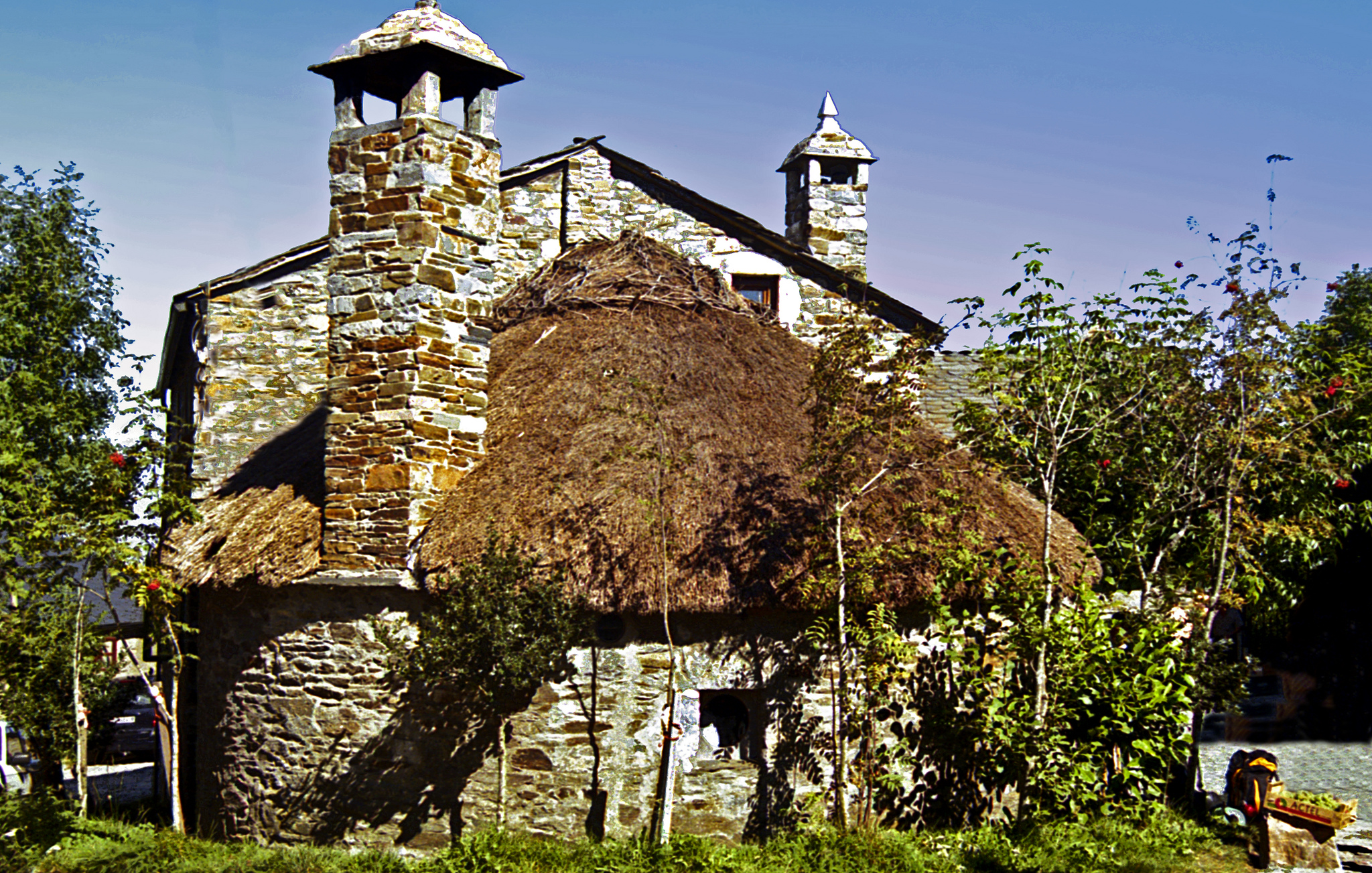
We end up in O Cebreiro, a town where, according to the legend, the Santo Grial is guarded, a very important symbol placed in the Galicia flag. In O Cebreiro we will surely find a place to rest between its big pallozas and wonderful landscapes… Everyone wants to enjoy the sunsets and sunrises!
Welcome to Galicia, we are only 150 km away from Santiago!
FROM PONFERRADA TO CACABELOS… BRIDGE BY BRIDGE, WE LET OURSELVES GO BY THE CURRENT!
In order to leave Ponferrada we have two options. The easiest one is going by Puente del Castillo and once we are at the roundabout we take the second exit to continue going forward during 5 roundabouts more. After passing under the N-VI we see another roundabout and, turning around it to the left, we enter already to Columbrianos.
This is not the traditional route and, therefore, it doesn’t have the proper signs. In Tournride we propose this way because we know that exiting a large city can be a little confusing on bike. But, if you prefer the exactly Jacobean way, we also show you how to do it.
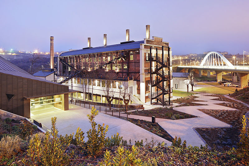
The traditional exit goes across the Puente de la Puebla and later changes course to the right by the Av. Huertas del Sacramento street, that ends up in a roundabout. We turn to the right and we cross the next roundabout, leaving to our right the Museo de la Energía (Museum of Energy).
The also called “La Fábrica de la Luz” (“The Light Factory”), Museo de la Energía is rather an educational and scientific space about the energy production. It’s located at the building where the first thermal power plant was built in all Spain. Years later, a research proved that during the opening ceremony in 1949, an attempt of murder took place with the purpose of killing Franco. In the 70’s the plant shut down and another one was built called Compostilla II, right next to the Sil and so close to first one which is still running today.
We leave the museum to the right, and we turn left around the roundabout so we enter to Compostilla. Although we can see signs of previous habitat, it actually came up out of the houses construction by Endesa for the thermal power plant workers. The name derives from Compostela, which proves it’s a Jacobean pass. A parish church is located at the town’s center that was built during the XX century and it’s surrounded by a park.
Going out already from Compostilla by the Cabo de Finisterre street, we cross the N-VI by an underground pass and later we change course to the left in order to get to Columbrianos. In the Real Street we will join pilgrims that have decided going out on bike from Ponferrada by the simpler route that we proposed in Tournride.
Columbrianos is a location with near 1400 people dedicated mainly to agriculture, especially flowers, wine and lettuces. The way doesn’t cover the entire locality, but actually changes course to its urban center to keep going to the west by the San Blas Street.
By a concrete track between cultivation lands we pass by Fuentes Nuevas and, in only a few meters, we get to the main Street of Camponaraya (which connects to the LE-713).
Camponaraya is the result of the two different towns union: Campo and Naraya, the latter being the oldest. They got united in XV century, when Naraya already had pilgrims’ hospitals. Following the main street we cross a roundabout and in the next one, we must take a concrete street that goes out by the left, right next to a wine cellar. We go up in a medium slope until getting to an upper crossroad of the A-6 and we flow into a comfortable land track quite wide, among vineyards.
The environment’s change is really nice, we leave the traffic behind and we go all over really nice vineyards from Bierzo. The way can go up and down several times, but it’s soft. We cross the highway with caution and by a concrete track we enter to Cacabelos.
Cacabelos (km 16) is one of the biggest centers we will visit today. We leave to our right the headquarters of Consejo Regulador de la D.O. of El Bierzo and going by the Santa María Street we enter to the monumental enclave, which by the way its neuralgic center is located at the right of the Cúa River.
Even though there are few remains proving that there were some kinds of settlements from Paleolithic times at the river’s shore, the foundation of Cacabelos that we know today has Roman origins. It was called Bergidum Flavium, although after the Empire defeat and the disappearance of the Visogoth kingdom, the territory was almost uninhabited. In the X century the town was mentioned for the first time with the name of Cacabelos, although the origin of its toponymy is not clear yet.
Cacabelos has the historic curiosity that from the XII until the XIX century it was under the jurisdiction of the archbishop of Santiago de Compostela. Before that position belonged to the diocese of Astorga, but in 1108 Diego Gelmírez, archbishop of Santiago and big promoter of the cathedral, ordered to build the church of Santa María en Cacabelos, which made the bishop of Astorga angry because he was messing with his territory. At the end, the king admitted that Gelmírez was right… At that moment the archbishop of Compostela had a lot of power!
The church of Santa María is still standing and is located right next to plaza mayor, at the town’s center. It still has the Romantic apse, but the rest is from C. XVI though. The tower, quite impressive in the middle of the facade, is from the XX century but it was built according to the Romantic shapes.
At the exact Santa María Street we will also pass by the chapel of San Roque. The temple was dedicated to this Saint in the XVI century due to the big epidemic disease that Cacabelos suffered at that time, because apparently this saint had protective properties of the disease. The temple includes the Museo parroquial de Cacabelos, which exhibits sacred art from XVIII century.
The pedestrian Street flows into the bridge over the Cúa River. There are proofs indicating that in the medieval times there was already a bridge located at the same place, which made Cacabelos an obligatory pass in Camino de Santiago.
After crossing it we keep forward and we leave the municipal shelter to our right. It has a curious configuration because it is organized in two-people rooms at the yard of the church of la Virgen de las Angustias, surrounding completely the temple.
We leave Cacabelos behind following the LE-713 in a positive slope. We have passed the first 16 km of the stage between the Ponferrada Bridge and the one of Cacabelos, between vineyards already we will go to Villafranca and, later, the Valcarce River’s shore will guide us directly to the border with Galicia… We are almost there, pilgrims!
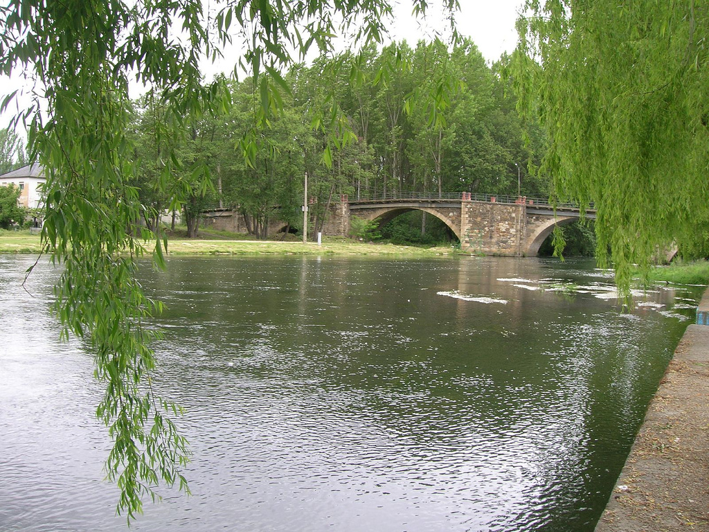
FROM CACABELOS TO VILLAFRANCA DEL BIERZO, “THE LITTLE COMPOSTELA”
After 2 km uphill, we get to Pieros, a little town located at the highway’s right. Going out town, only 200 m after, we see a detour to the right and several painted signs in the highway.
Due to how the traditional way follows the course of the LE-713, which for walkers can be quite uncomfortable and dangerous, this alternative way has come up. It gets lost to the North, passing by Valtuille de Arriba, and later it connects again to the traditional way before entering to Villafranca.
Both ways are completely bicycle; the distance difference to cover is only 1, 5 km. The one going through the detour is longer and, therefore a little harder. It continues uphill during a few meters and then it goes through land and gravel paths in a profile full of intermittent and soft leaps. The highway one is much simpler, because after the detour the LE-713 course continues downhill during 2 km, in order to take a path to the right where it connects with the alternative way.
A few meters after joining both ways, the land path turns into a concrete track that we take to enter to Villafranca del Bierzo. This places owes its birth and development to El Camino de Santiago and its proximity to Galicia (which was part of it for a long time), this makes its traditions and popular celebrations leave the Leon roots behind and get more familiar with the ones from Galicia.
Since la orden de Cluny (The Cluniac Reforms) created a monastery in the XI century between these mountains with the purpose of helping pilgrims, other ones started to do it too and the place ended up having a lot of hospitals and services: drugstores, temples, leprous hospitals, stores, etc. In fact, here were settled a lot of Frank traders and businessmen that’s where its name comes from: “villa francorum”. The Monks of Cluny also were the ones who started planting wine in this area, which it’s a characteristic and distinguishable product of Bierzo.
By just entering to this town, we see at our left the church of Santiago. Since XII century, this temple has the privilege to be the only one, along with the cathedral of Santiago that can grant the Jubilee. Sick pilgrims who don’t get to arrive to Santiago, they will get forgiveness here and their pilgrimage will be considered finished, that’s why they call Villafranca “the Little Compostela.”
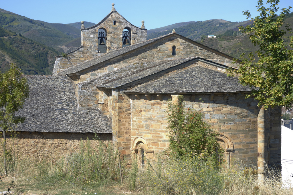
The church is dedicated to the apostle and its architecture is simple: a single ship covered with a cannon vault and complete with a semicircular apse that only opens up in three bays. This simplicity contrasts the huge sculpture’s quality of its covers, especially the one of la Puerta del Perdón (The Forgiveness Door). Just like the one from the cathedral of Compostela, this door only opens two jubilee years for sick pilgrims who go across it. One thing is certain, it’s necessary to have covered 150 km as a minimum to get the indulgence.
Following straight by the pavement street, with an uncomfortable surface for cyclists, we find the front of Castillo del Bierzo. This quadrangular construction, mainly made of masonry, was built in the XVI century and was conceived as a fortified palace, actually. It has four towers, where the family’s blazons are sculpted.
Following by the highway we border the castle and we turn right. Right after, a sign indicates the detour to a pedestrian slope that takes us to the historical center of the town.
By this pavement street we pass by the front of the City Council of Bierzo and the Convento de los Padres Paúles. This religious people came to this convent in 1899 (before it was inhabited by Jesuits) but 7 years ago they abandoned the building due to the lack of demand for their seminarian studies. Since then, it is carried by the City Council of Villafranca. The Museo de Ciencias Naturales is located at one of its sections, which has dry specimens of different species, mainly birds. A part of the building runs also as a shelter for pilgrims.
We continue by the Alameda Baja street, leaving the nice gardens of the avenue to our right. After taking the curve to the left we see the la Colegiata de Santa María de Cluniaco. This monumental building is the result of the extension superposition from the XII century, when the Cluny monks settled down in this valley between mountains to found an attention place for pilgrims, which was the ground of Villafranca del Bierzo.
La Orden de Cluny, that took place in France, created a monastery net in order to foment pilgrimage and help walkers on their trip to Santiago, with the consent and support of the crown. The net of big centers that they created, turned Jacobean pilgrimage into what it is today and they worked as diffusing centers of the romantic, getting for the first time that an architectonic style was used in the entire Europe.
There’s nothing left from this initial Romanic Factory in this convent, because in the XIV century, pilgrimage entered in a deterioration moment and the place was abandoned. Two centuries later it was decided to turn the monastery into a collegiate church, rebuilding it entirely. Therefore, the monumental building that we see today is from the Renaissance times, being really noticeable the variety of the coverings used in the different spaces of the temple.
Leaving la Colegiata behind, we keep on moving by the Street and we go across the bridge over the Burbia River, going out already of Villafranca del Bierzo.
WE FOLLOW THE N-VI TO THE SHORE OF VALCARCE AND WE ARRIVE TO AT LOS ANCARES FEET EN LAS HERRERÍAS
At the exit of Villafranca the pedestrian way follows the course of the N-VI by a concrete path. For us it will be much comfortable to follow by the highway shoulder. We will cover the kilometers quickly, besides the profile is very simple! Since the freeway was built, the national highway doesn’t have that much traffic and goes through the big mountain slopes of Bierzo, quite a green sea. In autumn we can see how trees are painted with different colors, from yellow to red and green… A true show of nature!
At the exit of Villafranca the highway becomes a curve to the left to connect with the N-VI. Right in the junction point, to the right, the artist Raquel Montero developed at the end of 2016 her artistic intervention “El bosque azul”. In an area that has been burned during 2015, she painted the dark trees with a strong blue color in order to turn a desolate landscape into something magical.
Once at the N-VI, we continue by the right apse during 3 km to get to Pereje, a small town that has a bar functioning. In order to enter to town we must change course to the entrance, if not we will pass it by.
We continue during another 4, 5 km to get to Trabadelo, a town with nearly 400 people. If we hear someone talking, we will realize of how close we are from the border, because a lot of them speak Galician. This part of Bierzo has its story very connected to Galician, which you will really notice each time we get closer to the independent community of the apostle.
At the exit of Trabadelo you must have caution, because once we pass under the viaduct of the A-6 we have to take a land path that takes us back to the N-VI. If we go too fast we will pass over the detour!
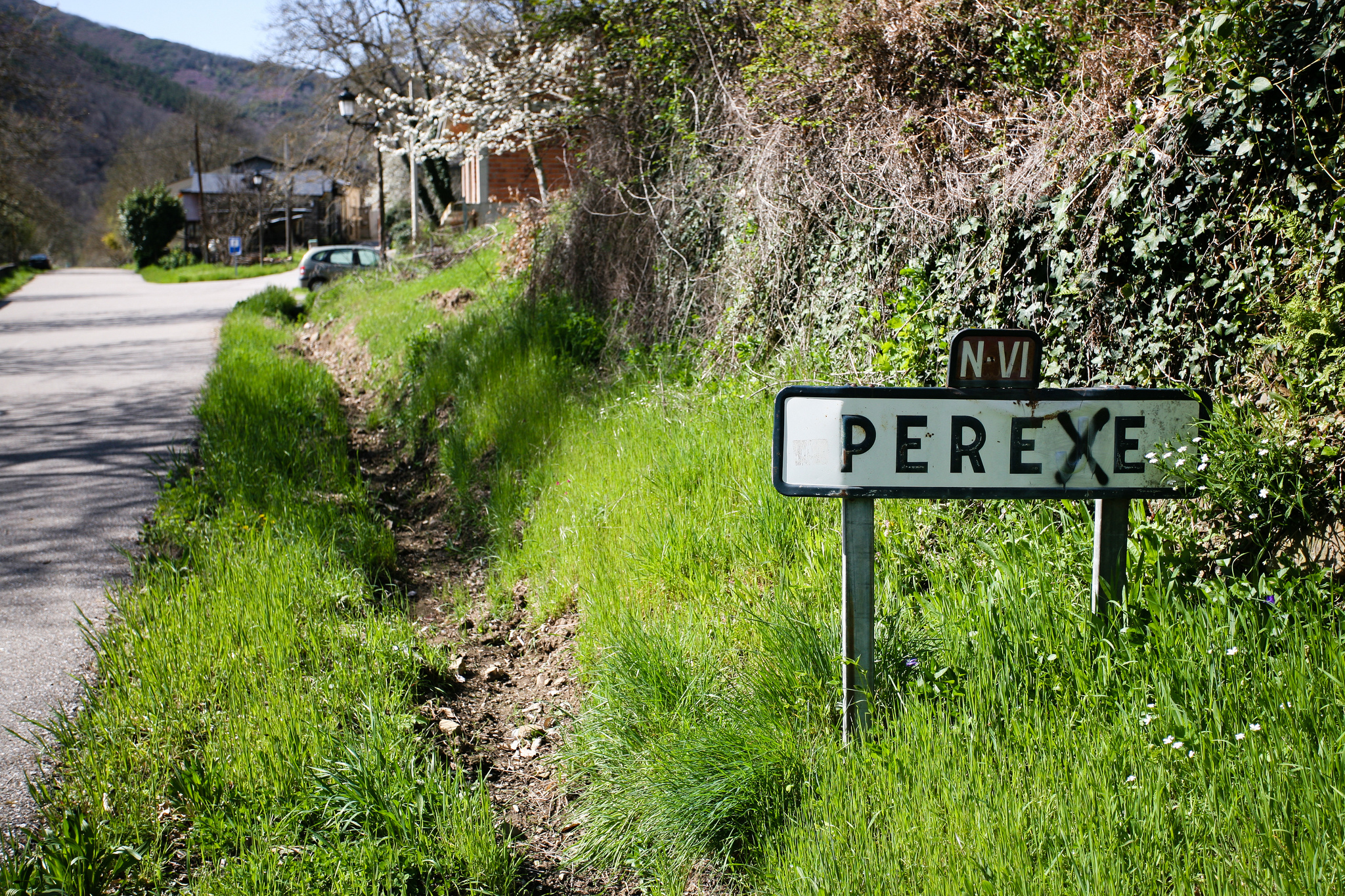
Once we are again at the national highway, we cross again the viaduct of the A-6 and pass by the front of the service station of Valcarce. This is a mythical stop place for truck and regular drivers on their way from Galicia the Spain’s center, it has opened 24 hours a day for years for everyone who has stopped there. At the lower part it has a store selling typical products of Bierzo, where we can buy true delicacies…
After passing by the service station we see at the left of the N-VI La Portela de Valcarce. This town is called like this because in the past it used to function as some kind of “door” that used to be opened or closed to travelers with the purpose of making them pay (or not) a tax for the owners of those lands. Alfonso VI ended up deleting these prices, seeing that there were a lot of abuses, because this point was a key to the communication of northeast with the rest of the peninsula.
We go back to the N-VI and, a few meters after, we must pay attention. We have to abandon the N-VI, taking the detour to the left which indicates “Vega de Valcarce”.
We change the national way to the regional one. By the N-006A, a highway less transited that follows the course of the Valcarce River, we continue until Ruitelán passing by several Jacobean towns.
The first one we visit is Ambasmestas, a relaxing settlement that has a pickle factory and a very old cheese factory, from the end of the XIX century. Then, we keep on moving until Vega de Valcarce. This town will be the biggest one we will find until the end of our stage. If we haven’t bought anything to eat or we don’t have enough water, we recommend you to stop at some of those stores in order to buy something.
The town of Vega de Valcarce is flanked by two castles, being the one of Serracín the most important one. It’s in a higher height, between mountains that come up at the shore of the Valcare River. The names come from the count who held it, his name was Sarracino. It was surely built up in the X century, even though the majority of what is left today is from the XIV and is not entirely preserved.
In Vega de Valcarce there’s also an old mill in the river, which has been restored not that long ago. It’s from the XIX century and has a single floor. It still preserves the machinery that used to move thanks to the water current running under the building.
We go out of Vega de Valcarce and we go by the concrete track until flowing into the N-VI. In a few meters away we will get to Ruitelán which has the highway as a main street. The church of San Juan is located in this street, with an initial construction in the XIII century but restored in the XVIII.
The most special thing about the church of San Juan is the chapel of San Froilán, to the right of the main. According to the legend, this saint finished his religious studies in the IX century and had a spiritual crisis. He decided to retire to a cave in the mountains of Bierzo in order to live as a hermit and, as a matter of fact, people believe that the location of the chapel in the actuality is where his natural cave was before. After a long period of isolation, San Froilán decided to prove his conecction to God filling his mouth with hot embers. Seeing that he didn’t get burned, he decided to finish his retirement and dedicated a lot of years to preach by the whole area of Bierzo and Galicia.
We leave Ruitelán behind by the N-VI and, in about 900 meters, the highway becomes a really pronounced curve to the right. Before arriving, we must abandon the national way by a concrete track that shows up to our left, following the river shore. In less than 500 meters we get to las Herrerías… This is our starting point to ascend O Cebreiro!
LET’S GET INTO LOS ANCARES…. WE HAVE TO ASCEND O CEBREIRO ON BIKE
Las Herrerías is a nice town, with a long configuration, that is located at the foot of the mountains, at the left shore of the das Lamas River. We enter to the town crossing the river by a bridge with Roman origin of a single arch that has been restored not that long ago. Las Herrerías owes its development and its not-so original name to its smith tradition. In the past there were four forges in this place that used to work with metals from the nearest mountains, which made the place an important focal point for commerce. In fact, one of them has been preserved with all its tools in a building named A Casa do Ferreiro.
At the exit of Las Herrerías we notice how the slope increases in a reasonable way. We start ascending now! The surface joins us as well; it’s a good concrete track (CV-125/1). At the exit of town, the track forks in two and we must follow by the right, directing to “La Faba”. One kilometer later, the pedestrian way and the bike one gets divided, with different painted signs on the ground.
We must continue by the concrete track that will keep increasing the slope. There are no steep slopes or high plateau on the ascent. It’s constant until getting to la Faba, the inclination is the only thing that varies, with parts between 7% and 25% of slope. The best thing to do is to adjust pinions and chain rings and try to keep on a slow speed but constant in the ascent. If we force too much the first kilometers, maybe at the end we will have to get off the bike.
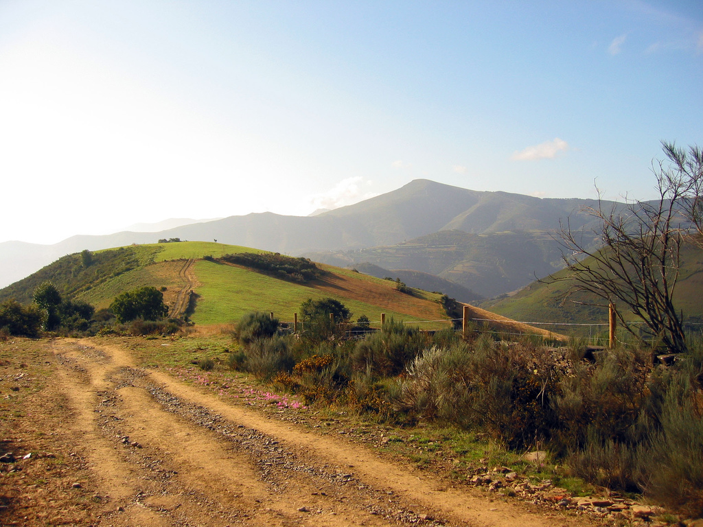
Not that many cars go across this highway, so the traffic shouldn’t get in our way. We go up during 2 km, until a detour appears in a pronounced way to our right. The signs on the concrete recommend the cyclists to turn right in order to go directly to La Laguna without stopping at la Faba, and here in Tournride we advise you to do the same.
If you avoid the recommendations and keep going forward, a pronounced curve will take you to La Faba and, from there, the only way of going out is following the pedestrian paths or going back to us until the same point of the detour. The pedestrian path is inclined and with a dangerous and also very wide surface, so we will surely have to get off the bike and push it through.
If we take the pronounced detour to the right, we keep going up by the track CV-125/1. The slope gets slow softly, but the fatigue that we already have also inclines the balance to its way. In about 3, 5 km we arrive to Laguna de Castilla, last town of this community. We are at 1165 meters of height and we only have 2, 5 km left to get to O Cebreiro and entering to Lugo. If we want, we can enjoy the wonderful views in this small town of only 25 people.
Just by going out of la Laguna, a Jacobean milestone indicates the detour to a land and stony path that appears to the left. Although this time we don’t find different signs, we recommend going through the concrete track. The land track marking the border crossroad has a very bad surface, with big stones, and even though it’s way wider than the others, it doesn’t have any kind of handrails to avoid falls through the hillside of the mountain. If we continue on highway we will follow the same itinerary in a parallel way, but in a higher height.
After a couple of kilometers we get to the border. On the track there’s no signs at all, but there’s a small path that takes us to the pedestrian way, where there’s a huge milestone marking the provincial limit with the symbols of El Camino. If you want, you can get off your bikes to see it.
Only a few meters after, we finally enter to O Cebreiro. We will realize at this point of the radical change on landscapes, architectures and people that we have experimented in only one stage… Welcome to Galicia!

