STAGE 14: FROM MELIDE TO SANTIAGO DE COMPOSTELA
Erea FabeiroFRENCH WAY BY BIKE
Distance to Santiago: 51 Km
Distance for stage: 51 Km
Estimated Time: 5-6 hours
Minimum height: 250 m
Maximum height: 470 m
Route Difficulty: Medium
Places of public interest: Melide, Lavacolla, Monte do Gozo, Santiago de Compostela
Itinerary map: To see the whole journey on Google Maps click here
In this stage is very memorable the combination of sensations that are experienced when approaching the end of the pilgrimage, even more than the difficulties that are suffered or the places where you go through. The excitement of knowing that the Jacobean goal will be achieved gives us the strength to face the continuous changes of slope and road surfaceas well as the last climb of the French Way in O Monte do Gozo.
After leaving Melide, it is spent most of the time by paths and corredoiras in the mount. From Salceda (Km 25) the N-547 is interposed all the time in the route, crossing it several times and the road follows its course in some sections. From Salceda there is not much left, we border the airport and from Lavacolla (Km 42) we do not return to any mount or dirt path. We go up to O Monte do Gozo (Km 48) by asphalt and from there we go down to the valley where is located the Jacobean Cathedral: the apostle’s “Camp of the Stars” (Campus Stellae).
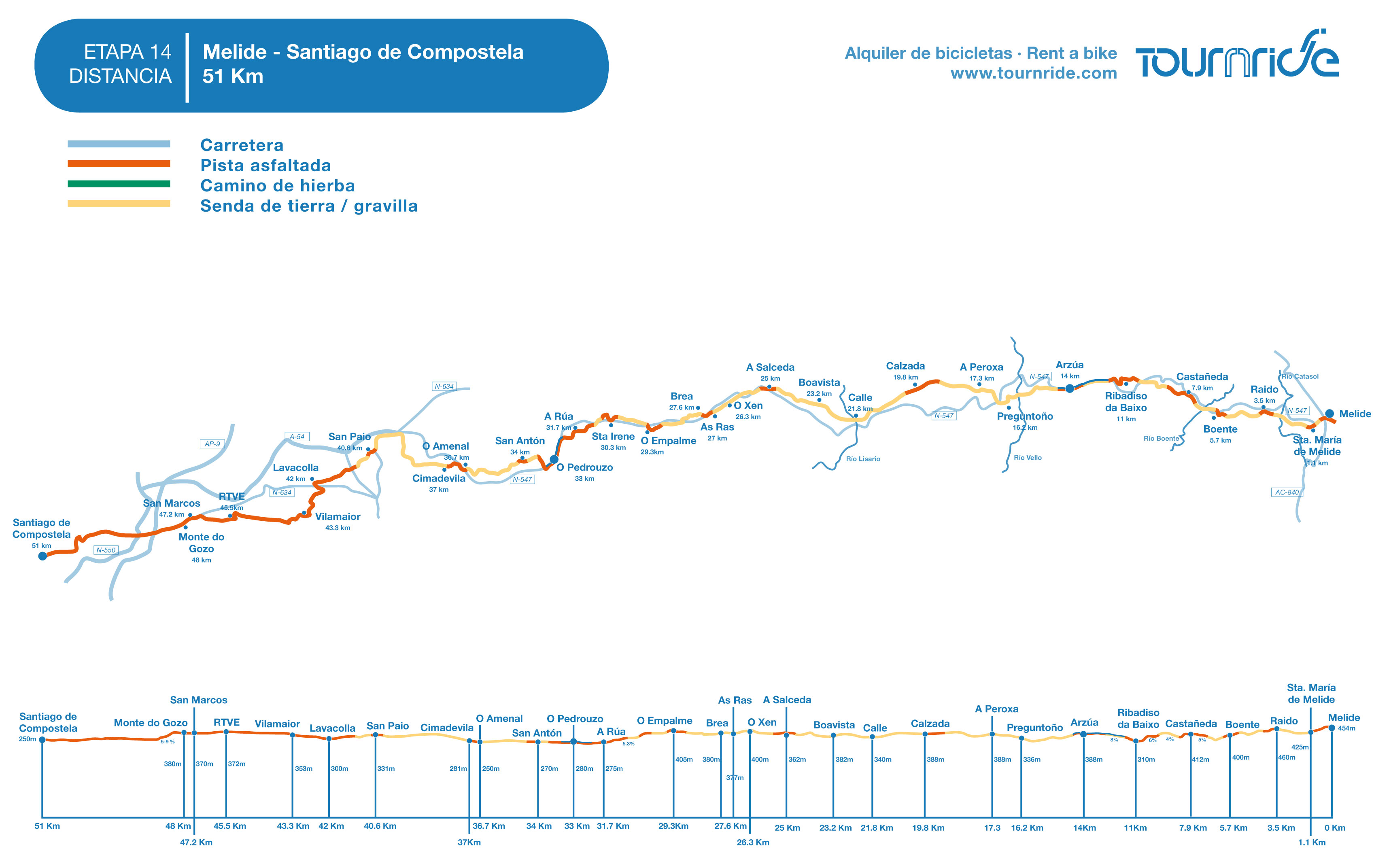
PROFILE AND STAGE’S MAIN ROUTES
This stage begins by running along long stretches of forest tracks between trees, with stops in small villages. The N-547 will be always close, crossing occasionally, but from Salceda (Km 25) it will interpose more and more in our way. From Salceda to O Amenal (Km 36,7) the road crosses about ten times on our route, five of them without a safe pedestrian crossing; so, extreme caution must be exercised. Even so, in many sections among crosses we will continue our way among trees, which brings the sensation of rural tranquility.
After passing O Amenal (Km 36,7) we start the ascent towards the airport fence, which we border by the north to continue towards Lavacolla (Km 42). From Lavacolla we take the last ramp of the French Way: the ascent to O Monte do Gozo (Km 48), the first place from which we will see the towers of the cathedral.
In addition to this range there are others that we will have to face in the journey: from Castañeda (Km 8) to the upper pass of the N-547 and the one that is between O Amenal (Km 36,7) and Cimadevila (Km 37 ), which continues until reaching the airport – but ends more narrowly. Anyway, the highest ramp – along with the ascent to O Monte do Gozo – will be the one we will find at the exit of Ribadiso de Abaixo (Km 11), which has an average slope of 8% that will take us to shoulder of the road.
Although these are the strongest differences in the level, we cannot forget that we are still in Galicia, which means that its topography changes permanently and its roads are the “legbreaking” prototype route. From here and up to A Peroxa (Km 17,3) the road will be especially a succession of ups and downs, which may be more or less pronounced.
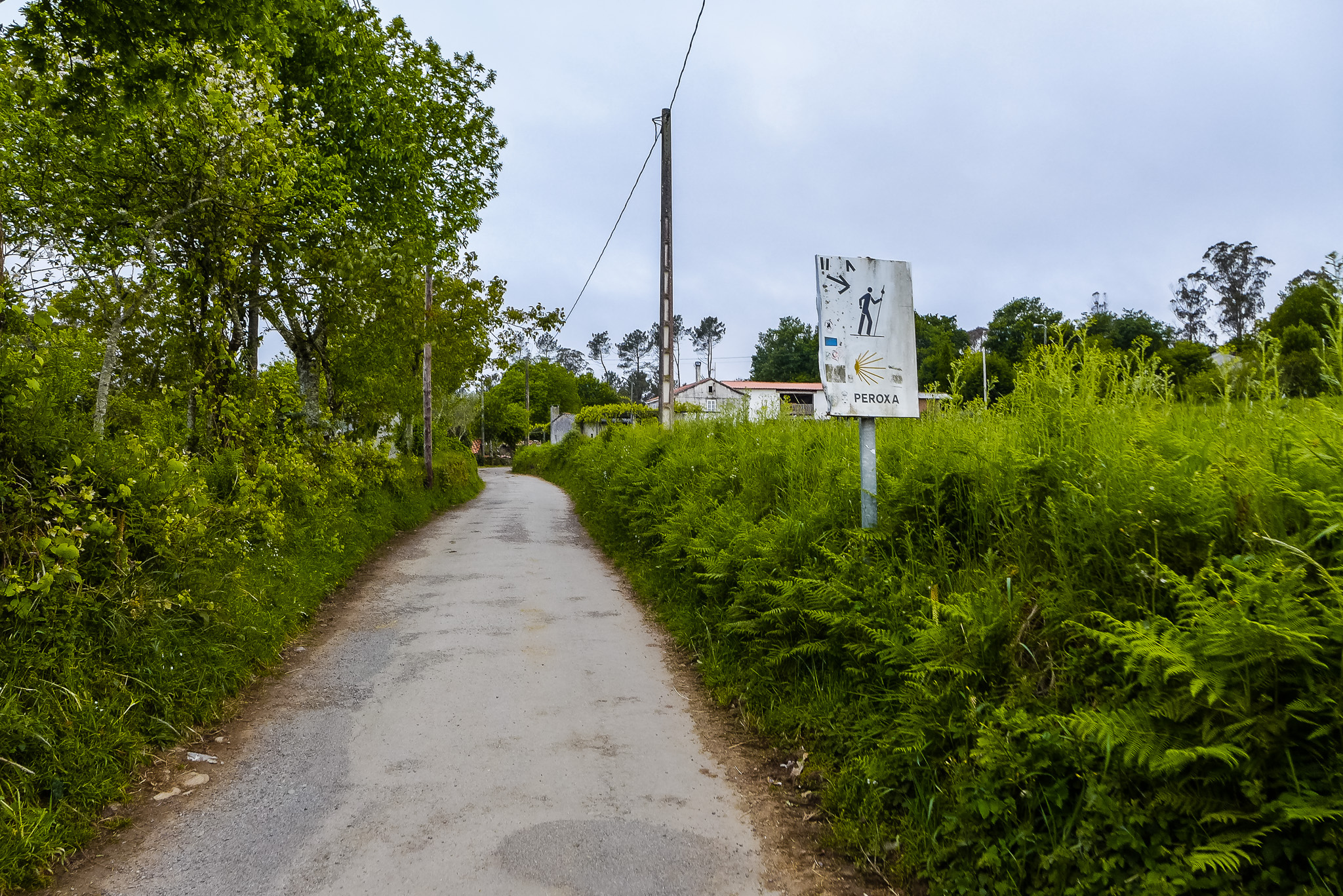
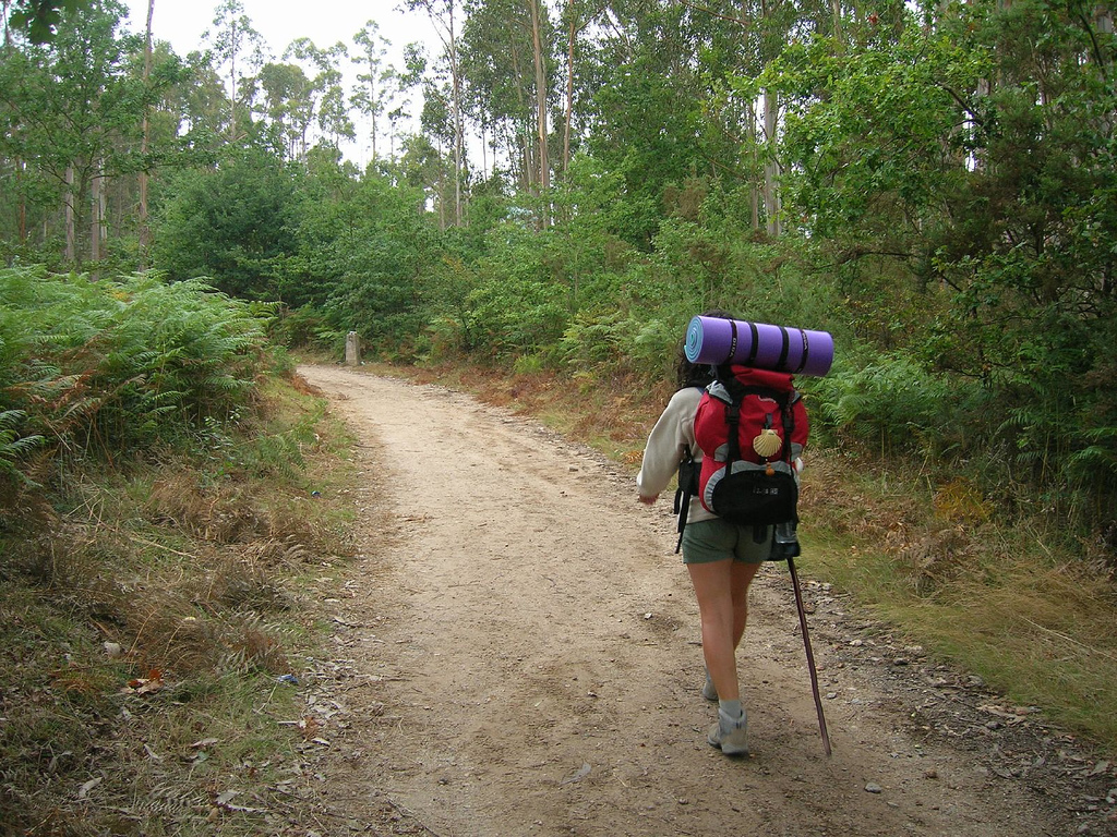
Anyway, the main difficulty we could encounter with is, without doubt, the mud. Many of the tracks that we travel are made of a very soft road surface, reason why when it rains they become a quagmire. Uncomfortable for walkers, it can be a torture for us. The truth is that if you do this route in rainy season you could only take the N-547, since there are no secondary or county roads that follow our route. Going for the national one would be a shame, because you won’t go through almost any Jacobean locality and you would lose the last rural immersion of the French Way. So, our recommendation from Tournride for this stage is to go by the pedestrian path during the entire route..
From Lavacolla we will only be traveling by asphalt – or cobbled path – to the cathedral. Until then, most of the roads will be dirt when going among mounts or gravel when they join small populations.
We must also take into account that at this stage many streams, brooks and rivers cross each other. Galicia is green because of its large amount of water! In general we will not have problem to cross them and we will only have to bring out our abilities when passing on Raido River (Km 2,5), almost to the exit of Santa Maria de Melide. A narrow granite walkway, in which you must pass in Indian file, helps to save the flow.
Finally, the entrance to Santiago can be a bit confusing, since it is quite the urban zone that we must cross. At the exit of O Monte do Gozo (Km 48), take the N-634 after avoiding stairs. By the left-hand sidewalk, or on the right-hand shoulder, we enter Santiago through the San Lázaro neighborhood, crossing several roundabouts and, in the third, we turn obliquely to the left. Already at the entrance to the Concheiros street, we continue straight on the pedestrian street of San Pedro and after a crosswalk we finally enter the monumental area of Compostela… We are at our end of the Camino!
PRACTICAL ADVICES
– Itinerary Recommendation: In this stage there are no county or secondary roads that follow the course of the route. The only options are to go on the N-547 or follow the pedestrian route. In Tournride we recommend to follow the Jacobean signage by the pedestrian route.
– In rainy season we can find the main difficulty of this section: mud. Many forest tracks are composed by a very soft road surface and therefore we will multiply our effort to advance, we will have to use short gear!
– The first 17 km to A Peroxa are a real “legbreaking” section. From there the road surface will be changing, but the variations will be generally less abrupt.
– Beware of crossings of the N-547 with footpaths, sometimes they are a bit dangerous. In the map of stage we mark with signs the crossings in which we must exercise extreme caution.
– In Santiago de Compostela there are three offices that you cannot miss:
1) The Pilgrim’s Office. Next to the Obradoiro square, in Carretas street nº33, is the reception office for the pilgrim. Here your credential will be sealed for the last time and they will give you the Compostela for free, the document with your name and surnames – in Latin – that certifies the fulfillment of the Jacobean pilgrimage. There is also the option of obtaining a Certificate of Distance (3 €), which shows where and when you have traveled, as well as the kilometers traveled. Here they sell tubes to save the papers (€ 2), but you will also find them in many of the souvenir shops of the city, generally at a much lower price.
Office hours: Open every day except 25th December and 1st January. From 1st November to 31st March from 10.00 to 19.00h. In Easter and the rest of the year from 8.00 to 21.00h.
2) The Tournride office. If you come to our office after picking up your credentials, which is 5 minutes from the cathedral, we will pick up your bicycle so that you do not have to worry about it anymore and we will give you the luggage that we have been keeping, if you have decided to use our luggage delivery service. Besides … we always like you to spend your time to tell us about your experience!
We wait for you in Laverde Ruiz street no. 5, from Monday to Friday we open from 10.00 to 14.00 and from 16.30 to 19.30; although if you come on weekend one of us will come to the office to serve youWe only ask you to tell us the time you will come, so that we do not have to be waiting in the office on holidays. You can write the day before to info@tournride.com or call us on +34 981 936 616 during the week. You can also press the option for Tournride Full Assistance on that number.
3) The tourist office. Although, as always, in Tournride we propose a walk to know the city that is end of stage and goal of pilgrimage, it never hurts to know more. The Galicia’s Tourist Office is located at Rúa do Vilar 30-32 and on the same street, but at number 63, there is the tourist office of the City Council of Santiago de Compostela.
– To leave Santiago there are multiple connection options, given the large number of tourists it receives, its strategic location and its condition of capital of the community. Renting bicycles with Tournride facilitates the logistics of your departure, since you will not have to worry about the packaging or the extra cost of sending your own bikes back home. So, carrying on only your suitcase, you can go from Santiago…
By plane.The airport of Lavacolla increasingly receives direct flights, both to different parts of Spain (Alicante, Barcelona, Bilbao, Ibiza, Madrid, etc.) and other parts of the world (Dublin, Geneva, London, etc.). In the page of Aena you can see them all. In Galicia there is also an airport in A Coruña and in Vigo, cities that are located less than 45 minutes by train and where you can find many more connections. In addition, for international flights it may be a good option to check the connections of O Porto (Portugal), airport, since sometimes flights can be found at a good price and from Santiago you can go directly to the airport by bus with Alsa.
By bus. From the bus station of Santiago, to the north of the city, there are connections with the rest of Galician cities or Spain, also there are some with other parts of Europe.
By train. The train station is not far from the center and on the Renfe website you can see all the destination options that are offered, which are many of them!
DETAILED ITINERARY AND HISTORIC-ARTISTIC PATRIMONY
Today will be a day to record in our memory … We will know the cathedral of Santiago! In addition to the Temple and the old city of Compostela, both World Heritage, we will have the opportunity to immerse ourselves for the last time in our way in the Galician countryside, passing among native trees and others coming from the antipodes – like the eucalyptus.
We will also visit religious heritage, some of them with very curious and representative remains as in the church of Santa Maria at the exit of Melide.
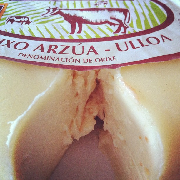
And, besides the historical and artistic heritage, we will make our mouth water with the gastronomic; especially in Arzúa. Here we can try another product with a Designation of Origin in Galicia, the Arzúa-Ulloa cheese, which matches perfectly with the locally produced honey or with the delicious homemade quince.
As we approach Santiago we will enter an increasingly urban environment, culminating with the first sight of the towers of the cathedral in O Monte do Gozo.
But above all, today will be a day of mixed emotions; in which we will realize how they face the joy of arriving in Santiago with the sadness of reaching the last point – not the end – of our Way.
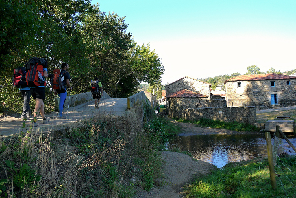
FROM ARZÚA TO SALCEDA IN A CONSTANTLY “UP AND DOWN”
The departure of Melide is simple, nothing has to do with others that we have already spent in big cities. From the central roundabout of the town we must head north, following the indications of the “Museo Terra de Melide”. Passing to the left side of the street we head towards the Concello. After passing the town hall we turn successively to the left and to the right and climb a small but intense ramp in the Main street. The arrows point to a dirt and gravel path with a lot of vegetation on both sides, which leaves us on the N-547.
After crossing the road multiple signs indicate the way to the church of Santa María de Melide (Km 1,1). This village has always been configured as a distinct entity of Melide, although today practically seems to be part of the main town. The church that appears to the right of the road is of a Romanic origin and is full of small details that deserve our attention.
Most of the building elements of the church of Santa María de Melide are decorated. In the archivolts we see chequered or small rectangles, as well as geometric motifs or some forms reminiscent of ancient Celtic symbols -triskeles, swastikas, spirals, etc.-. The chapiters are also full of carved pieces, we can see lions and beasts – whose meaning of protection and threat we talked about in
the previous stage– and plant forms.
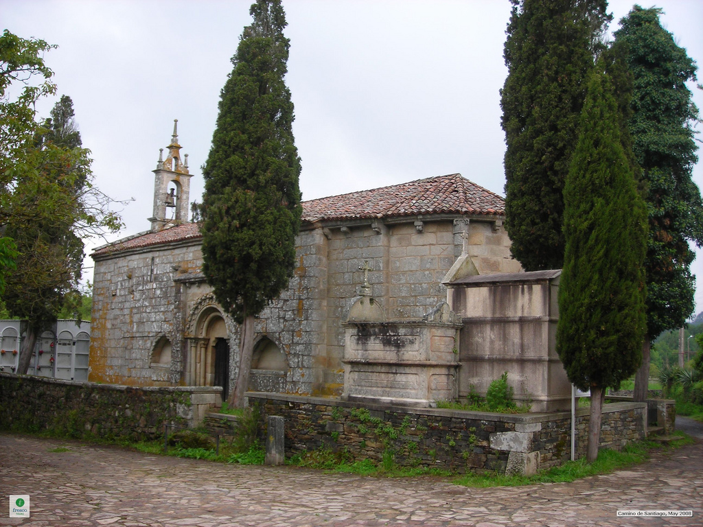
Inside the church there are two exceptional elements: a Romanic altar, decorated with small arches under which paint of different colors is preserved; and a metal grid from the 12th century which is kept in the modern sacristy of the temple.
And you maybe wonder… A grid? What value can a grid have? Well, although you may think that the value of the grid of Santa Maria lies in the artistic aspects of the beautiful spirals that form it, its greatest value is historical and sociological, since if we place it in its time, it tells us things about medieval society and his way of seeing life.
In the High Middle Ages (up to the 12th century) the church was the most important social gathering place. The temple represented in itself the social hierarchy and, therefore, each person had its space delimited according to gender, estates and progress in the fulfillment of the sacraments. The most sacred part was the apse, facing east, the place where the sun rises and represents the light and the divine. In this area only the priests could be, those who had “united” for their whole life to God. In the naves, the richest were in front and often separated women and men. At the foot of the church, on the entrance gateway, were those who had not been baptized yet – that’s why the baptismal font was there, without being baptized you could not step on the naves.
Therefore, walking from the entrance of the church to the apse was a representation of the path to God. Each sacrament allowed you to enter into a different part and also marked all the important moments of life, from birth (baptism) to death (extreme unction). In fact, in the absence of ID or passport, the social register was the books of the parishes!
The fact of being baptized or not left you inside or outside the social life, and it also prevent you to access to some jobs or being able to live in certain areas – Jews, for example, lived in different neighborhoods. The place where you sat at Mass indicated at what point in your life and society you were. To emphasize this many times, the spaces were delimited physically with bars or wooden structures. They were also used to “hide” to the congregation some of the most sacred moments, such as transubstantiation. In fact, in the Orthodox Church this is still done, separating spaces with large wooden structures with icons icons (religious paintings). In the Catholic Church the separation of spaces began to blur in Gothic, when light entered the temple and its philosophical conception changed completely. The separating elements were removed, proof of the social changes that followed with the emergence of cities and the bourgeoisie. Most of these grids or structures, which witnessed what it was like to live in a society of estates, were lost. But not this grid of Santa Maria, which is the only one that remains in all Galicia.
After this curious visit we leave the Santa Maria cobbled and we follow a footpath of gravel that in a few meters penetrates in a dense forest. We follow this dirt track in a continuous up and down among oaks, chestnut trees, pines and eucalyptus. As we proceed towards Santiago – and especially if we follow later to Muxia or Fisterra – we will realize how the eucalyptus, tree of Australian origin, is displacing the native Galician species.
This, in general, is due to this way of dividing the field in smallholdings – inherited among all the children – that is own of Galicia. Since the 1980s, many people who lived in the city inherited pieces of forest and ceded the exploitation rights of their land to Galician pulp and paper mills. Eucalyptus is an extra-fast growing tree that works well for paper chemistry, but which dries the soil a lot and expands and colonizes the surrounding soil. Little by little the eucalyptus has been displacing the Atlantic and riverside species, typical of Galicia, which need much more water and have a much slower growth, such as oak or chestnut.
Today many see eucalyptus as a plague and one of the biggest Galician environmental problems, while others support it as an economic engine and enhancer of the industry. The truth is that, although the Galician government continues to extend authorization to the pulp and wood industries to continue working, eucalyptus plantations are being extended in some Galician areas.
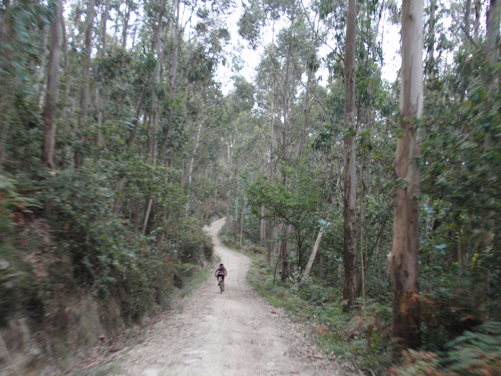
Among trees we cross a stream by a simple walkway of granite and reach the maximum level of stage (470 m) in the area of Parabispo. We left the forest to touch the shoulder of the N-547 in Raído (Km 3.5) and we entered again among the trees. In a continuous up and down we cross another section of forest until Boente (Km 5.7), town divided in two by the national highway.
Before crossing the road we will see a cruceiro and a fountain, called “de la Saleta”, , of which they say that its water has beneficial properties for health. On the other side of the national road is the church of Santiago, with Romanic origins but tremendously reformed in the 19th century – there is only one window and two chapiters of the 12th century. The image of Pilgrim Santiago that is conserved in the greater altarpiece draws attention.
We leave behind Boente along its cobbled street until we reach a path that, once again, is covered by the thick leaves of the trees. On this “legbreaking” road we cross the N-547 by a tunnel, we continue by mountain and soon we take a path that begins to gain height parallel to the national highway. In the upper part it is deviated to the left to enter Castañeda (Km 7,9).
The medieval pilgrims brought to Castañeda a stone they had collected in Triacastela, to be processed in their furnaces and to help the construction of the temple of the apostle. Leaving the village you by descend a path among pastures, first by asphalt and then by dirt road after a junction with another track. The profile is favorable until we cross a stream and begin an ascent to a superior path to the N-547.
After passing the national road the profile is again downhill until entering Ribadiso da Baixo (Km 11). As it explains its name, this small locality is in the riverside of the Iso river, crossed by a simple bridge of a single arch, in which the vegetation has colonized the space of the stone.
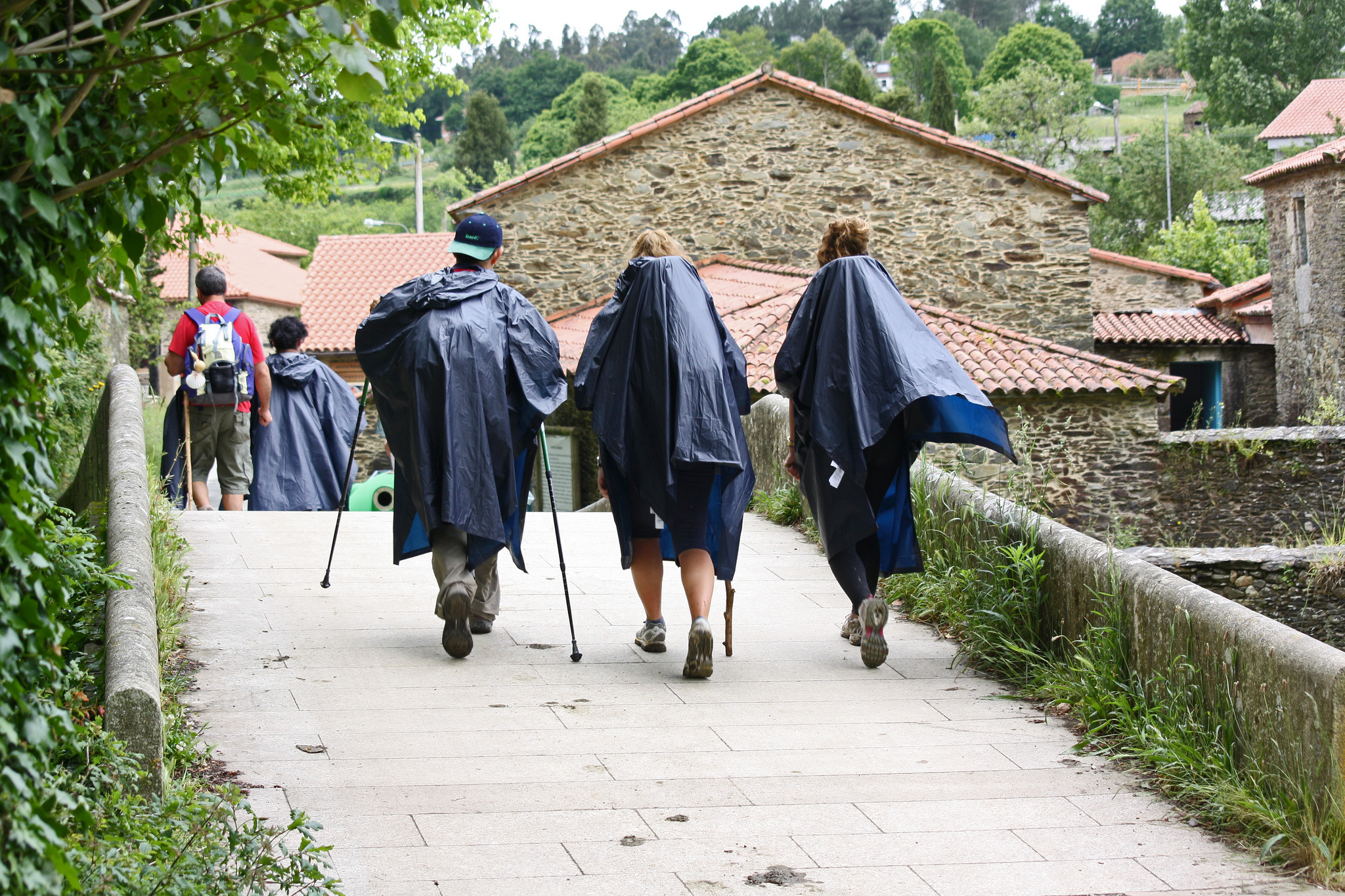
A single street configures the town, with the services – bars and shelters – on both sides. The public hostel of the locality is located in the border of the river, just after crossing the bridge, and occupies the space of an old rehabilitated hospital.
At the exit of Ribadiso the street begins to rise until becoming a ramp quite powerful that ends in a tunnel under the N-547. A paved track then follows the course of the road and ends up becoming a path parallel to the left side of the national road, which leads directly to Arzúa (Km 14).
In Arzúa, pilgrims coming from Irún along the Northern Way, a route that was used in the Middle Ages when they were still recovering territory to the Arabs and many of the areas through which the French route passed was on the battle line.
Arzúa is a town that, despite its millennial history linked to the Camino de Santiago, does not retain many old buildings. Most of the buildings are modern, even its parochial church of Santiago is of the middle of S. XX – of the temple. The two carvings of the apostle like pilgrim and like matamoros draw attention, it is an iconography of which we have already spoken previously. The chapel of the Magdalena is the only medieval rest that we can find. It was part of an old convent of S. XIV.
Although it does not have a great artistic heritage, Arzúa can become the ideal rest stop. After touring these first 14 km of route we will be very grateful to sit and taste the local cheese, which can be eaten bathed by the honey that is also produced in this area.
Galicia has four Protected Denominations of Origin of cheeses, although of course in the community many more types are elaborated. O Cebreiro already had an opportunity to try it when entering the territory and now in this area we can try the Arzúa-Ulloa, a fatty cow cheese that is generally consumed little cured, quite fresh. In Galicia it is often said “that it is scattered” throughout the plate, since if you cut it does not stand its form and it extends outwards. In addition to these D.O.P., the other two Galician cheeses are Tetilla and San Simón, the latter is smoked.
FROM ARZÚA TO PEDROUZO, TWO MODERN LOCALITIES WITH THE N-547 AS THE MAIN ROAD
After this delicious stop we leave Arzúa leaving its main road to the left, along the cobbled street of Cima do Lugar. In a favorable profile this street will end up becoming a gravel path that will take us to a zone called As Barrosas forest, because when it rains a great amount of mud is formed … So in the rainy season we must shorten gear!
We passed a chapel dedicated to St. Lazarus, an advocacy that we have already seen on the Way in other remote places, as many people with infectious diseases wandered hoping to heal and were attended in lazaretos.
After crossing a river, we began to climb this humid forest track until we returned to asphalt at the entrance of Pregontoño (Km 16,2), a small rural town where we can see the 18th century chapel dedicated to San Paio, with a enormous external portico almost the size of the temple itself. By asphalt we go through a tunnel under the N-547 and follow a straight path between meadows that takes us to A Peroxa (Km 17,3).
From A Peroxa we return to a forest track with profile, in general, favorable. Many of the trees – more and more of them, eucalyptus – from this area are decorated by the pilgrims, who fill them with papers with messages in all languages.
After crossing a creek we climbed up to a small town called Taberna Vella. Just after passing it, a great bridge takes us to pass on the pharaonic works of the highway A-54, a route whose intention is to communicate Lugo with Santiago, opening a little the communication of the interior of Galicia with the Atlantic side – although it takes many years in construction by successive postponements and delays.
After crossing the works we enter the town of A Calzada (Km 19,8), which is on the border between the concello of Arzúa and O Pino. At the exit of the village the asphalt becomes gravel and then again on a forest trail between mountains, although in general the profile is simple – and will continue to be until O Amenal (Km 36,7).
We enter the hamlet of Calle (Km 21,8), of a paved road surface, whose name comes from Latin callis meaning “path”, so that its toponymy probably reveals its ancient relationship with the Camino de Santiago. In the main path of the town we find an original granary, placed like a bow on the road.. We passed below it and when we left the village we met some milladoiros -stone cairn that are left as an offering.
We continue through forest tracks between the picturesque rural surroundings, a route to enjoy. The only problem we can find, again, is the mud in the rainy season. We arrive at Boavista (Km 23,2) and, shortly after, the right side of the N-547 at A Salceda (Km 25) from where the dynamics of the stage will change a lot: the national road will cross permanently in our way and the immersion in the peaceful rural environment will not be so intense as until now.
FROM SALCEDA TO SANTIAGO AIRPORT: WE ENTER THE NEARBY OF COMPOSTELA
The Jacobean signs lead us to leave Salceda along a gravel path on the right shoulder, where we begin to ascend slightly. We passed a plaque to a Belgian pilgrim who died and almost touched Compostela, along with others who have been leaving reminders in his honor, and in just 1 km we must cross the national road at a crossroads level, so that much caution is recommended.
We entered a path between eucalyptus trees and reached O Xen (Km 26,3) and As Ras (Km 27), small towns formed by a group of houses.
We cross the national road again, although this time we do have the option to do it through a lower tunnel. Already on the right shoulder, we leave a gravel track that takes us to A Brea (Km 27,6), a locality in which there are accommodation options.
The path leads us back to the right side of the national road, which we must cross in a slightly dangerous way to pass to a sidewalk on the left shoulder, where we find benches and a place to shelter in case of rain. We continue along a gravel path on the left shoulder until we reach O Empalme (Km 29,3), where we must change the side of the road at a dangerous junction. The cars here tend to go slower but the point coincides with a change of gradient.
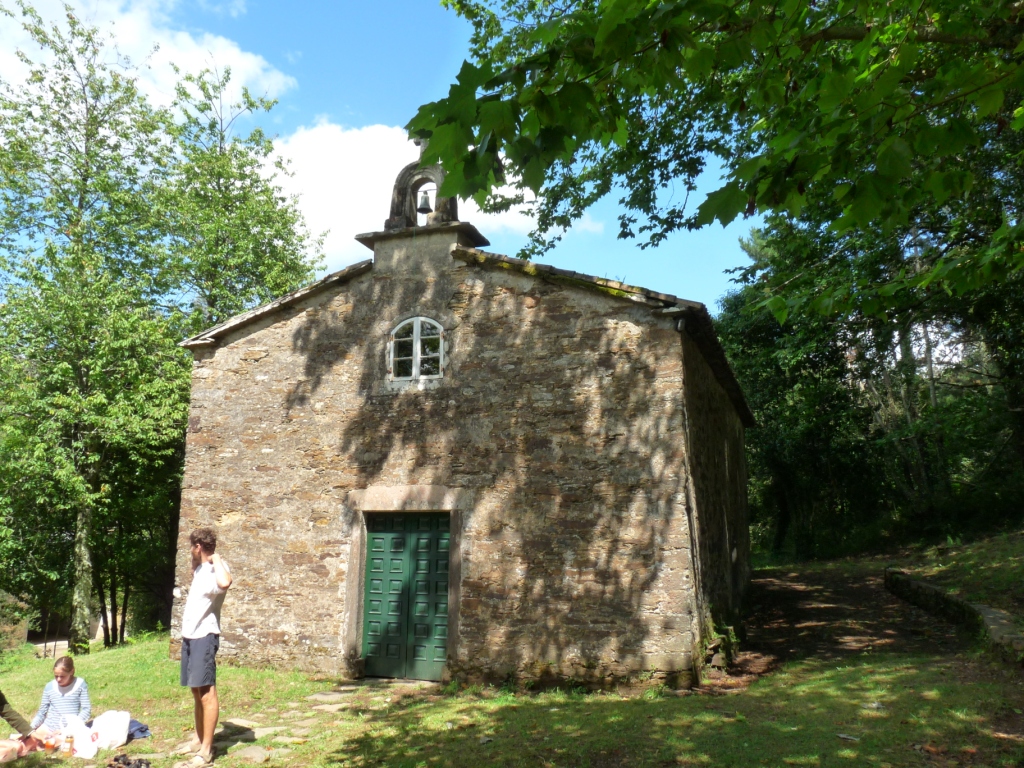
After the crossing we arrive at a path that alternates gravel and dirt and that gets inside trees, passing near the right shoulder of the road but to a different quota. Downhill we go to a tunnel under the N-547 that takes us to Santa Irene (Km 30,3). Here we can see the chapel of Santa Irene, a simple construction of the S. XVIII that gains a lot of charm thanks to all the oaks that surround it, some of great size. Near the chapel there is a fountain which is said to always keep young to the ones who wash with their water regularly. Too bad we could not take it home!
We must cross the N-547 without a safe pedestrian path to go to the right shoulder, where we find a rest area with a large fountain that has a carved scallop. After traveling a bit along the shoulder we enter a path between eucalyptus trees, that leads us to a step below the road, after which we follow by gravel to A Rúa (Km 31.7).
A Rúa is a small locality of a single street – which means its own name – with enough charm, it gives much tranquility.It has accommodation in which to spend the night and places to rest in a quiet rural environment, being very close to Pedrouzo, where we will find all services.
To get to O Pedrouzo (Km 33) we just have to climb to the left shoulder of the N-547, as the road crosses the village by the middle. In this town is where most of the walkers decide to spend their last night of pilgrimage, although it will take us a few to travel the distance that remains …In just 18 km we will be in Santiago! In O Pedrouzo we will find all the services that we need and can be a good place to rest or to take something to drink and to eat and to enjoy it in O Monte do Gozo, that is only 15 km and will offer us an unbeatable view.
After following the road, which is the main road of O Pedrouzo, we crossed the other side in a pedestrian crossing and climbed a street with a quite remarkable slope until arriving at the facilities of a school. There we turn left and we go through a forest track to San Antón (Km 34), a small town where we go down a paved track of only 100 m.
We enter a track that alternates with gravel and asphalt among carballos (oaks). During 1 km, we travel peacefully while the sun sinks between the thick treetops, until we leave in the daylight on a path between cultivated farms that, after turning left and right, leaves us in O Amenal (Km 36,7), located on both sides of the national road. We saved the way by a lower step and we entered the last section of the forest that we make in our pilgrimage. More than a pleasant picturesque walk will become a test of effort, as it is traveled in permanent vertical slope, with an average of 5% up to Cimadevila and 3% in the next kilometer and a half.
After reaching the highest level of 363 m the terrain is leveled and sometimes it has slightly descents. We reached the eastern edge of the airport, which was built in the middle of the paths that used to lead to Santiago. That is why we must get around it, surrounded by its northern part on dirt paths next to the metal fence of the airfield, where many pilgrims hang crosses or memories. This part of the road usually gets very muddy when it rains, which can be a great setback for us. We pass next to a large landmark that along with the Jacobeans symbols announces the entrance to Santiago.
LAST SECTION TO THE CATHEDRAL, ASCENDING TO O MONTE DO GOZO AND GOING DOWN BY THE URBAN AREA UNTIL THE CENTER OF COMPOSTELA
On the western side of the airport we will go to San Paio (Km 40,6), a small town with a church in the center and we leave by a gravel path between trees, which ends descending to cross the SC-21 tunnel.
After the crossing of the SC-21 a miliary tells us to continue along a gravel path and then descend by asphalt to Lavacolla (Km 42), a town whose name is related to a Jacobean tradition. According to the Codex Calixtino, the pilgrims washed in the Sionlla river of the town, to arrive clean to Santiago. His name would come from “lava-collus”, that is, “washing the neck”.
This tradition of cleaning before entering Santiago and the cathedral had an important symbolism, but also an obvious hygienic burden. It was about leaving behind all the dirt, which symbolically represents sins, to enter “clean” to see the apostle and receive full indulgence, but also … Imagine how medieval pilgrims could smell after months of walking and sleeping in outdoors! In fact, before the door of the cathedral the pilgrims stripped and washed again in the so-called “Fountain of Paradise”, also burning their clothes before the so-called “cruz dos farrapos” –farrapo is “old clothes” in Galician. Already clean and with new clothes, they entered in to see the Apostle, having won Heaven. After the visit many of them slept in the cathedral and yet the atmosphere had to be overwhelming enough to design the botafumeiro… a censer that can burn up to 40 kg of incense!
In Lavacolla we passed in front of a beautiful music stage, a construction that in the Galicia of the end of the XIX century was a true center of social relations. Given the rainy climatology, these structures half urban furniture – half buildings, allowed to enjoy music and dance in any situation, with a perfect visibility of the orchestra.
To leave Lavacolla we cross the N-634 and follow a paved track that, after passing the river, becomes a whole ramp. The slope does not level until Vilamaior (Km 43,3), a small town that we crossed from east to west to continue, always by asphalt, to Santiago.
Already by flat terrain we pass before the headquarters of the Galician television (TVG) and the territorial center of TVE and we climbed a street in slight positive slope to enter San Marcos (Km 47,2). On leaving San Marcos we will find on our right with the chapel of San Marcos and a great monument dedicated to John Paul II … We are in Monte do Gozo!
Monte do Gozo (Km 48) was called “San Marcos” in the past, because here the bishop of Santiago ordered in the 12th century to build a chapel to this saint. Legend has it that the chapel was actually built by St. Mark himself, because when he was traveling to Santiago, almost reaching the goal, he asked a German how much he had left to arrive and he lied to him, telling him that thousands of kilometers were missing. He did so because, according to tradition, whoever came first to the top and saw the cathedral was the “king” of the pilgrimage; he did not want St. Mark to take away his honor. The saint, discouraged, decided that he was not able to follow and was built in that place a chapel.
In that chapel people stopped praying until the S. XVIII, when it was abandoned – what we see today is a new construction. The mount became known more and more with the name of “o gozo” by the emotion that invades to the pilgrims when seeing for the first time the towers of the cathedral under his feet,in the valley in which is Compostela.
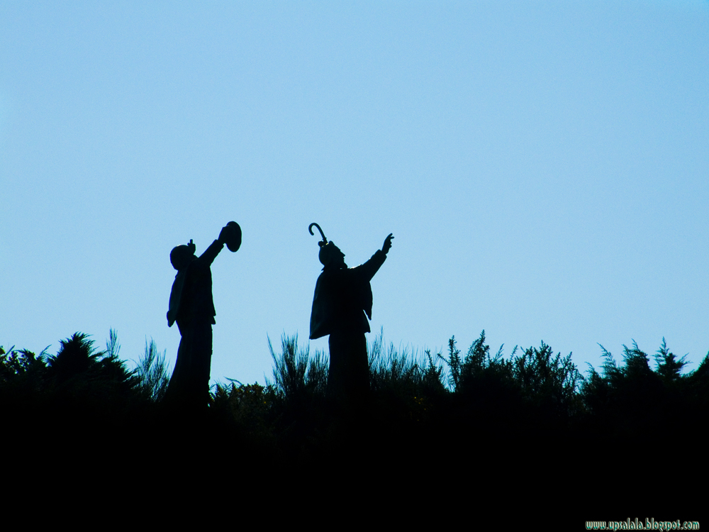
Next to the chapel is a path that leads to a large esplanade with a monument that was built in 1989, when Pope John Paul II went to Santiago to preside over the World Youth Days. Hundreds of pilgrims traveled to Compostela and built large facilities in this mountain to welcome the events. Today they are still maintained and have a large amphitheater – here have played artists like the Rolling Stones and Bruce Springsteen – a hotel, cafes, etc. In the viewpoint of the hill, from which we see the cathedral for the first time, there are two unmistakable sculptures by the artist José María Acuña López – the same one who portrayed a medieval walker in the upper San Roque – of pilgrims looking towards Compostela with his hand right raised.
We return to the asphalted street from which we came and descend to a point where a sign indicates a few stairs leading to a sidewalk on the N-634. We can avoid the stairs following the track to the right, since in a few meters it also ends in the road.
We arrive at a roundabout at the entrance to the neighborhood of San Lázaro, where red metal letters form the word “Santiago de Compostela” on one side of the roundabout, although the normal sign of entrance to the town, full of stickers of pilgrims, does not stop having its charm.
we can choose to go by the right side with the cars or by the curb of the left. At first the sidewalks are wide, but then they will narrow and become more and more uncomfortable.
We continue straight ahead and,two roundabouts further, we turn obliquely to the left to follow a street that ends in a grocery storeat the junction with the N-550. We must cross to the other side and continue along Concheiros Street, named after because it was once the neighborhood outside the wall where artisans made shells of scallop – usually made of brass – used as a symbol of the completion of the pilgrimage.
Today the street engages with the one of San Pedro, a neighborhood that was next to one of the seven doors of the wall. In fact, the street, today pedestrian and full of small commerce, ends at the junction of Puerta del Caminowhere the wall was with the entrance through which all the pilgrims passed. On the ground we see an inscription in different languages that says “Europe made pilgrimage to Compostela”, in reference to how this route helped to forge the links of the European identity.
After crossing the pedestrian path we enter the cobblestone of the old city of Santiago, which since 1985 is a World Heritage place. Within it are preserved a multitude of Romanic, Gothic and Baroque monuments between houses with galleries, porticos or small balconies.
Climbing the street of Casas Reais we will arrive at the Plaza de Cervantes, which has a fountain in the middle and a side with porticos. Here was formerly the city council of Santiago, until in the S. XX moved to the imposing neoclassical building that stands in front of the cathedral in the Obradoiro square.
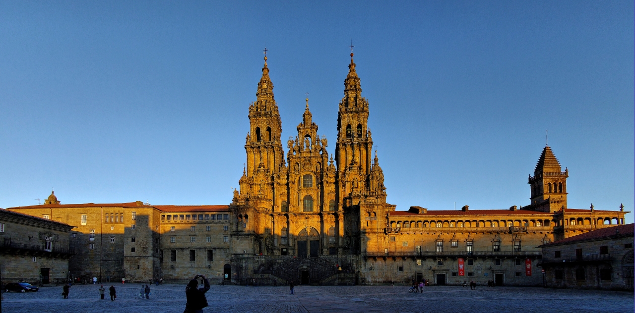
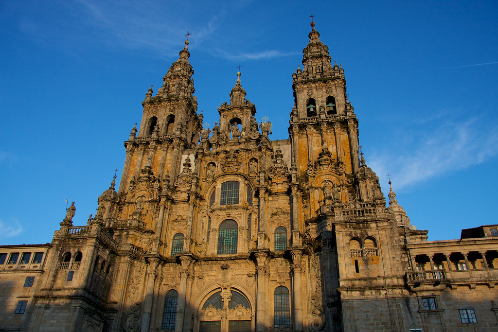
We follow the line with porticos in the square and we go down the street until we find to our left, finally, with the door of Azabachería of the cathedral of Santiago. Here was the aforementioned Fountain of Paradise, and through this door – which does not retain its original decoration – all the pilgrims entered to see the apostle. Today many prefer to follow the stairs to the Obradoiro square and see the imposing facade in the open space before entering the temple. We can walk along the stairs going along the side of San Martín Pinario, an old monastery that now houses multiple uses and is the second largest religious group in Spain – after the Escorial.
Already in the Obradoiro square we can, finally, get off the bike and enjoy that mixture of joy and sadness that is felt at the end of the pilgrimage. We will forget the effort performed in the hundreds of kilometers that we have traveled, as soon as we get off the bike, but the experiences and moments that our Camino has given us will remain engraved in our memory …From now on a part of us always wants to go back to Compostela!

