STAGE 10: FROM ASTORGA TO PONFERRADA
Erea FabeiroFRENCH WAY BY BIKE
- Distance to Santiago: 256 km
- Distance for stage: 54 km
- Estimated Time: 5 – 6 hours
- Minimum height: 510 m
- Maximum height: 1052 m
- Route Difficulty: High
- Places of public interest: Castrillo de los Polvazares, Rabanal del Camino, Cruz de Ferro, Molinaseca, Ponferrada
- Itinerary map:To see the whole journey on Google Maps click here
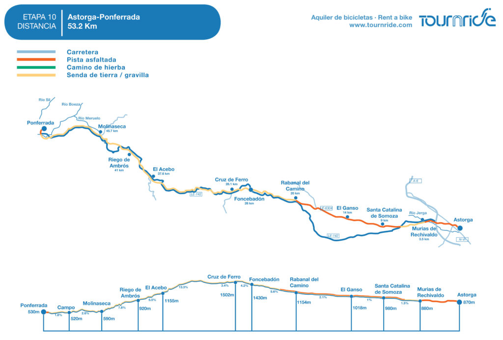
This stage has a higher difficulty than the others, but you get to admire spectacular landscapes as a reward and visit one of the milestones of the French Way: la Cruz de Ferro (1502 m). The LE-142 will be our route practically for the entire stage, having the pedestrian road parallel to it in a lot of sections. Due to how dangerous the paths can turn in some points, we recommend you avoiding the Jacobean signs and continue by highway. We will analyze in detail each segment on the general journey of the stage.
At Astorga’s exit, the positive slope will be permanent but soft, especially during the first 20 KM. When we reach Rabanal del Camino the descent gets a little harder until we arrive to Cruz de Ferro. It’s about 8, 6 Km with mid slopes between 4 and 5,5%.
From Astorga to Manjarín, the pedestrian paths are kind of reasonable for cyclists, although sometimes it is necessary to get off the bike. But from Manjarín to Molinaseca we strongly recommend you going along the road. Specially the previous segments to the entrance of Acebo de San Miguel and in Molinaseca, they are very dangerous.
By road, we can enjoy some amazing views and we only must be careful with traffic, because we can find some curves and two-way roads. The descent is heavy, between 3, 5 and 14%.
If we take the proper instructions, there’s no stage on the French Way that we could start with an upsetting feeling due to how dangerous they could be. This is one of the most special stages of the Way because it takes us to natural and spectacular environments and, we only have to take some alternatives itineraries in specific points.
We will give you more details about the journey on the following text. And as always, in Tournride, we wish you the best of The Way.
PROFILE AND STAGE’S MAIN ROUTES
We go out Astorga by the San Pedro Street that leads us to a roundabout where we cross the N-VI and we take the highway that will share the entire journey with us during the whole stage: the LE-142. By its shoulder or concrete track parallel to it, we cross the A-6 by an upper pass in 1, 7 Km and in only about 1, 5 Km later, we get to Murias de Rechivaldo.
At the entrance of Murias de Rechivaldo, the Jacobean path turns to left and we lose the LE-142 in front of us. The path is a firm wide track, so we can go whatever side we prefer. We simply have to keep on mind that if you only go by the road you will pass by Castrillo de los Polvazares, an odd street-house town declared as a Historic-Artistic Site in 1980. It is considered as one of the most beautiful places of Maragatería.
Since the LE-142 crossroad with the exit’s path of Murias de Rechivaldo until Rabanal del Camino, the route can be done by a small regional concrete road or by the gravel path parallel to it. The profile keeps on being very simple, with an almost imperceptible descent, because the normal slope will never be more than 3%.
At the exit of Rabanal, the Jacobean path leaves the LE-142 behind by the left and crosses it again by the road 1 Km after. We recommend doing this part by road because at the end of the way you will find some stairs and the surface is very rocky.
From here on, the slope gets harder with an average of 5%. Following the road, we arrive first to Foncebadón (km 26th). When we see the town’s welcome sign, the Jacobean signs indicate leaving the road behind in order to enter to town. In this case, the tracks crossing Foncebadón and traversing 1, 2 Km surrounded by mountains, are wide and they can be travelled perfectly by bike.
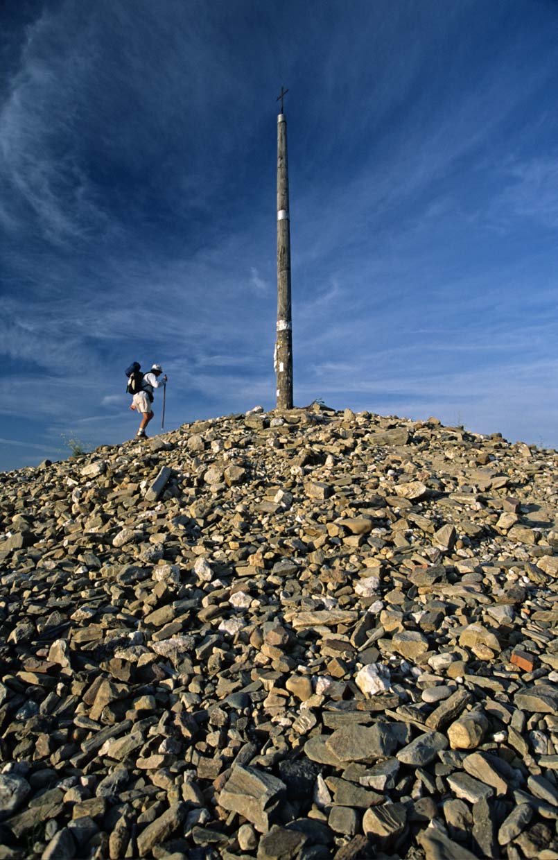
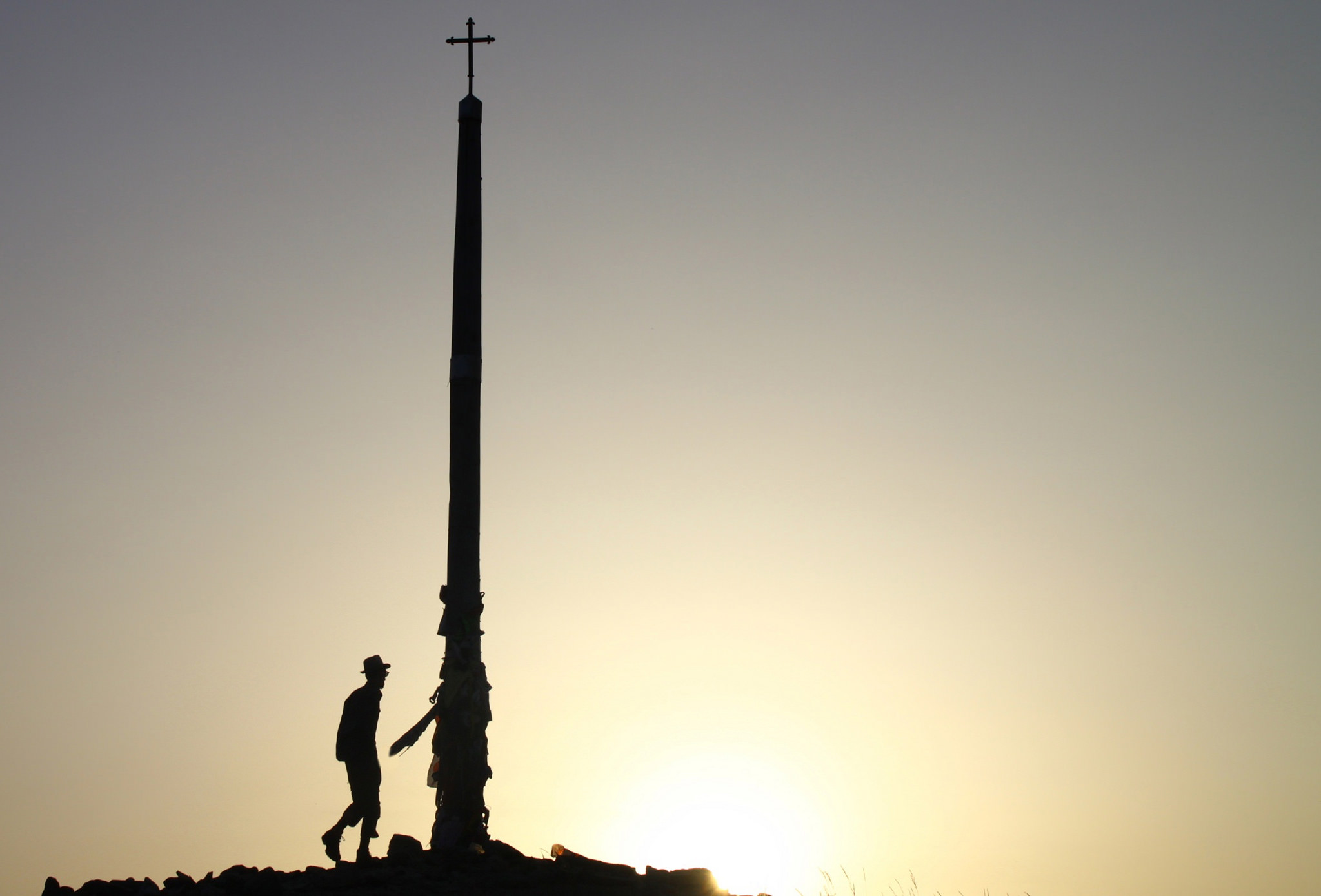
Once again on road, we continue ascending during 600 m in order to get to the mythical Cruz de Ferro, where following the Jacobean tradition we must leave underneath a stone that we have carried during our entire pilgrimage.
From the Cruz de Ferro to Manjarín, where it’s located la Encomienda Templaria of Tomás, one of the most famous characters of the French Way, only 2,3 are covered by the shoulder or by land path to their right.
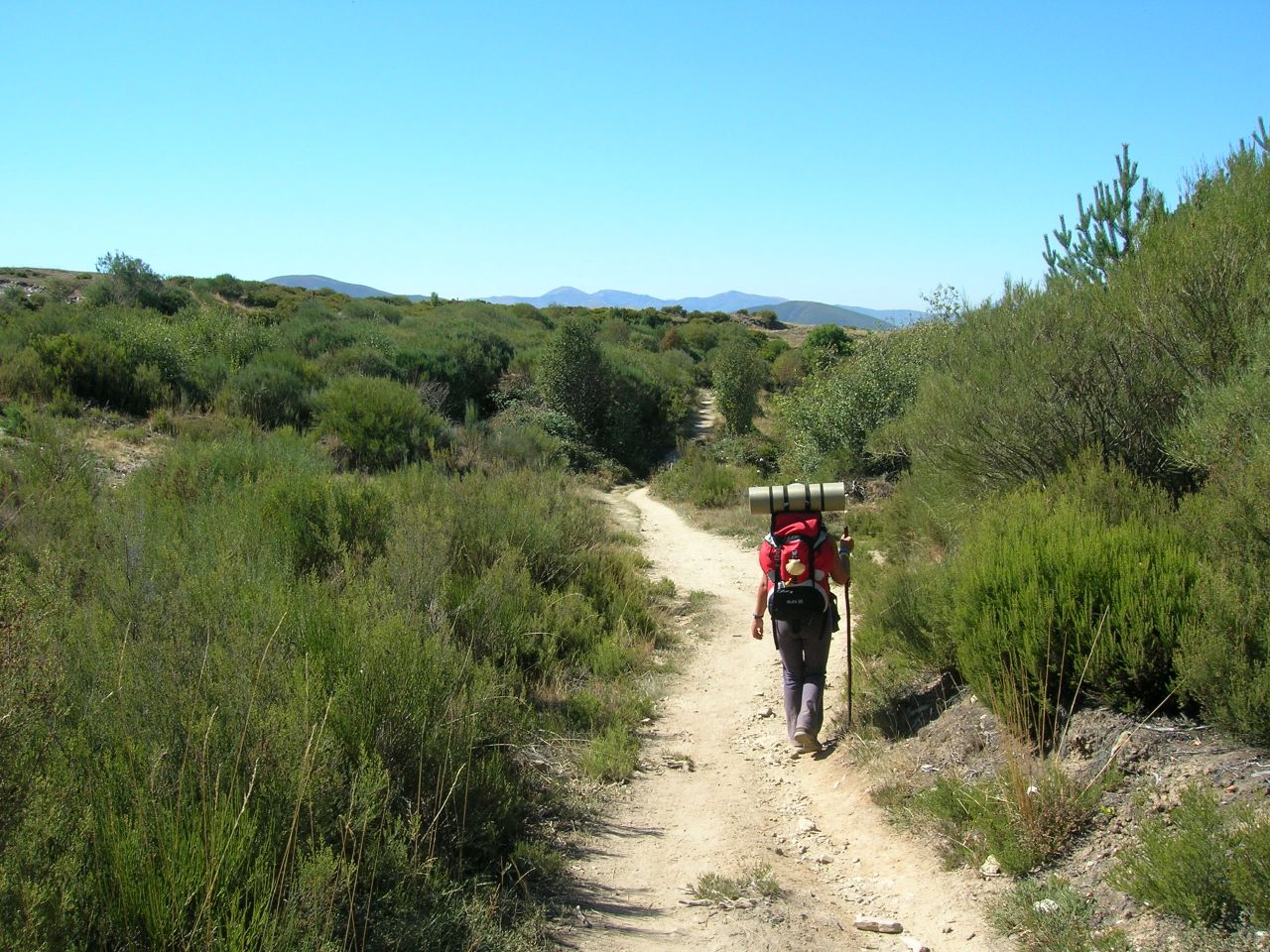
After passing by Manjarín, we must take one of the most intense descents of the whole French Way. It takes around 17,5 Km to Molinaseca. The pedestrian way follows the route of the LE-142, but changes course in some wide parts where we can get lost among the mountains. Although there are cyclists that tend to follow these Jacobean paths, in Tournride, we strongly recommend pilgrims travelling by bike to do this part of the stage by road. Even though you may be really experienced cyclists with high technical capacity, in some moments, you will have to share paths with pilgrims travelling on foot, which might cause accidents. Some paths are narrow, with rocky surface, strong slope and a lot of times are close to precipices’ borders… What a package!
The LE-142 goes through the middle of El Acebo de San Miguel and keeps descending by negative slopes with an average close to 9% until passing by the North of Riego de Ambrós and arriving to Molinaseca (km 45,7 of stage). The ride through this road can be a magnificent experience, because of how spectacular the views are.
Once we get to Molinaseca we cross the Meruelo River by the town’s beautiful stone bridge and later we follow the road’s course or the parallel path, until we get to Ponferrada. At the entrance of Ponferrada the pedestrian way goes by a very wide sidewalk.
Getting to the center of Ponferrada is very simple, because the way will lead us directly to the Castle’s great avenue and, just when we see the bridge crossing the Sil River we turn to the right in order to pass by the city’s majestic castle, and we end up at Plaza del Ayuntamiento.
In general, this stage is complicated but is actually one of the most remembered by pilgrims by bike. We simply recommend extremely caution while descending from Manjarín to Molinaseca and taking the refractory and lighting devices necessaries in case the weather is on bad conditions and prevents us to see clearly, so we can avoid hard-times with cars when we pass by the LE-142.
PRACTICAL ADVICES
If you start your journey in Astorga we help you getting there:
- By bus: Astorga is the center of a good junction of roads (A-6, AP-71, N-VI). Alsa is connected to the North of the peninsula and also with Eastern and Southern capitals. Eurolines (http://www.eurolines.es/es/ ) also runs in Astorga and communicates with European capitals.
- By train: Astorga has direct connections with Galicia (Ferrol, A Coruña y Vigo), Madrid, Barcelona, Basque Country (Bilbao, Irun) and other cities from Castile and Leon with the regional connections. For more information visit the Renfe’s webpage. http://www.renfe.com/
Please remember that in Tournride we leave your bikes in your lodging in León or Astorga if that’s where you started , and we can take your extra baggage in order for you to find it at the end of your Camino.
In order to get the credential in Astorga the easiest option is going to the shelter from the Asociación del Camino de Santiago de Astorga (http://www.caminodesantiagoastorga.com/index.php?modulo=30 ), where they can give you one. It’s really close to the center, right next to Plaza Mayor.
- Regarding the itinerary, from Tournride we recommend you choosing the road road from Rabanal to Foncebadón and also the part going from Manjarín to Molinaseca. During the rest of the transit, you can choose the itinerary you prefer.
- Be careful with bad weather, we recommend you to always keep yourselves informed about weather forecasting. The part between Rabanal del Camino and Manjarín is especially known by its cold mountain weather, with a lot of snow, wind and huge storms.
- There are a lot of towns with all the services, you won’t have to carry with all those supplies, unless it’s summer and the weather is really hot.
- Today, more than ever, it’s important to carry your saddlebag well-adjusted in order to keep your bike steady as possible.
- In less than 5 Km from Astorga we get to Castrillo de los Polvazares. The regular road doesn’t go that way, but we take a simple and short detour. This town is ideal for breakfast, because we will take a lot of time getting to the destination, it has all the services and a very special charm about it.
DETAILED ITINERARY AND HISTORIC-ARTISTIC PATRIMONY
Today’s stage is a transition one. We go out of Maragatería’s district from the capital and we continue flatly until arriving to Rabanal del Camino, going all over some small old muleteer towns where the popular architecture is well preserved. From there on, everything changes, the profiles gets hard and the landscapes turn into green, that’s when we know we’re entering to El Bierzo, Leon’s wastelands will only be part of our memory now!
Travelling through Leon’s mounts, we will pass by one of the most recognizable points from the French Way: Cruz de Ferro. We will start right after a dizzy descent in which all the spectacular views from our surroundings will be our best company and we will pass by some small towns as lovely as El Acebo de San Miguel.
After going across the magnificent medieval bridge of Molinaseca, we will be only a stone throw away of the end of the stage: Ponferrada, where we recommend a relaxing promenade so you can take advantage of your entire stay on the Bierzo’s capital.
¡Buen camino!
WE EXIT ASTORGA WITH AN EASY PROFILE (AT LEAST FOR NOW) WE MOVE FORWARD TO RABANAL DEL CAMINO
This exit from Astorga is much simpler than the ones from the previous cities, like Pamplona, Burgos or León. From the cathedral of Astorga, we must take the Portería street, which goes out right in the front. Turning to the first right, we follow the San Pedro Street until we see a curve at the left and that makes us crossing the N-VI by a pedestrian pass. At the front, we see the LE-142, where we can go out of Astorga.
Before crossing the A-6 by an upper pass, we pass by near the detour to Valdeviejas. Right after, we have the view of the chapel of Ecce Homo. This monument has a sign hanging on the door saying “La Fe, fuente de salud” (Faith, a health source), in several languages. This makes reference to an old legend that takes place on the chapel.
On the inside of the chapel, before there was a well where pilgrims used to satiate their thirst. People say that a pilgrim’s child fell into it and seeing how the well was getting even fuller of water, she begged for help to Ecce Homo until her child could go out of it. Because of this miracle they changed the temple’s abdication that was before dedicated to San Roque.
The Ecce Homo is the suffering Jesus that was submitted to different tortures before being crucified. When Poncio Pilatos showed him to the crowd after torturing him, some texts say that he screamed “¡Ecce Homo!” (“¡Here’s the man!”). When people want to stand out God’s humanity this is the way they represent it, like a suffering man.
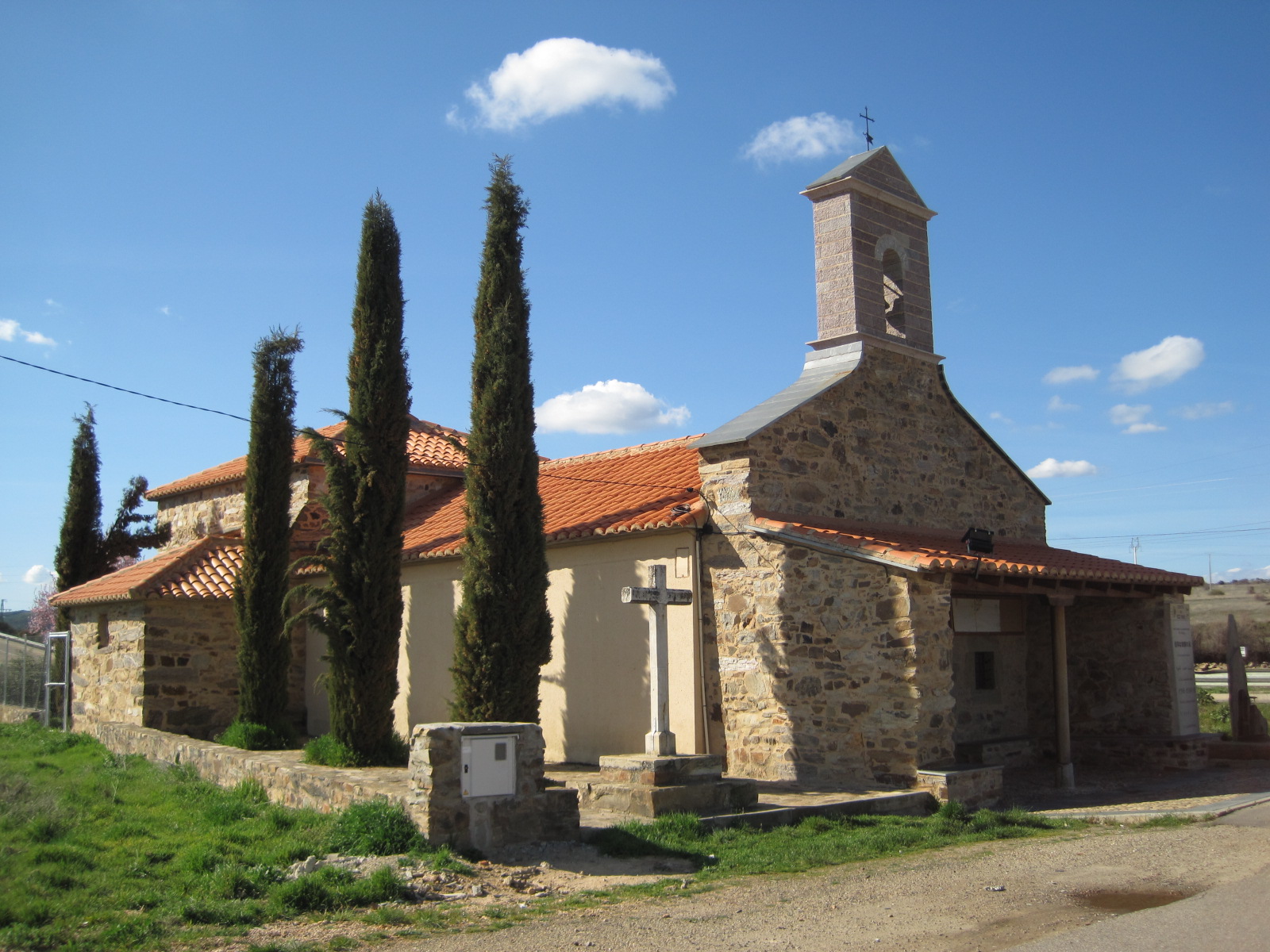
After crossing the A-6 by an elevated pass, we go through the road’s shoulder or by the parallel walking strait and we arrive to Murias de Rechivaldo (km 3,5).
After visiting Maragatería’s capital, Astorga, we will pass now by different towns of the district in our way to Foncebadón. This town, just like Castrillo de los Polvazares (which we can visit if we continue in less than 2 Km the LE-142 to the North) is an old muleteer population. The commercial traders used to live here who transported merchandise from the peninsula’s ports to the inside of the country. A lot of them have been well preserved, especially Castrillo, which is declared as a Historic-Artistic Site and it’s considered the most charming town of Maragatería. The stone pavement from the XVII century is well preserved in a good estate inside the place, which was built in that moment with the purpose of making the pass easier for mule drivers.
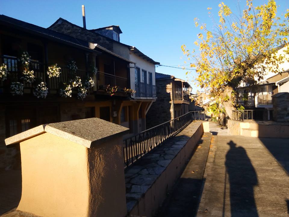
The buildings of Murias y Castrillo follow the same patterns of the popular houses from Maragatería. They’re made of stone masonry, with the door and window frames painted and double-leaf large gates, that were built with the purpose of allowing mule drivers to keep their carriages safe.
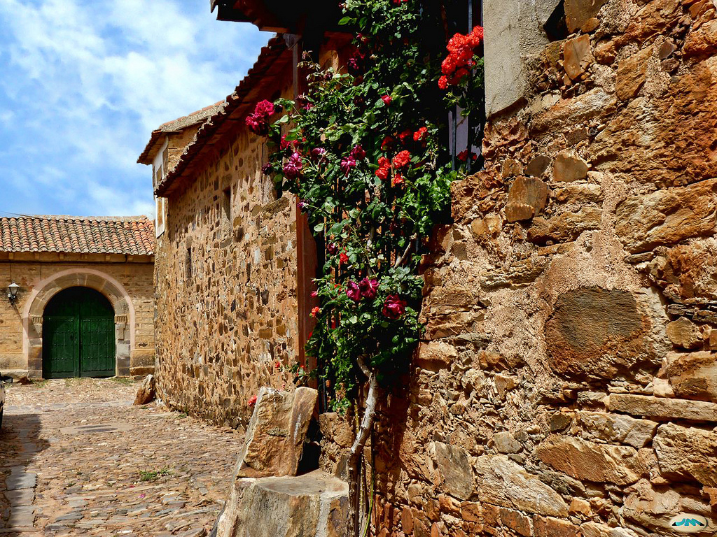
In Tournride we encourage you to visit Castrillo de los Polvazares, a town with a lot of charm which is located just a stone throw away by bike. In Murias de Rechivaldo, the most impressive place is the church of San Esteban that has a bell gable with some kind of portico with stairs, where a lot of time the storks make their nests.
If we pass by the Castle of Polvazares we must return to the LE-142 and in just about 1, 3 km we change course to the right so we can go by the LE-6304. Three parallel tracks come up where we can travel through: the road LE-6304 (two-way track), gravel track (a pedestrian track for pilgrims) and an agricultural track with reddish land. We can go through whatever way we find more convenient, in an almost flat profile we get to Santa Catalina de Somoza in only 2 km.
Santa Catalina de Somoza is another population of old mule drivers with a similar popular architecture. Besides, it has a great Jacobean tradition, that takes place on its urban configuration with the way as main street and is be the backbone of the population.
One of the biggest characters and experts on this French Way is native from Santa Catalina de Somoza, named Bienvenido Merino. He has about 30 years doing hand-made souvenirs for pilgrims that he carves in wood while he has a conversation with anyone who wishes, talking about Jacobean stories. He met some of the most famous pilgrims, like Paulo Coelho, whom he invited something to drink inside his house. When the Brazilian writer published, months after, his novel “The pilgrim of Compostela”, Bienvenido received a copy by mail. Besides, in some book’s editions the cover picture is the blue door from Bienvenido’s house; with the scallop shells he sells hanging up the door.
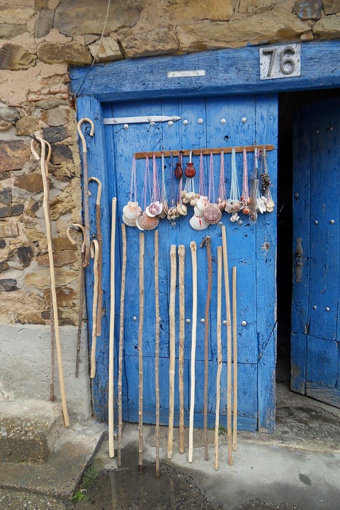
Following the course of LE-6304 in 4 km we reach El Ganso, small town from Maragatería. After crossing it, in about 4 Km we pass by a crossroad leading to Rabanal Viejo. Just a few meters away from this point, we can find one of the most known trees of the French Way, the “Roble del Peregrino” (The Pilgrim’s Oak), which has been there for a dozen of years until in 2013 a storm striped it off its place. We do not lie when we mention in our stage advices that weather can be bad!
Right after, at the road’s left, there is the chapel of la Vera Cruz, from the XVIII century which in the actuality is located next to the cemetery. After passing by close to it, we arrive to Rabanal del Camino (km 20).
As a reference of its name, Rabanal del Camino has been a pilgrim’s pass for centuries and in the actuality, with the rise of the French Way, has been restored and turned into a very welcoming place. The popular architecture follows the Maragatería’s conditions and some of the hotel places take up these ancient dwellings with big central yards.
Templars had a lot of history in Ranabal del Camino who took advantage of the situation in order to use it as a prior basis to its neuralgic center of Ponferrada. They tried to protect pilgrims in a better way, because at the top of the León’s mountains there were a lot of thieves and wild animals. The parish church of the town is witness of the Templar presence. Dedicated to Nuestra Señora de la Asunción, was promoted by this organization in the XII century and it’s a clearly example of the fewest Romantic temples that are located in Leon.
Because of the situation and services, this became an important Jacobean center in the Middle Age. Aymeric Pycaud used it as an overnight stay place in his IX stage, as we mentions in his Codex Calixtinus; and people say that Philip II spent the night on one of the houses on “la Calle Real” (“Real Street”, that’s where its name comes from) when he made pilgrimage on his way to Compostela.
In order to see the old part of Rabanal del Camino we have to change course to the LE-142, because the road goes all over the town from the South, in a lower height. The first way leads us directly to Calle Real.
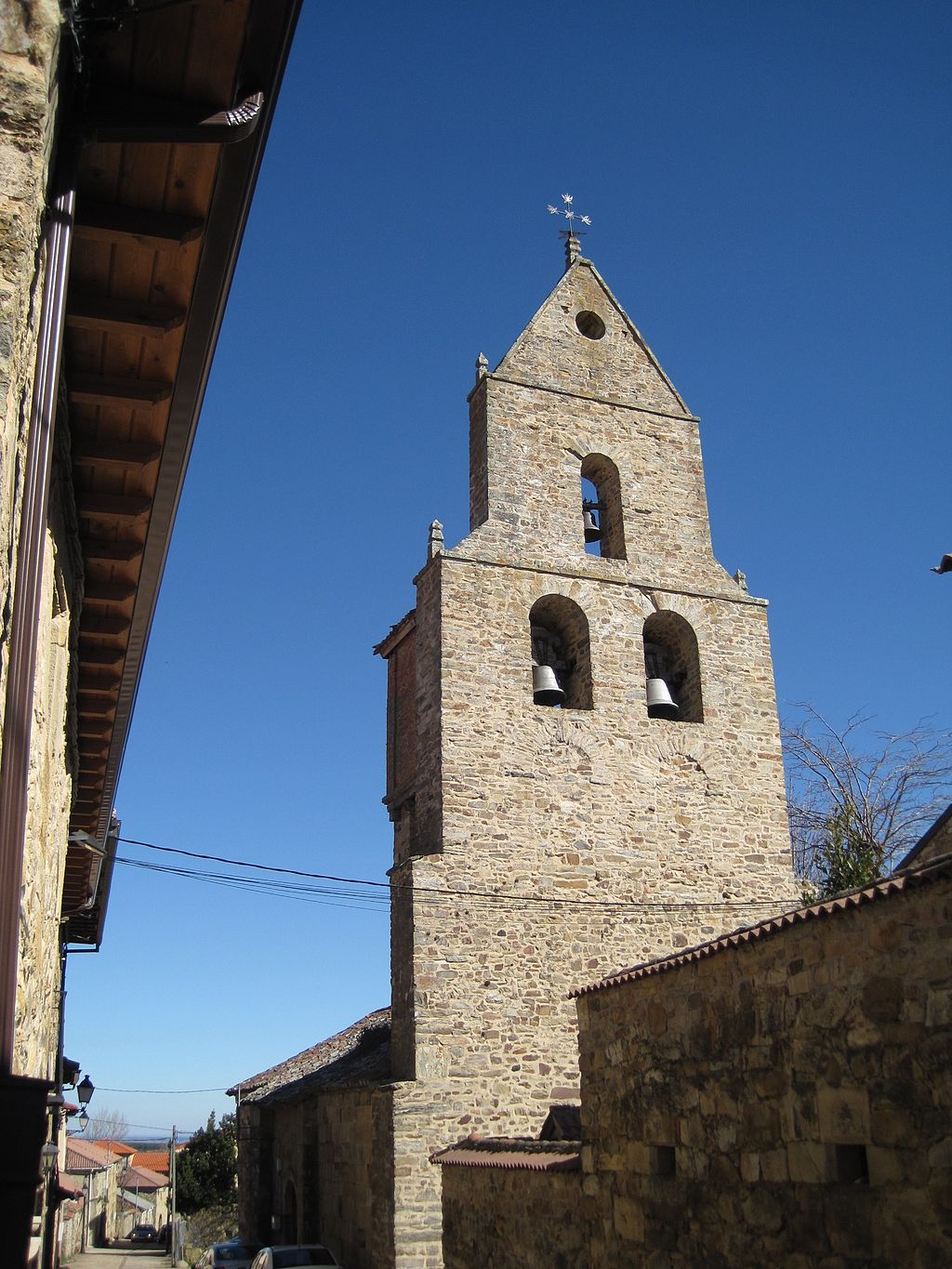
WE CROWN MONTE IRAGO AT LA CRUZ DE FERRO AND WE START OUR DESCENT TO MANJARÍN
At the exit of Rabanal del Camino, the landscape and profile change, the first turns greener and the second steep. Even so, the descent is not really hard, unless the weather is really windy or rainy.
The pedestrian way goes from the right to the left of the road, in different heights. The best thing on this part is to use the right shoulder of the LE-142, because the way can be quite narrow and the surface is not really good.
To enter to Foncebadón we do have to change course to the left because of gravel track that shows up after the welcoming sign to enter to town, if not, we can border it by the North. The exit path that connects again with the road is not advisable, even though you can ride your bike through it.
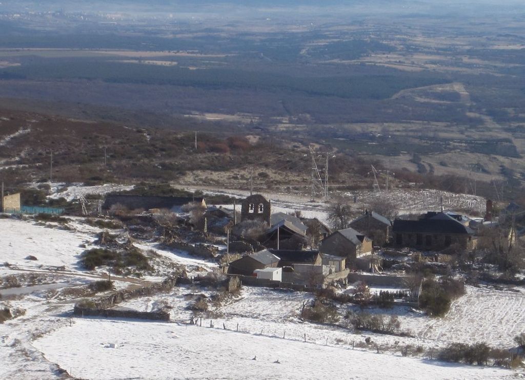
Still today, when we visit Foncebadón, we can really see how this city center, like a true Phoenix, is trying to rise from the ashes. The population appeared on the XI century when a hermit named Gaucelmo, settled down there and built a pilgrim’s hospital and a church. This area was dangerous, because of the bad weather conditions and the road’s insecurity. Thanks to the help he offered to walkers, Alfonso VI gave him these lands’ possession. As the centuries passed, the center grew thanks to the muleteer commerce and Jacobean flow, but with industrialization and pilgrimage’s decline, it got really hard to keep living in a place like Foncebadón. Due to this, in the 60’s everyone moved out and left the town uninhabited.
Pilgrims who made the way during the 70’s and 80’s, say that this was not a nice place to stay in, because there were dogs taking advantage of the still standing houses to find shelter and attack pilgrims to get their food. We really understand now why medieval pilgrims used to take their stick as an inseparable tool! In the actuality, with the French Way’s rise, there are reestablished houses and Foncebadón gets its life back by offering services for pilgrims, becoming in a nicer place each time.
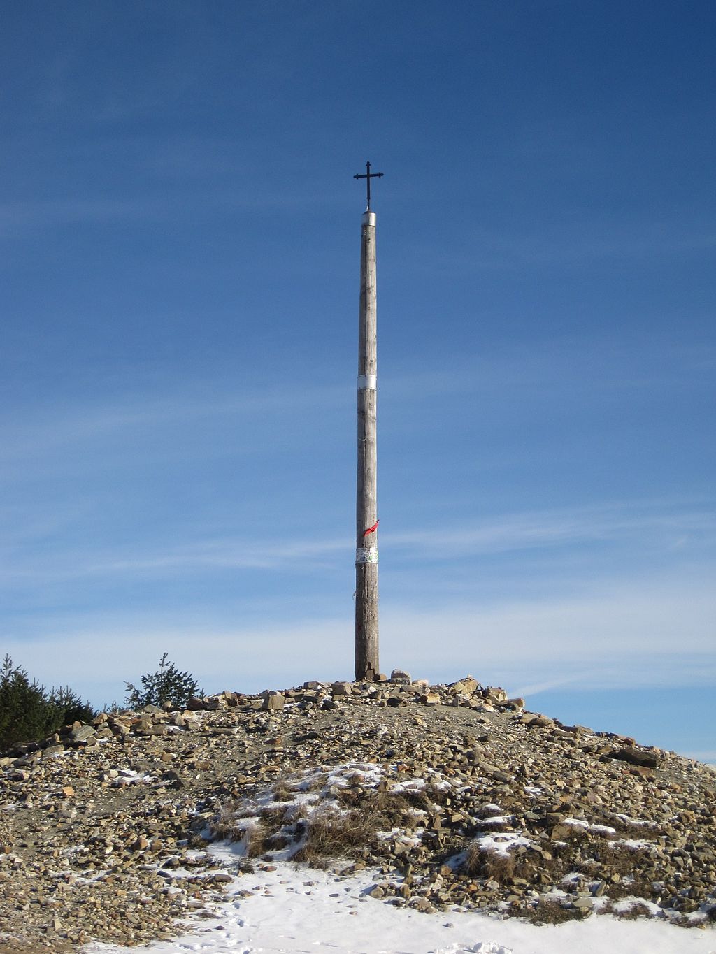
Once we leave Foncebadón behind, we go up by the LE-142 during 2 km with an inclination average of 4% until arriving to Cruz de Ferro, one of the most outstanding landmarks of the French Way at the top of El Monte Irago. From there we will have some impressive views of the surroundings.
It is said that Cruz de Ferro was placed there in the XI century by Gaucelmo, the Foncebadón’s hermitwho placed it over a big wooden pole so people can see it from faraway and guide pilgrims through the last part of the ascent to Montes de León. Today, this cross is at the Museo de los Caminos in Astorga, which is headquarters of the Palacio Gaudí, the one we talked about on the previous stage. That one we see today is an exact copy standing over a big pole of 5 m high surrounded by thousands of stones that pilgrims take from every part of the world since the beginning of their way just with the purpose of leaving it here.
ctually, Cruz de Ferro is a cruise, cruceiro in Galician; this is a monument that we will see in each route since the entrance in Galicia. The tradition of raise cruceiros has Celtics roots, they used to believe that dead people’s souls wander around the ways and that’s why their families left offerings for them there. A lot of times these offerings were stones and the places where there were too many already, were called milladoiros. With the Roman conquest, this traditions lived on and, in fact, in Galicia’s and Asturias’s area there are a lot of miliaries with inscriptions of Lares Viales (Gods of roads, like Mercury ) sculptured on them. When Christianism became oficial, these rites from Caminos crossroads also lived on and, in order to remove its pagan connotations, they built Latin crosses right in the same spots.
La Cruz de Ferro can be considered, hence, a cruceiro with a huge milladoiro around; that due to the stone collection, it’s a proof of how crowded can be the Jacobean paths. The strength transmitted by the image of so many stones and hopes put in that cross all over the centuries, make this landmark a very special place.
After having Cruz de Ferro as a reward, we prefer to continue by road, in a light descent until getting to Manjarín. In the past, right here there was a town that had a hospital for pilgrims, but today we only have the house’s foundations left, that we will see to both sides of the road.
On foot we can find only one of the most unmistakable shelters of the way, la Encomienda Templaria de Manjarín, managed by Tomás Rodríguez. Feeling himself part of the Templar tradition, he has been settled for years on this part, offering assistance support in exchange of milk with cookies and water. Just few years ago it didn’t have any electricity or water, even though they installed two solar panels.
WE IMMERSE OURSELVES IN EL BIERZO, NATURAL PARADISE WHERE WE GO DOWN TO MOLINASECA
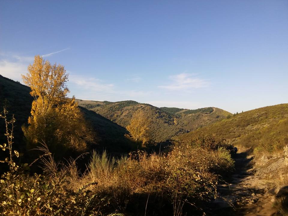
After passing by Manjarín we start one of the most difficult descents of the way that we must do by road. We are officially in El Bierzo and the impressive views of the surroundings stay with us during the entire journey. Who would imagine that only 30 Km behind we were crossing steppes and moors from Leon!!
The arrival to Acebo de San Miguel is especiallly inclined, a small town with an overwhelming charm which will be the first place we will visit to.
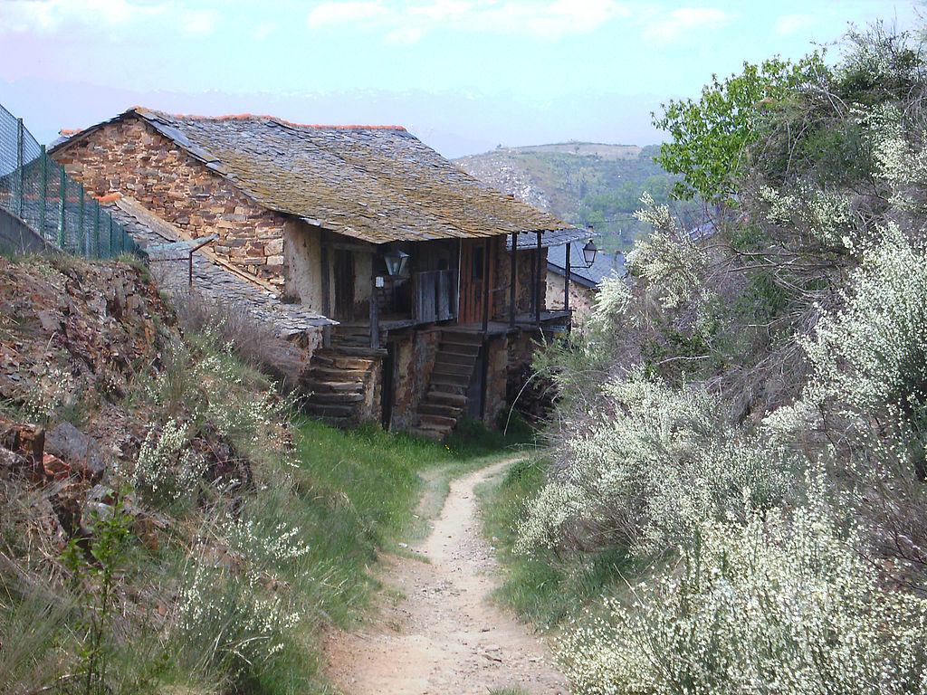
El Acebo is located at the hillside of the mountain and with the road as the main street. Little stone houses with black roof offering spectacular views, welcome us with different services such as pools, bars and restaurants.
At the exit of Acebo there is a monument made of iron with the shape of a bike united to a stick. It makes reference to Heinrich Krause, a German pilgrim who in 1988 fell off a cliff with his bike right in this place when he was heading to Santiago by the traditional Jacobean paths.
The walkers salute us from the left shoulder of the road until we change course by a path that goes over the LE-142, first by the right and then by the left. We leave the signs behind and continue through the concrete until arriving to Riego de Ambrós. The road borders Berzio by the North and in a higher height.
In Riego de Ambrós we can visit the chapel of San Sebastián, with its close fountain and the parish of Santa María Magdalena which has a nice altarpiece from the XVIII century. Pilgrims on foot leave the settlement behind by a stone path and slate chips. This way’s part is impossible for cyclists, so if we enter to Riego de Ambrós the best way to do it is going back to the LE-142 so we continue with our normal road.
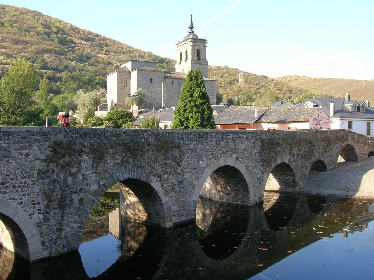
After 5 Km descending we reach Molinaseca, which it’s most famous monument is the Stone Bridge over the Meruelo River. A lot of walkers, after the heavy descent from Bierzo’s mountains, find in this refreshing water the comfort their tired feet needed.
JRight after passing by the entrance of Molinaseca, we can see the chapel of Nuestra Señora de las Angustias located at one side of the road. People say that a chapel was already there back in the XI century, even though what we see today was built between the XVI and XX century. Its headquarters is well supported on the mountain that, in fact, it’s part of it. The high belfry located at the western facade’s center had to be built in 1931as a counterbalance, because the mountain’s force could destroy the temple.
Following the road we get to the Stone Bridge, commonly known as “Puente de los Peregrinos”. People believe its origin is from the Roman times, but it’s not proven. There are medieval sources that indicate its existence since the XII century. In the actuality it has seven arches from different dates and sides, because it was object of different expansions.
Once we go across the bridge we immerse ourselves in all of the activities on Calle Real of Molinaseca where we will find all the services that we need. The streets finish at the LE-142 again. We’re almost arriving to Ponferrada, but for those who rather stop in the small towns and enjoy the countryside’s peace, Molinaseca can be a great option.
LAST KILOMETERS TO PONFERRADA
Going out of Molinaseca we continue going through the LE-142, in a much simpler profile, almost flat. In 5 km we go across the bridge over the Boeza River and, after, the Jacobean signs indicate taking a detour to the left in order to take a way and flow into el Castillo Avenue, right at Ponferrada’s urban center. Getting to the same avenue we need to follow the road without taking the detour, so it is just a matter of taste (the road is total appropriate for cyclists).
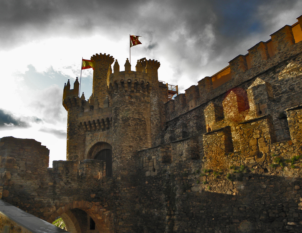
Continuing going through el Castillo Avenue we reach the bridge over the Sil River and, to our right, it appears before us the monumental Castillo Templario of Ponferrada.
If we cross the bridge we immerse ourselves in the most modern area of the city and, if we stay on this side, we can appreciate the castle and la Plaza del Ayuntamiento.
Welcome to Ponferrada!
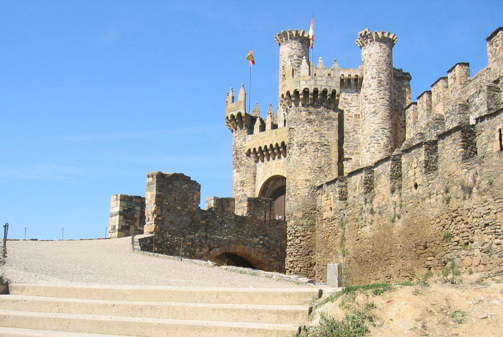
Ponferrada is a city divided on two by the magnificent Sil River. On the eastern shore the monumental area is located, where the majority of the architectonic medieval cultural patrimony of the city is, as well as the different museums. On the western border there is the most modern part of the city, modified and organized as an urban expansion district, where the industrial, hotel and office area are.
The size and the monumental character of the places of public interest turn the capital Bierzio into a perfect ending for the stage. We propose a 12 minutes’ walk in which less than 1 Km you will find all the clues you need to get to know this wonderful enclave and understanding how it has become what it is today. You can see here the promenade map.
We can’t wait for you to enjoy the Bierzo capital, a natural region bordering the Sil River, where everything that is part of its certificate of origin becomes synonymous of quality and good work.
Are you willing to get to know better Ponferrada?
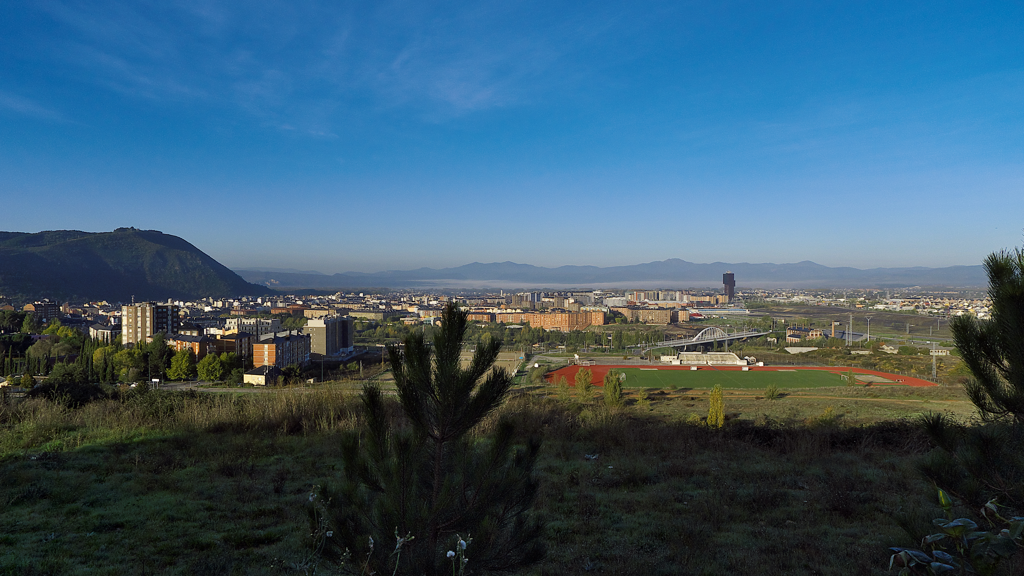
It all started with the “pons-ferrata”, an iron bridge for Jacobean pilgrims.
Even though there are traces indicating that on the shores of Sil there was some kind of settlement from Iron Times and Roman Times, there isn’t any document or source that would confirm it.
However, there are documents stating clearly how in 1082 the bishop of Astorga orders to build a bridge over the Sil River with the purpose of making the pilgrim’s crossroad easier. On the bridge they placed some iron chains as an impediment for the pass if you didn’t pay the respective toll, so that’s why they named it “pons-ferrata” (Iron Bridge). Some other researchers believe that the name, in fact, comes from the iron reinforcement that was placed on the bridge’s structure. In the western shore, after crossing the bridge, a small town was built up during the next century, around a church dedicated to San Pedro.
The other side of the river was uninhabited until Ferdinand II, in the second half of XII century, builds a small fortress over a promontory right on the Sil shore. On its surroundings, another settlement started growing and, in 1178, the King gave that part of the territory’s power to la Orden del Temple (Temple’s Order).
As we already mentioned, the mountain’s crossroads of León was a dangerous part of the way because of its hard weather conditions, the variety on its lands and the amount of thieves hiding between the wide vegetation. The Templars, the ones on charge of protecting pilgrims, made their fortress much bigger so they could have a total control and vigilance over the area. In 1211 Ferdinand II’s successor, Alfonso IX, decided giving the city to the Master of la Orden del Temple in Ponferrada, so they got the complete power.
Like everything that goes around Templars, his mandate in pons-ferrata is full of miracle legends and impossible feats. People attribute to them, for example, the sculpture’s discovery of la Virgen del Bierzo (la “morenica”) at holm oak’s trunk.
During the following centuries, they built around the city a lot of walls and the Templars built up an important power in that area. But as we already know from the previous stages, he Templar supremacy ended up being a total disgrace. Seen by monarchy and the main church of Roma as a threat to its authority, a complete mess between kings and popes ended up by abolishing la Orden del Temple in 1312, by force of murdering and expropriation.
Once the Templar knights disappeared, the biggest beneficiaries in Ponferrada were the big aristocratic families that were nearby the area: Castile and Galicia. In Leon’s area, los Osorio that, as we see in the previous stage, held the power of Astorga, having for a short period of time the power of Porferrada’s fortress. In Galicia, the family of The Counts of Lemos, settled in Monforte, also controlled the castle during some periods of the XV and XVI century.
The several fights over power between the Count of Lemos and his son at the beginning of XVI century ended up with a huge battle on the castle. The Catholic Kings took advantage of the situation and the instability to decree that the fortress was part of their property. They placed a chief magistrate in Ponferrada so he could take control on his name, and the organization of the city remained that way until XIX century, when they city grew a lot on the inside and outside of the walls.
Already in the XX century, the major city changed entirely thanks to the arrival of industrialization. The nearest coal and iron mines were exploited with heavy machinery and in 1949, a thermal power plant was open in the city.
In the actuality around 64 000 people lived in Ponferrada, that each day welcome–as it has been done for years- pilgrims who cross the Sil in order to continue with their way to Compostela.
Now that you know Ponferrada’s story… Are you willing to get to know its most important monuments?
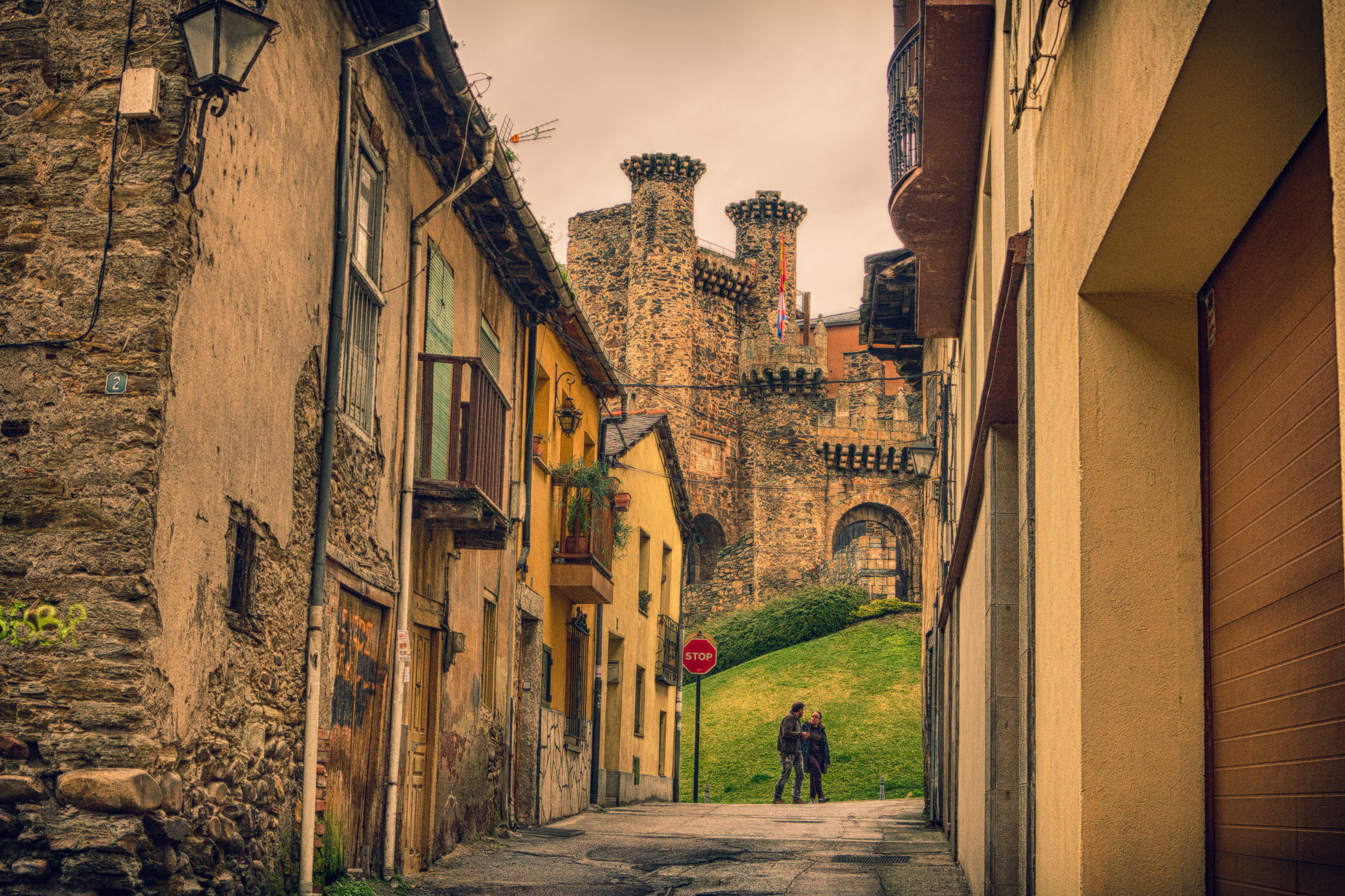
We start on the neuralgic center: el castillo templario
As a result of historical expansions, the castle that we can visit today in Ponferrada takes up the entire place as eight soccer fields. So, we can visit for a while! Putting aside the size, the thing that impresses the most of this monument is its exceptional state of preservation.
We explain you how to get there because it’s impossible to pass by Ponferrada without vising it. It has over 8000 m2, with double and triple defensive walls: towers with different shapes, barbicans (holes that shoot cannons) and gigantic walls; all of this surrounding a huge internal yard
The castle, actually, is the union of two big projects. The first castle has its base on the construction made by Templars in C.XIII with the support of the things already made by Ferdinand II before. When the Orden del Temple was abolished, Mr. De Osorio constructed the so-called “Castillo Viejo” (“Old Castle”) in one available spot, afterwards, the Count of Lemos expanded it in a way that he made a fortress-palace named “Castillo Nuevo” (“New Castle”).The Northern part, hence, is the only part left from the first constructions in C.XII.
The entire polygonal facility of the castle was bordered by a trench, except for the part heading to the river’s shore. After passing by the main door, made of masonry and flanked by two big fortified towers, we enter to the yard, and from there we can appreciate the huge Torre de homenaje, main structure of the castle.
From the second half of XIX century on, the monument started to get worse, people even used some of its stones to build blocks and use its yard as a grazing field. In 1924, they declared it as a Historic Artistic National Monument and, therefore, it’s now protected in a special way. They began like this, a reconstruction process that has finished with the building’s transformation into a museum. The ticket costs about 6€ and on Mondays it’s closed. The rest of the days it’s open from 10.00 to 18.00 with a lunch-break from 14.00 to 16.00. For more information you can see the webpage of el ayuntamiento.
Let’s have a museum tour and know Bierzo’s patron saint
In front of the entrance of castillo de Ponferrada is located the temple of San Andrés. It’s relatively new (C. XVII) inside of it a Christ figure is kept, that was before placed in one of the castle’s chapel, so that’s why its name is Cristo de la Fortaleza. It only has a main nave and its headquarters raises a baroque altarpiece with 6 alcove figures, in addition to the Christ one.
Following the pedestrian street Gil y Damasco, that borders the castle, we will see to our left the tourist office of Ponferrada and to our right el Museo de la Radio. The reason why there’s such a specific thematic museum in here is because this is the city that where Luis del Olmo was born, one of the country’s radio announcers with the longest career and who presented the oldest program of Spain’s radio history: “Protagonistas” had more than 12000 radio emissions. In this ancient building from the XVII century, known as “Casa de los Escudos”, his receiver collection is exhibited in a space that exposes fashion and all the uses that have been followed by the radio throughout the history. For more information about schedules and prices go to the webpage of the museum.
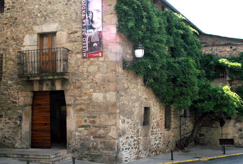
We continue our walk going up by the Gil y Carrasco Street that comes up right in front of the museum’s facade. We enter then to plaza de la Virgen de la Encina, where the homonymous church is located.
La Virgen de la Encina is the patron saint of Bierzo’s district since 1908. There are different legends about how this saint image was found, the majority making reference to Templars.. One of them mentions that the Virgin’s image was brought by San Toribio in the V century, when he made pilgrimage to Jerusalem (we mentioned his story on the previous stage). When he became bishop of Astorga he kept the image in the city and in C.IX, before the Muslim attack, the bishop at the moment took it out of the city and hid it in a holm oak of some forest. Six centuries later, Templars decided to expand their castle and needed a lot of wood for its construction. On September 8th of some year, on a Virgin’s day, they went looking for her and by cutting a holm oak’s trunk the complete image appeared before them, without any scratching.
The Virgin’s image is exhibited on its basilica’s headboard, in a niche before the major altarpiece. The sculpture we see is from C.XVI, the same century when the temple was built. In the past there was a church built at the end of the XII century, but due to how small it was, they decided to demolish it in order to build this new one. The current temple’s construction was tempestuous because in a lot of moments, they needed to stop due to epidemic diseases, administrative problems, among others. It almost took two centuries to finish it, so even though as a whole is very peaceful, there are different influences on it, from Late Gothic, initial Renaissance, Classicism, and somehow Galician Baroque.
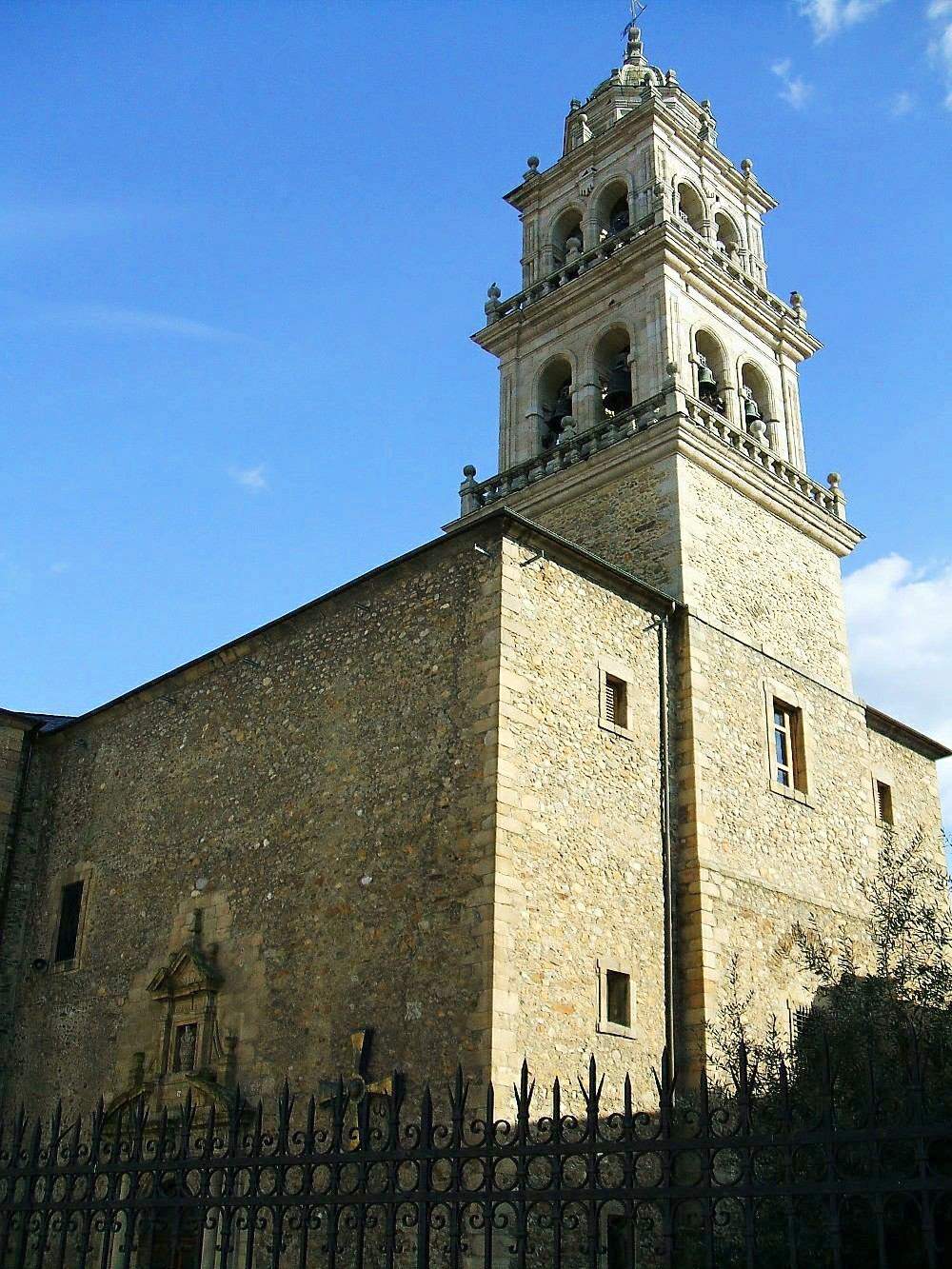
We go through Reloj Street and stop at el Museo del Bierzo and la Torre del reloj
We continue along Reloj Street and stop at Museo del Bierzo and the Torre del reloj.
Once we go out la plaza de la Virgen de la Encina by the North, we enter to el Reloj street. Almost at its end, before reaching Plaza del Ayuntamient, we can see to our right el Museo del Bierzo.
Even though they decided to make this project in 1966, its construction didn’t start until 1984 and was finished 12 years later. The building where it’s held, was the one where the chief magistrate of the city, mayor appointed by the King, lived during a few years since C. XVI. The main purpose of the museum is exposing the Ponferrada’s history and, to a greater extent, the history of Bierzo’s region. There are pieces from the Paleolithic period until the XX century. In the afternoon it’s only open from 16.00 to 18.00, so if you would like to visit but you don’t have enough time in the afternoon; you can enter the next day from 10.00 in the morning.
After passing in front of the museum we will cross under an arch where la Torre del Reloj is risen over. Actually, the arch is the only door left from the medieval walls that bordered the entire Ponferrada’s perimeter. Above them, two bodies were built from the XVI century, the first one with Phillip II’s shield and the one above with the clock on its upper part. The third body that we see today, with a bell, was made the following century.
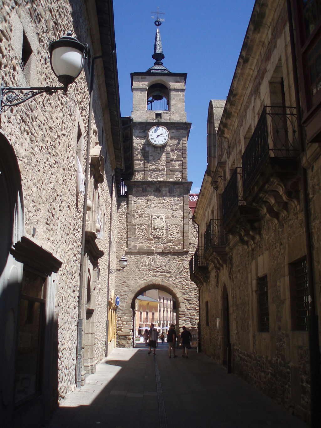
At el Museo del Bierzo the clock’s original mechanism is kept, the one from XVI century. Unfortunately, it’s not possible going up the tower, where we assume the views would be fantastic.
After crossing the old door of the medieval wall, we will get to Plaza del Ayuntamiento. Either in the proper church or in the surrounding streets we can find a lot of hotels where we can taste the best of Bierzo’s gastronomy: roast peppers, wine, chestnuts, cherries, etc. As a formal plate you can’t miss el botillo, pork marinate meat stuffed and smoked. They eat it cooked and with potatoes, legumes or vegetables. This is a perfect delicacy to give enough energy!
If you’re not really that hungry and you prefer keep walking a little bit, in Tournride we offer you to go to the bridge’s town and take a walk by the Sil River’s shore. To get there you have to go out Plaza del Ayuntamiento by Sta. Beatriz de Silva Street and go down after by la Calzada street. We get directly to the bridge, where in the past people supposed that it was located the pons-ferrata that gave the city’s name. After crossing it, we see the Plaza de San Pedro, where was located the church that was place of the first medieval settlement of the area, few centuries ago.
We recommend you passing by the Eastern shore of Sil River until crossing over el Castillo bridge and finishing at the starting point of our walk.
Tomorrow we will make a huge advance in our pilgrimage… We will finally enter to Galicia! We are getting closer to the end each time; from Tournride we hope you enjoy your experience to the best. In order to do so, we will keep guiding you in your French Way by bike.
¡Buen Camino, pilgrims!

