STAGE 5: FROM LOGROÑO TO SANTO DOMINGO DE LA CALZADA
Xavier Rodríguez PrietoFRENCH WAY BY BICYCLE
- Distance to Santiago: 612 km
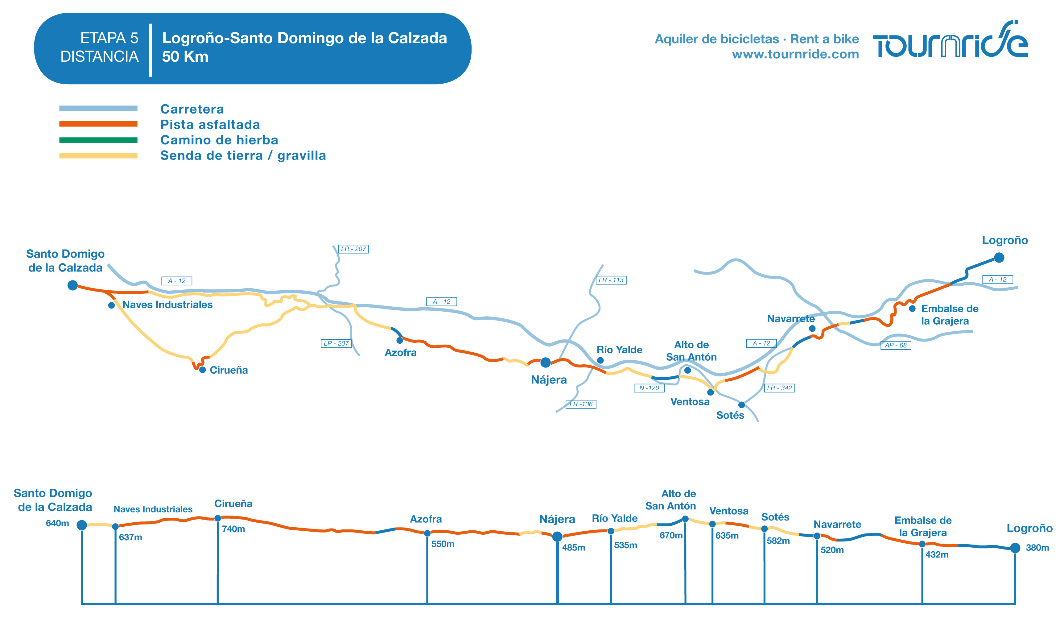
- Stage distance: 50 km
- Estimated time: 4 – 4,5 hours
- Minimal height: 740 m
- Max height: 380 m
- Difficulty of the route: Medium – low
- Places of interest: Navarrete, Nájera, Santo Domingo de la Calzada. Optional diversion to San Millán de la Cogolla to see the Monasteries de Yuso y Suso.
- Itinerary in Google Maps: To see the tour in Google Maps click here
PROFILE AND STAGE’S MAIN ROUTES
When leaving Logroño by the industrial zone we arrive at a bike lane that in very light ramp (of about 1.5%) makes us appear at the edge of the reservoir of La Grajera in less than 2,5 km.
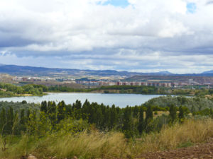
We skirted the reservoir on the right, on a sloping path that ends in a narrow ramp. We must raise it for 1 km until we reach the edge of the A-12 motorway.
We continue along that asphalted track with the motorway to our right for little more than 1 km, when we join the N120 for only 200 m, since we must take a exit signposted to the right and that leads us to cross the AP 68 for a overpass. All this stretch from the reservoir to the AP 68 we do it in slight slope for asphalted tracks or gravel quite comfortable. Caution only when crossing the N120.
Since we cross the AP 68 through that upper pass the profile will be a slight ramp until we reach Alto de San Antón (kilometer 20 of stage). That is to say, in the following 9 km we overcome a difference in altitude of 230 m, alternating gravel tracks with other asphalted between fields and vineyards.
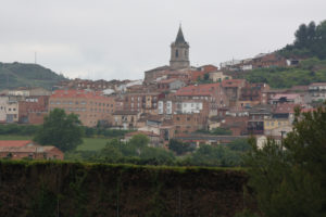
Navarrete is on top of a sort of hill. After crossing it, we leave for the N 120, which continues for 1.5 km until a gravel track to the left, marked with a milestone with the yellow arrow.
For 1.5 km we must follow that dirt track on a slight ramp until turning right to approach again to the N120 and continue parallel to it until you see a fork to the left. A sign indicates that if we take that path to the left we will pass by Ventosa and we must choose if we want to cross this locality or to obviate it.
If we pass through that locality we will travel 1,3 km until arriving at it by a foot of gravel, in a slight ramp of less than 2% that alternates with flat sections. After visiting it we will return to the trail, walking a little over another kilometer until turning left and reaching Alto de San Antón.
If you do not want to go through Ventosa we will travel a little less than 3 km in a straight line, with the A-12 to the right, until reaching the Alto de San Antón.
Following the same dirt path between agricultural fields we will cross the A12 by an underground passage, then continue with the road to our left. In slight slope we will arrive until Nájera in less of 6 km, entering by its zone of industrial estate.
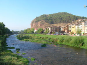
We leave Nájera on the east by Costanilla Street, asphalted and in slope. After 800 meters the sign becomes gravel and so it will remain until we reach a signposted crossroads, where we will return to take paved road. The profile will be generally very soft.
Nice walk between fields where we cross Azofra (kilometer 34 of route) and we return to the edge of the A12. After going parallel to it for 1 km we arrived at a roundabout that we crossed.
After crossing the LR 207 at that roundabout to reach a dirt path, we see that the road forks, marked with a yellow sign and arrow.
If we go to the left we will follow a dirt path in ramp between fields until we reach Cirueña, where we can visit the hermitage of the Virgen de los Remedios. It is a difference of height of about 150 m in about 5 km. We will leave after Cirueña by another path of earth, but in slight slope and with smooth profile. In about 5 km we will arrive at Santo Domingo de la Calzada.
If, after passing the LR 207, we continue straight ahead instead of going to Cirueña, we will have to travel a little more than 9 km near the edge of the A12 by a gravel track. During the first 4 km we will have more jumps but then the profile will become very smooth until entering Santo Domingo de la Calzada, where is the end of the stage.
In summary, at this stage, a difference in elevation of about 350 m is overcome, but it is done gradually. There are two points where the profile becomes a little more steep, in the arrival to the Alto de San Antón after passing Ventosa and passing by Cirueña, before entering Santo Domingo de la Calzada.
In addition, there are three route variations that we can do:
- Choose whether or not to pass by Ventosa near the kilometer 17 of route.
- To choose to pass or not by Cirueña in kilometer 38 of route. If we choose to go by this locality the difference of stage mileage does not very much, but it does require us to reach a slightly higher level.
- Go to visit the Monastery of San Millán de la Cogolla from Azofra to return by Cirueña to Santo Domingo de la Calzada. We will do 33 km instead of 14 km from Azofra to the end of stage, but the visit is well worth it.
In general, this stage is simple. Good firm, height differences but we will overcome on continued light ramps. Many of the tracks we will take today are perfect for cyclists. A stage to enjoy!
PRACTICAL TIPS
- If you start in Logroño, in Tournride we help you get there. Logroño is a very well communicated city, with airport and train station and buses.
Go by bus: Here you can see the bus connections with the rest of Spain and the companies that make each way (some of them are, Alsa, Bilman Bus y PLM).
Go by train: The train station is here and the best thing to know about its connections is to visit theRenfepage, since with transshipments you can reach almost from anywhere.
Go by plane: The airport is here, 9 km from Logroño and you have to go by taxi or by car. It only has regular connections with Madrid. The other option is to fly to Pamplona and take a bus from there
Remember that in Tournride and we can take your spare luggage so that it is waiting for you in your way end..
- From Navarrete to Nájera there are more than 13 km with no place to stock up, unless we pass through Ventosa midway. If you do not want to stop at Ventosa, take supplies in Navarrete
DETAILED ITINERARY AND HISTORICAL-ARTISTIC HERITAGE
This stage, which we travel throughout La Rioja, will allow us to visit natural environments as impressive as the Najerilla River and visit some of the most emblematic of the Jacobean.
We will start the day by a pleasant green road that, crossing the Riojan landscape, will take us to Navarrete, where we can see the impressive late-Roman remains of San Juan de Acre. Going through places full of legends such as the Roldán Poyo we will reach Nájera, where we will enjoy its impressive natural heritage and natural environment and we will learn about other legends and miraculous apparitions. The road will take us to Santo Domingo de la Calzada, one of the most mythical localities of the region, founded by today Santo Domingo García in the 11th century, who dedicated his life to building infrastructures to facilitate the pilgrimage to Santiago.
We can also deviate to visit the monastery of San Millán de la Cogolla, considered the birthplace of the Spanish language.
Can you ask for more?
WE LEAVE LOGROÑO BY THE RESERVOIR AND VISITED NAVARRETE GRAJERA
We leave Logroño by the industrial estate and from the Avenida de Burgos we arrive at a roundabout where we see the park of San Miguel behind. From there we take an underground passage that crosses the LO-20 and makes us leave Logroño.
We leave in a pleasant green way that takes us by the park of the Grajera until arriving at the reservoir. We then skirted the reservoir along the same path.
The Grajera reservoir was created in 1883 to irrigate the orchards near the city and gradually became conditioned as a park. If you travel this route on a hot day and when you see the water you think about taking a bath, do not even think of it! It is a protected environmental area and the water ecosystem is studied, so no human interaction with it is allowed.

We ascend the ramp from the reservoir until reaching the fence that marks the edge of the A12, where the pilgrims have hung many wooden crosses. Along the way we will see that there are more places in which this tradition is repeated.
We follow the road until crossing the AP 68 by an overpass and see to our left the remains of the church of the Hospital of San Juan de Acre. After their excavation, the most interesting remains were taken to the cemetery of Navarrete, which we will see on our way out of town
WE ARRIVE TO NAVARRETE, IN THE TEDEÓN HILL
Navarrete is at the top of Tedeón hill. This strategic position made until the S. XVI had a very defensive character, with a castle at the top and surrounded by walls. Little by little all these elements were thrown to take the form that it has today, with two parallel major streets in the hillside of the hill and with the Way of Santiago crossing it from east to west.
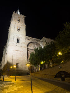
In the center is the main monument of the town, the church of the Assumption of the Virgin. On the outside, its Renaissance lines are simple but, if we have an opportunity, it is worth going inside to take a look at the wonderful altar and altarpiece in Baroque style, completely covered with gold carvings.
The number of references and sale of pottery in the town will surely call attention to us and is that Navarrete is one of the most important traditional potter’s centers of the peninsula. Its pottery tradition goes back to Roman times, when with the mud of the Najerilla river pieces of the so-called “terra sigillata” were made, a type of red Roman pottery
We leave by the town by the N120 and we find to our left the cemetery of the town, where as we have already said we will see the remains of the church of San Juan de Acre.

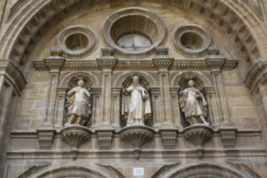
Stone by stone moved the remains from its original location to this point, where it continues to impress the thickness and quality of the walls and their ashlar masonry. The cemetery gate is the old north door of the church and is flanked by two large windows that were once at the head of the temple.
In Tournride we recommend that you get closer to see the decorative details of the whole, in a late-Romanesque style. There are numerous representations of legends (such as that of Roldan and the giant Ferragut, which we will explain later), biblical passages such as St George and the dragon fight and tender ones like angels hugging each other.
There we can also see a plaque in memory of Alice Craemer, who died in 1986 when she was hit by a truck while doing the Camino.
FROM NAVARRETE TO NÁJERA: WE DECIDED TO VISIT VENTOSILLA AND WE KNOW LEGENDS OF STRUGGLES AGAINST GIANTS
We continue our way and, after about 4 km, passing under an upper pass of the A12 and always with the motorway to our right, we will see a sign that indicates the detour to Ventosa. If we pass through this locality we add about 1 km to the route.
Keep in mind that if we do not go through Ventosa, we have 9.5 km to get to Nájera, so if we want to eat or we are short of water, it is not a bad idea to spend to stock up. In Ventosa there is also a hostel with a closed place to store the bikes.
We go by Ventosa or not, we pass by Alto de San Antón (675 m of altitude) from where we will see Nájera for the first time in the distance (485 m of altitude). We will not lose sight of it for the next 7.5 km that we will carry out in a slight slope until arriving there.
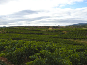
But before reaching Nájera, after crossing the N120 by an underground passage, we will see on the way to our left the Poyo de Roldán..
First we will leave to the left the hill to which they are referred as the poyo and, a little later, we see an explanatory poster that recalls the legend of Roldán against the giant Ferragut happened in that hill and that in Tournride we reflected to us in summary way in Some lines. We recall that Roland was the nephew of Charlemagne, the emperor of the Franks. It is a historical personage, although his military feats have happened to shape the history a sort of mythical legend on his life.
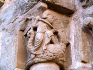
Here we remember how one day came to the ears of Charlemagne that in these lands there was a Syrian giant called Ferragut who proclaimed the supremacy of Islam against Christianity. Knowing this, Charlemagne sent a group of soldiers to kill him, who fought with him for days without success. There came a time when Roldán asked his uncle to fight and they did, for two days and two nights. Exhausted, the two opponents made a stop and began to talk about their religions. He created a relaxed atmosphere between them and the giant confessed to Roldan something that would eventually cost him death: he told him that his only weak point was his navel. Roldán attacked at that point when they returned to the fight and defeated the enemy.
This legend fits historically in the struggle to expel the Muslims from the peninsula during the Reconquest, when the figure of Roldán was often used as a great defender of Christianity whose military supremacy was related to the superiority of Christianity.
WE COME TO NÁJERA: “PILGRIM: IN NÁJERA, NAJERINO”
This town of great Jacobean tradition welcomes us with this message painted in a farmhouse at the entrance of the village, a nice way to enter feel at home in our 27.5 kilometer stage.

We enter through the east and cross the river Najerilla by the stone bridge attributed to San Juan de Ortega,, impeller of infrastructures of the Way between the XI and XII (although the bridge has been reformed).
Already on the west bank, we cannot miss the Monastery of Santa Maria la Real, pantheon of ancient kings of Navarre. He was commanded to found King Don Garcia Sanchez II in 1052, after conquering that territory from the Muslims. He dedicated it to the Virgin because in that place a while ago this had appeared to the king in a cave, when he was hunting. The monastery was managed by Cluny until the S. XIX, today is Franciscan.
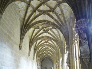
At the foot of the church is the cave where the legend of the Virgin occurred. At its entrance is the royal pantheon of kings of Navarre, with twelve burials with majestic carved tombs of between the X and XII.
The church is between Gothic and Renaissance styles. The cloister, a real jewel, is buzzing very much, where many nobles are also buried. It is worth your visit (we advise that it has a cost of € 4).
In Nájera it is also worth to enjoy the natural environment of the Najerilla, nestled between impressive red earth walls.. In this locality harmoniously coexist an impressive place with great monuments in stone like the monastery that we have seen.
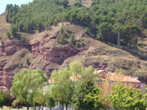
SIf we see ourselves with strength and want to see some amazing views of the place, we can climb the Nájera castle before leaving. It is between the castle of La Mota and the village. Its origin, like the one of the castle, is Muslim. In the S. XVI was rehabilitated to be palace, but at the end of that century stopped being occupied and began to deteriorate until in the S. XVII and almost there were only ruins.
Thanks to the various archaeological campaigns that have been carried out, many remains have been discovered, now safeguarded in museums. Although “in situ” there is not much of the glorious past, the views and natural surroundings that surround us is worth.
IN AZOFRA WE DECIDED (OR NOT) DRIVING TO SAN MILLÁN DE LA COGOLLA
We leave Nájera up a paved slope on Costanilla Street. Soon we are already on a good track of land that in 5.5 km will take us to Azofra, in profile smooth.

In Azofra we enter by its main street, that as in many jacobeos towns crosses the whole locality and it coincides with the Way of Santiago. In Azofra we will find all the services that we need and we must make the decision to deviate to visit San Millán de la Cogolla. If we decide to go see it, we will make 33 km to Santo Domingo de la Calzada. If we continue straight, 12 km.
What is it that awaits us if we decide to make the effort to add 21 km on our way to visit San Millán de la Cogolla? As one of the most impressive monastic complexes in all of Spain, formed in fact by two monasteries that were initially differentiated: Suso and Yuso. The whole is a World Heritage Site since 1997.
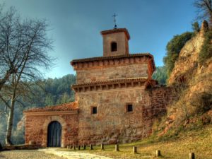
The origin of the group is found in S. V, when in Rioja lands Emiliano was born, a hermit who dedicated his whole life to the service of Christianity, so he was canonized and today we know him as San Millán.
When Emiliano dies, his remains are taken to a cave in that place, which then becomes a church and then in the center of a monastic community. We must take into account that this community was not like the monastic communities that we know today, but followed the Mozarabic rule and was mixed, lived in it men and women. This was very normal in the Iberian Peninsula until the S. IX.

In the 11th century Don García Sánchez II, the same king who ordered the construction of Santa María la Real, orders to carry the remains of the saint to Najera. But, by a miracle, those who carry it remain “nailed” without being able to move, which is interpreted as that the saint did not want to leave the place.
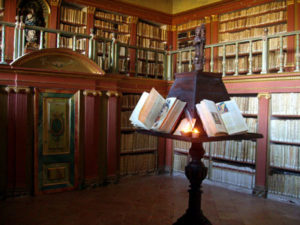
Therefore, the king orders to build next to the Monastery of Suso another monastery to leave there the remains and the monastery of Yuso is constructed. This monastery already follows the Benedictine rule and is only masculine. The two coexist side by side until the year 1100 when they come together and begins their time of splendor.
This golden age materialized, above all, in an incredible production of codices, most of which are stored today in an immense library in the monastery that can be visited. In fact, it is considered that here the coded Castilian language arose as we understand it today, because a monk in this “scriptorium” was the first one who wrote in Castilian in one of these codices. It is very significant because, at that time, Latin was the language “cultured” and therefore the only one that was written. Castilian, on the other hand, was the popular language and not writing was neither regulated nor codified. When beginning to write begins to form the Castilian as we speak today.
In addition to the historical importance of this complex, the place is impressive from the artistic and architectural point of view, so the visit together becomes a delight. From Tournride we advise you to inform yourself before undertaking the visit to the monasteries, to avoid the displeasure to arrive and that, for example, is Monday and are closed.
FROM AZOFRA TO SANTO DOMINGO DE LA CALZADA
We leave Azofra by the northwest following a paved track that in a few meters happens to be of land, but of good firmness. We continue until reaching the A12 and, after crossing 1 km by the side of the highway, we arrive at a roundabout from which leaves the L207. We cross the other side of this road to follow a dirt track.
About 50 meters after crossing the road we see a bifurcation. This is where we should choose if we want to continue straight to pass through Cirueña or turn right to go straight to Santo Domingo de la Calzada.
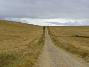
If we decide to go for Cirueña, we must go down a dirt track on a gentle ramp for about 5 km until we reach a large urbanization with a golf course, recently built. To the north of this urbanization is Ciriñuela, the old town. Between the two isthe hermitage of the Virgin of the Remedies,, temple of recent construction in masonry and brick, with pastel colors and simple interior.
Actually, the distance that is crossed passing or not by Ciriñuela does not vary much, they only add about 2 km, but the walk is much more pleasant taking the detour. If we continue straight we will all the time almost glued to the highway, instead of by roads of good firm between great fields of vineyards.
A WALK OF AN AFTERNOON BY SANTO DOMINGO DE LA CALZADA, “WHERE SHE SENT THE HEN AFTER ROAST”
We enter Santo Domingo de la Calzada on Calle San Roque, to the east. As always, in Tournride we tell you a bit about the history of the place of the stage and we propose a short walk in which you can know the place a little.
In this case, the walk takes 15 minutes and in it you can see the main monuments of the place traveling less than 1 km Click here to see the tour map.
Are you urge one?
First thing: let us know the life of Santo Domingo, patron of the engineers
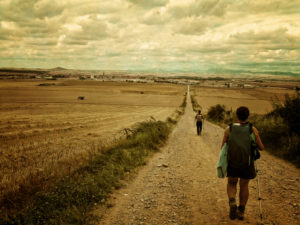
The emergence of the locality of Santo Domingo de la Calzada is related to the life and work of Domingo García, a man who in the 11th century dedicated his time to build infrastructures to facilitate the way for pilgrims.
It is said that what today is Santo Domingo de la Calzada was in the 11th century a forest of oaks next to the river Oja. A hermit named Domingo lived in that forest, retired to his spirituality because he had not been admitted to the Benedictine monastery of San Millán de la Cogolla. He saw every day the difficulties that the pilgrims had to overcome the geographical accidents in those lands, at a time when the Way was in all its splendor. Together with a bishop, who also set out to help them, Domingo built a wooden bridge over the river Oja.

When the bishop died, Domingo continued creating infrastructures, the most well-known stone walkway that ended up giving name to the present locality in his honor. He changed the wooden bridge over a stone and built a shelter and church.
TAll this gave an economic and population boost to the town that was being created, at that time, enhancing the settlement of merchants. King Alfonso VI, seeing how helpful this was, decided to give Domingo the direction of other works of the Way and he and his disciple Juan de Ortega continued to carry out different infrastructures. For this reason, Santo Domingo is today the patron of the engineers of roads, canals and ports.
MIRACLES OF SANTO DOMINGO
Domingo’s dedication and solidarity and kindness, which made him well known to the poor and rich during his 90 years of life, have caused that over the course of time have been attributed multiple miracles to this saint.. Many of them in life and others of healings of pilgrims when they visited his tomb.
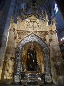
His most famous miracle is that of the rooster and the hen. This story tells how a family with a young son who was pilgrimage to Santiago stopped at the hospital of pilgrims that Domingo had built. The hospitalera fell in love with the boy, but this did not correspond to him and, disrespectful, she hid a valué of the shelter in the backpack to the young person, accusing to him of robbing it when it went with his family of the place.
The boy was condemned to the gallows, sentence that was fulfilled. But after he was hanged, his parents approached and listened as he spoke and told them that he was alive thanks to Domingo. The parents went to tell the corregidor, knowing that before such a miracle he would exculpate his son. When he heard his story, he told them jokingly that the young man was as alive as the hen (already roasted) who was preparing to eat. Suddenly, the hen revived and the corregidor, astonished, excused the boy.
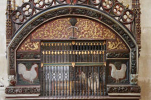
Hence the motto of the town of Santo Domingo de la Calzada, “where the hen sang after roasting”. In honor of this story, a live hen and rooster are kept in the cathedral of the town, which is changed every 15 days and during the local festivities of the town they eat “ahorcaditos”, typical sweets.
WE START OUR WALK ALONG CALLE MAYOR …
We start walking on the east side of the village, entering Calle Mayor, at the center of which is the complex that once started Santo Domingo and which we will also visit.
A few meters from the beginning of the walk, we find on our left with a large stone building: it is the monastery of Nuestra Señora de la Asuncion, S. XVII. This Cistercian abbey has a hostel for pilgrims (free) and a lodge that nuns use as a way of life.
We continue walking and in a few meters we will pass by the tourist information office, where if we want we can make a stop to get a map or more information.
In about 60 meters to our left opens the square of the Alameda, a small green corner where we relax if we need it. Across the street is a very special building: the house of the Brotherhood of the Holy. It is formed by several buildings, from the S. XVI to a modern hostel and has a great material on exhibition on the life of the saint. In this place is where they raise the birds that are then taken to the cathedral to remember the miracle of Santo Domingo..
We will arrive at the Plaza del Santo: tower, cathedral and parador

In the center of the town is the cathedral of Santo Domingo. Its southern door opens to a square in the main street, where there is a large tower.
The Exenta Tower is the highest in La Rioja and is nothing other than the bell tower of the cathedral. It is rare that the bell tower separates from the main building, but it is believed that in this case it was done because the ground was unstable (being near the river) and this was the best place to hold so much weight. In fact, it is said that to help cement the tower were added to the ground remains of animal bones. Before this baroque tower there was another Romanesque and Gothic, destroyed by a fire and by its bad state, respectively.
The entrance ticket for visiting the cathedral can also include the entrance to the exempt tower, which from its top floor offers spectacular views of the surroundings. From Tournride we recommend that you opt to climb as it is well worth it.
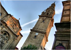
Next to the tower we see the entrance to a small hermitage, the hermitage of Our Lady of the Plaza. It is said that it was built on an ancient oratory that the saint had made with his own hands. The aspect that it has today is the result of the superposition of different works until 1710.
In front of the tower is one of the two “paradores” in the town. The Parador occupies what was formerly a hospital of pilgrims, carried out by Santo Domingo. It is striking in its lobby, with many Gothic arches and a paneled wooden ceiling.
We enter the cathedral of Santo Domingo de la Calzada
In the square of the saint we will see the south portal of the cathedral. In this arm of the temple is where the sepulcher of Santo Domingo and the chicken coop where a rooster and a hen are conserved not to forget its miracles.
This same cathedral that we visit today has its origin in that primitive temple that Domingo García built in the S. XI near the river Oja, next to a hospital. The growing importance of this nucleus in the Way of Santiago was that successive reforms were added to that initial construction until arriving to form what we see today.
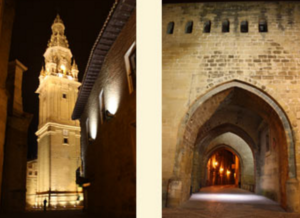
The relevance that the place was charging can be seen not only in how it was carved in stone, but also in the rank that the early church was welcoming. Already in 1106 its rank was increased to colegiata and in S. XIII the episcopal seat moved from Calahorra to Santo Domingo, reason why the temple became cathedral.
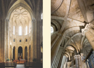
The result of all this is a large temple with a pilgrim plant in Latin cross, formed by a mixture of styles that concern from the Romanesque to the Baroque that we find, for example, in the Exenta tower.
The pilgrimage plant is a type of temple form that includes a kind of corridor that skirts the ships and the spinning, so that you can go all the way inside the walls without intervening at any time in what happens on the ship Central and on the cruise. Thus, you can visit the church tomb without disturbing if there is a mass at that time. The cathedral of Santiago also has this type of plant.
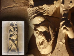
In the Cathedral of Santo Domingo we encourage you to open your eyes to look at the decoration on the capitals of the columns, especially those of the apse. Both inside and outside there is an impressive late-Romanesque iconographic program, with scenes of fantastic animals and representations of passages from the Bible. Experts consider it one of the best and most complete of this era.
In the northern part of the cathedral is the cloister, which today houses the Cathedral Museum.. If you are interested in the history of the place and sacred art, do not hesitate to visit it. Schedules and prices of the visit to the cathedral and the museum here. In addition, in the south arm of the cathedral we will also see the chicken coop where the rooster and the hen are kept remembering the miracle of the saint.
Between rest of walls and old convents, we finished our walk with the best of the gastronomy riojana
We cross the apse of the cathedral and we arrive at the Plaza de España, where the town hall is. The most characteristic of the building are the arcades open to the square by lowered arches, where merchants used to bet to sell their products under cover with the shelter of the wall behind them. When the town hall moved to the upper floor, this began to expand successively until during the Baroque was given the shape it has today.

From the square we leave to Burgos Avenue, which surrounds what used to be the wall that protected the old town of Santo Domingo de la Calzada. In fact, a few meters later we will see some remains of her quite well preserved.
The walls of this population totaled more than 1.5 km of perimeter in total, with an average of 12 meters of height, 38 turrets and seven doors.. What we see today in the Avenida de Burgos are the remains of one of those towers and part of the thick walls that protected Santo Domingo.
We continue bordering the old nucleus until arriving to the Parador of Santo Domingo Bernardo de Fresneda.. It was built in the 16th century to welcome a Franciscan community, but in the 19th century with the disentailment the place was abandoned. Nowadays it has been renovated and it houses a Parador with restaurant. Also part of the place is used as a workshop to restore works of art.
The church of San Francisco welcomes the tomb of Fray Bernardo de Fresneda, who was archbishop and confessor of kings like Felipe II or Carlos V.. He himself put many means to reform the church that would welcome his tomb and his effort makes today his visit worth it. Special attention to the church cruise, a good example of Renaissance.
We are on Juan Carlos I Avenue, the perfect place to finish our walk in Santo Domingo de la Calzada, because in this street and in the parallel the majority of restaurants are concentrated.. You will find offers for all kinds of pockets and you can try typical dishes like cod or potatoes to La Rioja, To drink, of course, a good glass of Rioja.
Tomorrow you change community again, we enter Castilla y León and we will pedal until reaching Burgos, another of the great Jacobean cities. ¡Buen camino!

