STAGE 1: SAINT-JEAN PIED DE PORT TO RONCESVALLES
Cristina FernándezCamino de Santiago by bike
- Distance to Santiago: 765 km
- Distance in phase: 26 km by Route of the Ports of Cize / 28 by Route of Valcarlos
- Estimated time: 4-5 hours
- Minimal height: 233 m in Saint Jean Pied de Port
- Maximum height: 1480 m in Alto de Lepoeder by the Route of the Ports of Cize / 1057m, in Alto de Ibañeta by Ruta de Valcarlos
- Route Difficulty: High / Very High
- Places of interest: Saint Jean Pied de Port, Upper of Ibañeta, Roncesvalles
- Itineraries on Google Maps: To see the route on Google Maps click here
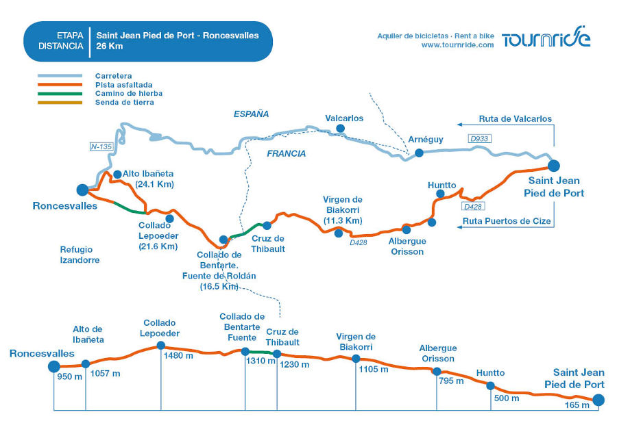
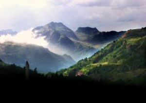
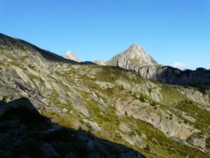
In this first phase we will face what may be the hardest route of all, but it as a reward to us we get one of the most spectacular views of the road. We will cross the Pyrenees from Saint-Jean Pied de Port to Roncesvalles, an extraordinary landscape full of history in a stage in which we will overcome about 1250 meters of unevenness.
PROFILE AND STAGE’S MAIN ROUTES
At this stage we have two itinerary options:
- Choosing the traditional route that Pilgrims walk on foot, called “Route of the ports of Cize” or the “Route of Napoleon”
- Skipping this route and choose to hit the road, following the D399 and the N135. This route is known as “Ruta de Valcarlos”, because it goes through that place.
The considerations to take into account to choose one or another route are mainly weather, our physical form and the month of the year in which we peregrinate.
Due to the mountain accidents that some pilgrims have suffered during winter when crossing the traditional route by disinformation, or due to excess of confidence the transit by the Route of the Ports of Cize between the 1 of November and the 31 of March has been banned. If we pilgrimage during these months, we must obligatorily do it by the road route.
If you choose the Route of the Ports Cize…
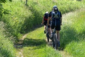
Despite its difficulty, the Route of the Ports of Cize is the most spectacular and the effort to make it really worth it. If you are in a plenty physical form, you are able to deal with this sender. Always realize that at some points you’ll have to bike off and push, but it is more of having patience than fighting against exhaustion. In this road we will feel way more the weight of the saddlebags, when climbing some stretches with more than ten kilograms, can get noticed.
Even if you are there within the months allowed, if it is bad weather, either because it rains or snows, or because it is very windy or cloudy, do not take this traditional route. It can be very dangerous in bad weather, rain muds the ground and with lots of wind the effort ascending multiplies. If it is very cloudy we will not get any reward in views and landscapes speaking, therefore, it doesn’t make much sense to go by the Ports of Cize.
If you choose the Route of Valcarlos…
The road route is less spectacular but necessary in case of bad weather and easier. If your fitness is not so good, this may be a very good option for you. The route follows the route of the national road D933 until Arnéguy, where it crosses the border with France and enters in Spain by the N135. Pass through Valcarlos and continue to the mythical Alto de Ibañeta (1057 m.).
The general phase profile condition for the Cize Port Route is quite uneven. As we have already mentioned, they are almost 1250 meters of climbing. Still, we must keep in mind that the main slope will be found shortly after leaving Saint-Jean, where we will climb a slope of almost 13% over more than 4 kilometers. Although it is almost at the beginning of your path, do not hesitate to get off the bike if necessary, otherwise you could get exhaust and have problems to face the rest of the road. Also remember, completing the road in electric bikes is always a very good option and can help you in moments like these. When arriving at the viewpoint of Arbola Azpian the slope gets smoother and thus it will continue like that until the maximum quota of the phase, in the Height of Lepoeder (1480 m.). From that moment we will start a descent to Roncesvalles which is much enjoyed, although we must go down and not relax as it also requires some technical difficulty.
On the other hand, the phase profile on the Route of Valcarlos is smoother than the traditional route; in total it overcomes a difference of less than 900 meters. Leaving Saint-Jean Pied de Port we will take the D933 road and through the first eight kilometers the unevenness to overcome will be only about 200 meters. Arriving Arnéguy, where the French-Spanish border crosses, the D933 road becomes the N135 and the slope will become progressively steeper as we approach the Alto de Ibañeta, the highest point on this itinerary. The overall slope in that stretch will be about 6%. In this route we must be careful with cars/Trucks traffic. It is a general road and we always must take the necessary precautions, wearing the reflective vest, or lights if necessary.
Route variants
A third route option would be to combine both routes. We can take the Route of the Ports of Cize and when arriving at Collado Leopeder and take a detour that will take us direct to Alto de Ibañeta, where we continue along the N135 until arriving at Roncesvalles.
If you are an experienced rider and when you reach Roncesvalles you still see yourself with strength or you find that there is no place to sleep, you can continue to Zubiri. It is about 22 km more to go, but it is all downhill and it is a rather gently road. If there is no place in Roncesvalles but you do not see yourself able to get to Zubiri, there are intermediate places where you can stay overnight, such as camping in Burguete (which is only 3 km away from Roncesvalles).
PRACTICAL TIPS
From Tournride we want to make easier your beginning of the journey. To do this, we gather here some tips and useful information for this first phase:
They always say that “beginnings are hard” and this phase is an example of it. If you decide to do it you will get an incredible experience and an incredible connection with nature, but you must do it calmly and listen to your body. If you feel that you should stop and push the bike at some point, do it.Never forget that since 2015 it is prohibited to take the traditional route of the Ports of Cize between 1 November and 31 March.Since that through the Route of the Ports of Cize does not pass practically by any population, a refuge has been enabled to spend the night in case of emergency. It is called Izandorre refuge, and it’s located in Lepoeder. Inside we will also find a communication system (TETRA network) that will always have coverage and that will put us in touch with the 112 with the push of a buttonBring food and water for the whole route, especially if we take the traditional route. Sometimes the sources are dry.We always insist that it is necessary to find an appropriate balance between the weight of the saddlebags and what we need to carry with us. It may be the case that for being this first phase, you did not bring some things and think about picking them up when you need them. But if you choose the Route of the Ports of Cize it is interesting that you think a little more about bringing adequate provisions, both food and drink as shelter or tools in case you have to fix something on your bike. If you have rented a bike with Tournride, you will have the assistance insurance that can assist you and repair your bicycle, as well as a basic pack of tools in the saddlebags.
To leave Saint-Jean Pied de Port you have to cross the Rue d’Espagne, whatever route you want to take. At the end you will find a sign that marks the Route of the Ports of Cize, nailed next to the symbol of the shell (it is written in French and you can read Chamin de Saint Jacques de Compostelle). If you want to go along the Route de Valcarlos, obviate that sign and continue straight until you find the yellow sign that, pointing to the right, indicates the road to Arnéguy and Valcarlo.
During the Route of the Ports of Cize you have to be careful when crossing the border with Spain. From Saint-Jean Pied de Port we can follow the secondary road D428 but, when we reach that point, we have to abandon it and travel a little less than two kilometers along a grassy track. The detour is indicated by a wooden sign that points to the right, next to the road. In the grass, a few meters ahead, there is a cross of fenced wood with flowers and offerings around that can serve as reference. It is called the Thibault Cross.
Already in Spain, the Navarrese government has greatly improved signaling by installing series of numbered posts that serve as a good reference to never doubt that we are on the right path.
To get to Saint-Jean and start from there, you have several options:
Take a bus from Pamplona to Saint-Jean Pied de Port. There are not available all year round, usually only until October. Always confirm before leaving on the Alsa (LINK) page. Average price is 20-22 € and depending on the month there are two to four daily departures
Take a bus from Pamplona to Roncesvalles (Alsa or Conda from the page of Movelia LINK http://www.movelia.es/transicion_conda/venta.htm# ). When you arrive in Roncesvalles you can find people with whom to share a taxi to Saint-Jean, they are waiting for you to get off the bus.
You can reach any nearby town in France or Spain and from there look on pages like BlaBlaCar (https://www.blablacar.es) or forums of the Camino de Santiago to get to Saint-Jean.
If you start the road in Saint-Jean remember that in Tournride we have a luggage pick-up service at the beginning of the road and delivery at the end (link) and delivery of bicycles (link). When Arriving Santiago de Compostela your luggage will be waiting for you in your hotel or in our office, where we will also pick up the bike.
We inform you that in Roncesvalles there are no ATMs, although in Saint-Jean there are several. Since in Saint-Jean you can have extra charges for taking money from abroad, we recommend that you take the money you will need to spend that night in Saint-Jean and the next in Roncesvalles. The first ATM you’ll find will be when passing Roncesvalles, in Burguete.
WHAT AM I GOING TO FIND ON THIS PHASE? NATURAL AND HISTORICAL-ARTISTIC HERITAGE
As we have mentioned in other occasions, the French Way is a living and ever-changing story, a great millennial story carved in stone. During your tour you will be impressed by its large medieval and modern buildings. But in this first phase we will have the opportunity to immerse ourselves in natural landscapes so immense that will make us forget, at least for a day, the great achievements of Humanity and will remind us of the grandeur of nature.
The Pyrenees: nature, mythology and important historical border
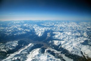
We’ll cross the Pyrenees, a mountain range of 415 kilometers long that naturally separates France and Spain. The names of some of its peaks of more than 3000 meters remind us of its magnificence and also its dangerousness: Monte Perdido or Pico Cursed almost lose the title of the highest before the Aneto (3404 m altitude)
All the etymological explanations that come from the denomination “Pyrenees” come from ancient times. For some people the name of the mountain range was given in memory of the tragic love story of Pyrenees, a girl who fell in love with Hercules. Legend tells that he left her in this area and she, crazy in love, began to chase after him, but some wild animals devoured her. When Hercules heard her screams and came back to try to help her, it was too late. Feeling distressed and guilty, he built a grand mausoleum piling up rocks to form the huge mountain range we now call the Pyrenees.
Other explanations relate the word “Pyrenees” to pyros, “fire” in Greek. Greek historians such as Strabo speak of such a colossal fire that it even melted the underground gold and silver mines, caused by the clearing of crops by some shepherds. It could also refer to another mythological history of Pyrenees. This one tells that she gave birth to a snake just before she died and that when she placed her body in a bonfire, she created a fire so monumental that made those who saw it, would call these blazing mountains the “Pyrenees”.
The Pyrenees have been since ancient times a very important natural border that has influenced the advance or retreat of conquests and civilizations. The route that pilgrims follow today, which we have called the Port Route of Cize, is based on what used to be a Roman road: Via Trajana, which linked Astorga with Bordeaux.
The same path was used by the Arabs when in the 8th century, after conquering the Iberian Peninsula; they crossed the Pyrenees to try to do the same with the rest of Europe. After losing to Carlos Martel in the Battle of Poitiers in AD 732, they had to retreat and the Pyrenees served as a natural border between the two sides. There Charlemagne put the “Hispanic Mark”, the border of his empire with Islam.
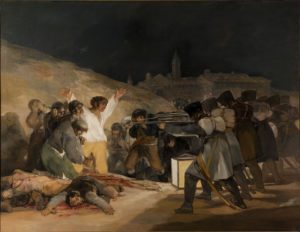
The same old Via Trajana was the one that the cleric Aymeric Picaud toured in the 12th century when he wrote his “guide” of the Way of Santiago, collected today in the Codex Calixtino. Also Napoleón crossed through it in the XIX century when he tried to conquer Spain, what triggered the War of the Independence, portrayed by Goya in its famous picture of the executions of the three of May.
We leave from Saint-Jean visiting his main monuments
And which monuments can we find today as we traverse those paths loaded with history? Let’s start at the beginning of our stage: Saint-Jean Pied de Port, named for being “at the foot of the port” of the mountain. This small village was founded in the middle Ages and today, combining its mountain location and its antiquity, it becomes a picturesque place to start the journey. In fact, it is estimated that 1 in 4 pilgrims arriving in Santiago have left or have passed over there.
Its main streets are two: the Rue d’Espagne and the Rue de la Citadelle. The town is divided by Nive River and La Rue d’Espagne links these two sections by a bridge. On the north bank is the church of the Assumption, also known as Notre Dame church du Bout du Pont, named after precisely because it is at the “end of the bridge”. The red stone church has the appearance of fortress and is medieval. Even it is Gothic style, its facade is quite compact and lack of decoration, although inside the fineness of its vaults and obsidian crystals that recall the so-called “Gothic light architecture of “.
In the northern part of the Rue de la Citadelle is the Gate of Santiago, declared World Heritage in 1998 along with the routes of the French Way. The town is walled and has several doors, but this one is the famous because since the 11th century all the pilgrims from Europe chose to take the route through Saint-Jean to enter Spain. If we go up all the Rue de la Citadelle we will arrive at the Ciudadela de Mendiguren, an old fortification of the S. XVII which has a breathtaking view of the surroundings.
What can you see on the route of the Ports of Cize…
If we take the traditional route of the Ports of Cize, along the way we will find three key points. First, at kilometer 11.3 on our left we will see the Biakorri Virgin. She is the protector of the shepherds to whom the thousands of pilgrims who see her along the way leave offerings. From there, there are good views, so if you want to rest for a while this could be a good time to sit and recover forces admiring the landscape
Following the road, at kilometer 16.5 you will find the Fuente de Roldán. Roldán is a mythical commander of Charlemagne’s army who, according to Carolingian texts and songs of deeds, died fighting the Basques in a battle that took place near Roncesvalles between the 8th and 9th centuries.
At kilometer 21.6 we reached the highest level of the stage in Collado Lepoeder. From here we can continue down this route descending a steep slope with impressive views until arriving at Roncesvalles, or, deviate to reach Alto de Ibañeta (km 24, 1). In Ibañeta we will see a chapel with angular roofs built in the 60’s. It was made in memory of what was formerly part of an old monastery, in which there was a bell that was touched to prevent the medieval pilgrims from getting lost. From there, we have little of the phase left, now that in less than two kilometers of descent we can reach Roncesvalles.
What can you see on the Route of Valcarlos
Instead of taking the Route of Napoleon we take the Ruta de Valcarlos, we will pass by Arnéguy and through the town that gives name to this itinerary: Valcarlos. Already Aymeric Picaud wrote in his “guide” of the road that through the valley called Valcarlos “also pass many pilgrims who go to Santiago and do not want to climb the mountain.” The place is related to the battle of Charlemagne’s army against the Basques. In fact, it is said that his name can come from that fact (“valley of Carlos”).
In Valcarlos we can see the church of Santiago Apostól, built between the XVIII and XIX centuries. In the lower part has a triple arcade and, to break with the predominant horizontal of its facade, in the middle stands a square tower with a pyramidal roof. If we decide to go inside, we will see how most of the decoration is centered on the neo-Gothic altarpiece (S. XIX) that adorns the apse.
Near the church facade, following a little street, we will see a sculpture by the artist Jorge Oteiza, thought as a monument to the pilgrim. Six geometric figures of different materials are embedded in a concrete base, resembling a row of pilgrims walking towards the same place
In Valcarlos is still practicing an ancestral dance declared of Cultural Interest of Navarre. Their dancers are called “bolantes”, due that they dance in the air making fly colored ribbons that they hang on their white suits. If you have the opportunity to witness one of their performances, do not hesitate to stop and rest for a while. You always dance on Easter Sunday during Holy Week, but you can also look at the page of the town council of Valcarlos (LINK http://luzaide-valcarlos.net/es/inicio/ ) if there is one programmed
Continuing along the Route of Valcarlos we also reach the Alto de Ibañeta and, from there, we descend to Roncesvalles. In this town, where about 30 people live, we can see different monuments in relation to the Camino de Santiago.
Roncesvalles
We visit the Collegiate Church of Santa María and the Chapel of St. Augustine
The most emblematic is the Collegiate Church of Santa María. The building was built in the 13th century and, within the Iberian Peninsula, is one of the few examples of French Gothic. During the following five centuries it underwent through different fires that ended up favoring that in the XIX century it was decided to rebuild it practically complete. During these works much changed in its original form, so today we can see how in spite of the fact that in the interior it conserves the gothic lines (oval arches, gothic forms, clerestory …) in the exterior there are many baroque elements. In this church every day at 20.00 there is a special Mass dedicated to the pilgrims. At the end of it, the names of the people who have arrived that day to the town and those who start the next day are read, blessing them and asking for them while enjoying organ music.
Near the apse of the collegiate church, bordering the lodge, we arrive at the Chapel of St. Augustine, original of the XIV century, but rebuilt at the beginning of the XX. On the outside it looks very solid, looks almost like the tower of a fortress. However, its interior vault, supported by four huge corbels, stands out for its elegance and for the elaboration in the carving of the nerves that compose it. In the center of the space is the sepulcher of the king Sancho VII “the Fort”, formed by a size reconstructed in S. XIX on the primitive one of XIII century.
We finish in the chapel of Santiago and the Charlemagne´s Silo
Near the house of priority is the group formed by the church of Santiago and the Chapel of the Holy Spirit. The church or chapel of Santiago is a small Gothic temple (XIII Century) of rectangular plant and simple cover, of vault of ribbed arcs. The exterior is also sober, consisting of a wall of irregular ashlar. The arch of the cover, given that the temple is Gothic, is aimed. In the tympanum there is a carving of a monogram of Christ. The Christ is a pictogram that represents Christ. It contains the first two letters of the name of Christ in Greek (X and P) and has the letters alpha and omega, which were the first and last letter of the Greek alphabet, representing Jesus Christ as the beginning and the end of all things.
The Chapel of the Holy Spirit is also called Charlemagne’s Silo. It is the oldest building of the town, dating from the 12th century, although it is much transformed. It is said that Charlemagne built this building to bury his dead knights in the battle of Roncesvalles, among which was Roldán, from whom we already saw a commemorative fountain on the phase from Saint-Jean. It was built on a pit, in which the bones of the dead army members could have been thrown. In this ossuary it is said that during the centuries the remains of pilgrims were left. Over the pit was made the chapel, which is square and covered in a simple way. As this space was at a higher level it was decided in the XVII century to make a stone arcade on three sides. In it, under its semicircular arches, canons of the collegiate church of Santa Maria were buried.

