STAGE 13: FROM SARRIA TO MELIDE
Erea FabeiroFRENCH WAY BY BIKE
- Distance to Santiago: 111 km
- Distance for stage: 60 km
- Estimated Time: 6 hours
- Minimum height: 360 m
- Maximum height: 730 m
- Route Difficulty: Medium – High
- Places of public interest: Portomarín, Palas de Rei, Melide
- Itinerary map: To see the whole journey on Google Maps click here
This stage has three very different parts. The section from Sarria to Portomarín (km 22) will bring out our technical skills, as it runs along paths and corridors that, especially in the rainy season, are muddy and flood with the nearby streams.
After crossing the Miño and entering Portomarín, the dynamic changes completely, since up to Palas de Rei (km 47) the Jacobean path goes always around the LU-633 or by a paved road that has practically no traffic. We can advance much faster and the distance between populations will be a little higher.
From Palas to Melide (km 60) we alternate sections along the N-547 with others by forest, which will again complicate our path but give us a great view of the surroundings.
In general, it is a changing stage and “legbreaking”, but that allows in each one of its differentiated sections to know different aspects of the Galician culture; like its popular architecture -such as its granaries or cruceiros-, its lifestyle in the rural environment and a great artistic historical patrimony – Romanic churches, castles or castles – and some of its great villas, all with a great Jacobean history.
We hope you enjoy this immersion in the rural!
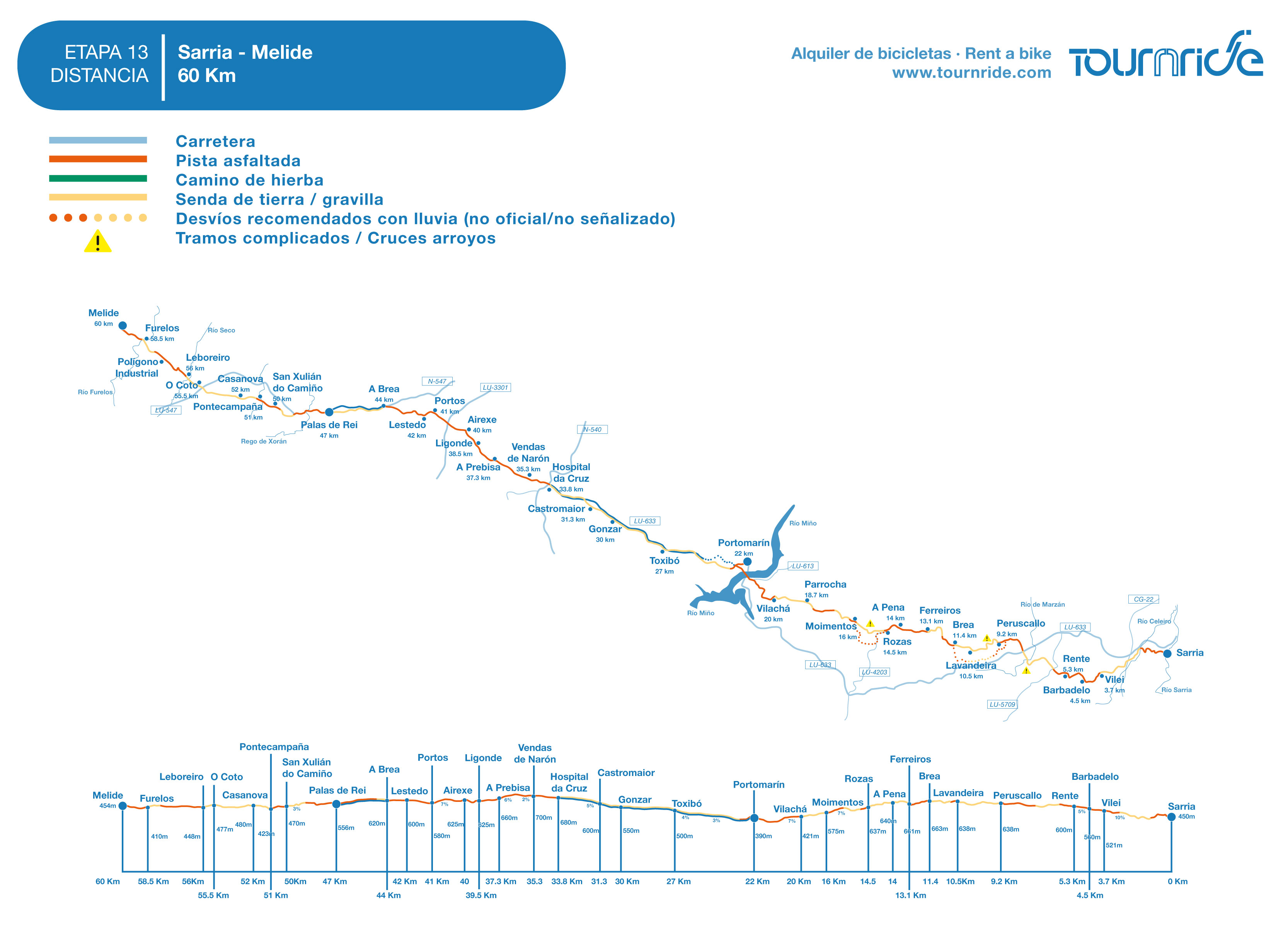
PROFILE AND STAGE’S MAIN ROUTES
From Sarria to Portomarín the road does not pass through the localities of Santiago, so if we want to visit them we can only do it by going through the pedestrian path, which alternates corredoiras or narrow paved paths between forests and cattle farms. In general it can be said that it is cyclable, in spite of being legbreaking, , since it continuously changes of slope and that in very concrete points the road surface can be complicated enough. The options in each section are as follows:
– From Sarria to Portomarín (km 22): Either go by the pedestrian path or follow the LU-633, which turns south to the exit of Sarria and does not return to cross the Jacobean route to Portomarín. It does not pass through any locality but it passes through Paradela, one of the largest villas in the area.
– From Portomarín to O Hospital (km 33,8): The pedestrian path runs parallel to the LU-633, so we can choose dirt/gravel road or the shoulder of the road. They only separate after passing Gonzar, where the yellow arrows indicate paths to pass through Castromaior and the remains of his old Celtic castro.
– From O Hospital to Palas de Rei (km 47): After passing O Hospital you have to cross a road junction by an overpass. All the national ones deviate from our route, but we take a paved trail – made for the pilgrims – in which the walkers have their own sidewalk and in which there is almost no car traffic. We will comfortably go through it until shortly before Pallas, where it ends in the N-547.
– From Palas to Melide (km 60): You can go on the N-547 but after passing Palas we will turn north until shortly before entering the end of stage, without passing through the localities of the Camino. If we follow the Jacobean indications we will enter the forest in most of the route, with some sections of complicated road – mud or rock that can be slippery – and others with paved trail.
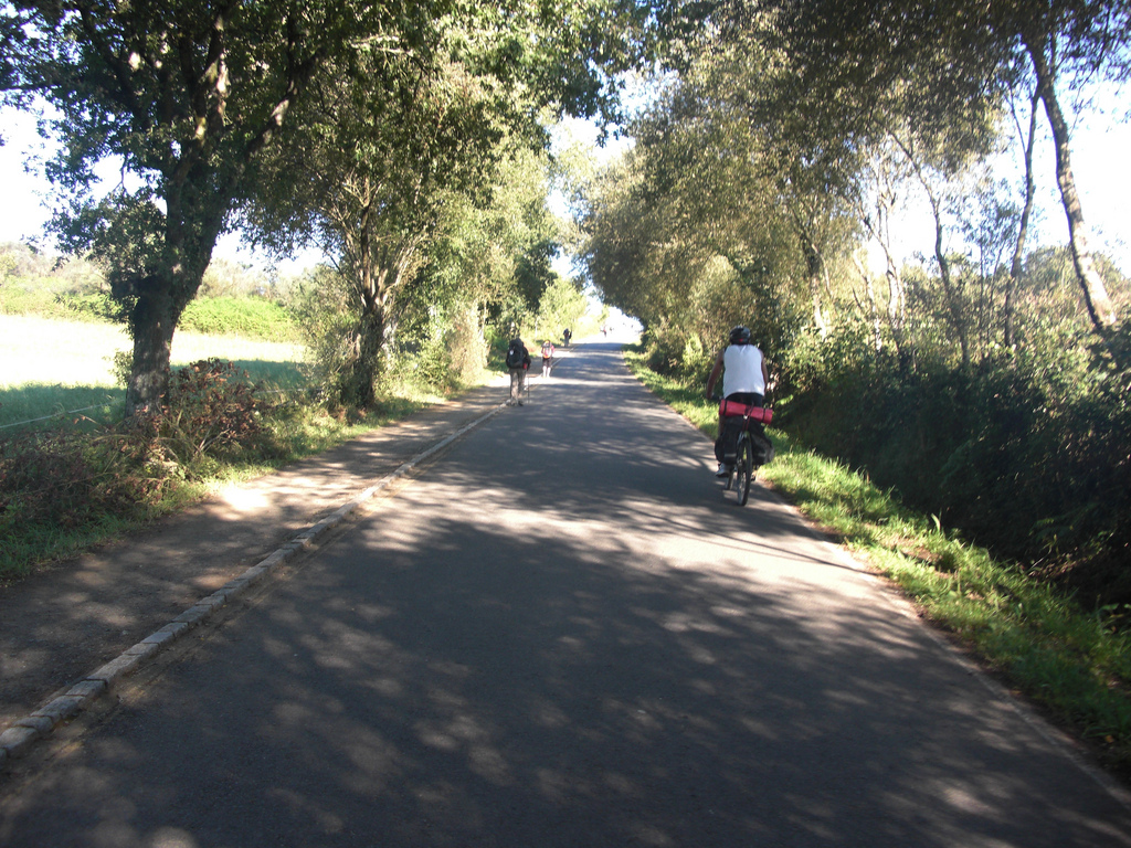
In general, it is more logical to do all this stage by the pedestrian path, following the Jacobean indications. For this it is necessary to have good mountain bikes buenas bicis de montaña, since the road surface and slope are very changing. Even so, in the map in PDF and in the GoogleMaps Google Maps we mark the points of conflict and we suggest you recommended detours, especially in the rainy season.
As for the profile, we summarize here the general trend of each section, although there will be permanent jumps and slope changes that will turn this stage into a perfect example of the route legbreaking.
During the first 8.5 kilometers, from Sarria to Peruscallo, the profile is ascent, being especially hard the first steep of less than 1 km with an average slope of 10%. From Peruscallo it “levels” for 6 km, , until Couto, where begins a descent that becomes much more pronounced from A Parrocha. We arrive thus to the side of the Miño river, minimum height of the stage (360 m). We cross the bridge to see Portomarín and from there to Ventas de Narón (710 m height) there are 13 km of climb, with average slopes of 2-5%, although with continuous jumps and a final section of climb to Castromaior in which the slope is more demanding. From Ventas de Narón to Melide are missing 27 km in which the profile is of continuous changes of slope, although there will be more descents than ascent ramps.
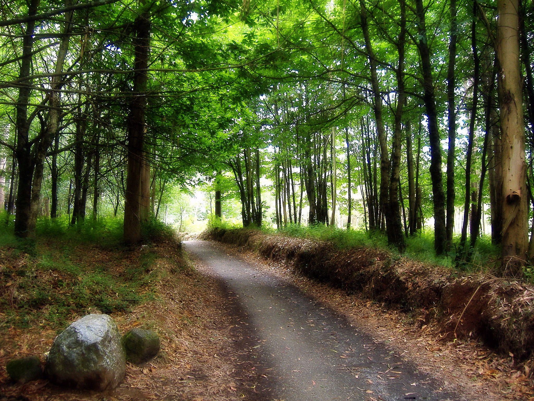
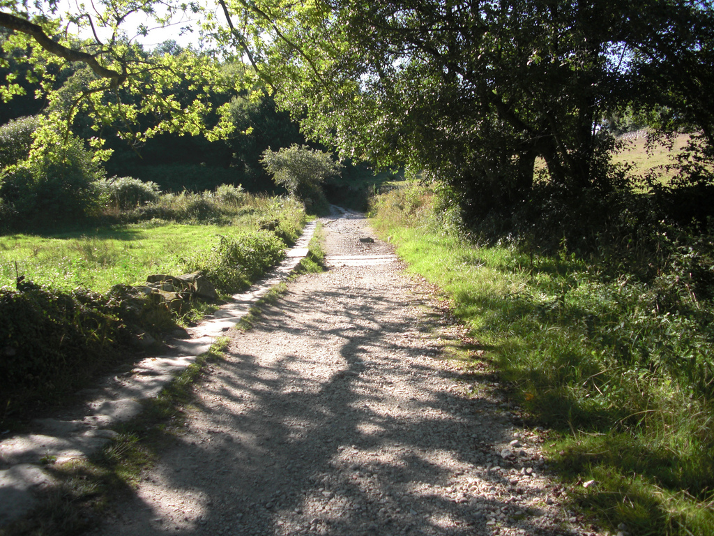
As for the layout of the pedestrian path at this stage, it can be said that it is a continuous succession of towns or, rather, small towns formed by the conjunction of three or more livestock houses. Among them is a multitude of small paths and corredoirasalternating continuously different types of road surfaces. It crosses different streams and bridges, some by old constructions and of good factory and others by small improvised catwalks. It is a path that will reconnect us with nature and may be more demanding than others we have done before, but that will bring us a lot of emotions. We will not get bored in any moment!
PRACTICAL ADVICES
– As in O Cebreiro, from Sarria there is not enough distance to Santiago so that we the cyclists get the Compostela. Even so, the pilgrimage is not a matter of certificates and therefore we tell you, as always, how you can reach Sarria if you want to start pedaling there.
Since many pilgrims who go on foot start in Sarria this locality has good communications, although many of them are linked by Lugo. We can reach Lugo by bus from many points of the peninsula, especially through the connections offered by Alsa and, from there; take one of the routes that Monbús makes every 1-2 hours to Sarria.
There is also an average of 6-8 trains arriving in Sarria from Lugo every day. If we want to go direct, from Barcelona and Madrid arrive from one up to three trains a day.
In addition, you know that in Tournride we leave you the bike during the day before the start of your trip in the accommodation that you decide in O Cebreiro. We can also take your spare luggage so that it waits for you at the end of your road, so you will not have to carry unnecessary weight!
– This is a legbreaking stage, it is necessary to constantly adjust plates and sprockets to not force the rhythm all the time. The landscape compensates for the effort.
– We will permanently find populations. Not all have services, but you will not have too much trouble to supply yourself with water or food, so you do not need to carry unnecessary weight.
– In winter or in times of heavy rain, in Tournride we recommend avoiding some sections of the pedestrian path, because the road surface is too muddy and complicated. Sections we recommend avoiding:
1) Peruscallo section (km 9,2) – Lavandeira (km 10,5) – A Brea (km 11,4). It runs along a narrow path of stone / soil / grass in the course of a stream. If there is a large influx of people or it has rained, you will have to stop all the time taking care not to fall into the water. We propose a detour before Peruscallo that runs a little to the south by dirt and asphalt road.
2) As Rozas section (km 14,5) – Moimentos (km 16). The road goes through a corredoira that when it rains becomes a pool of mud with many stones. You can avoid it by following the paved path and then by the LU-4203..
3) Portomarín section (km 22) – junction with LU-633 (km 24). At the exit of Portomarín the signs indicate the crossing of the river to go during 2 km by a path of complicated road surface, narrow and with great stones. Especially if it has rained, we recommend going for the LU-633.
DETAILED ITINERARY AND HISTORIC-ARTISTIC PATRIMONY
At this stage we will discover the natural surroundings of Lugo and we will enter, after passing Palas de Rei, in the province where the great house of the apostle is located: A Coruña. Along these 60 km we propose you to open your eyes to interpret everything that the rural landscape, with its special configuration and constructions, tells us about the traditional Galician culture. Among dozens of small towns – we will pass through more than 60 localities – we will see the mosaic of fincas divided by marcos, in which the neighbors work the field in a sustainable way and take care of the frisonas and rubias gallegas; the cows of the community. We will learn the symbolic importance of the hórreos and we will cross corredoiras among centenarian carballos.
Immersed in this impressive environment, a clash of green chlorophyll and blue sky on the horizon, we will find continually with wonderful jewels of rural romanic, surrounded by cemeteries full of colorful flowers. And this stage is part of the Ribeira Sacra, an area that besides being a geological and natural wonder also boasts the highest concentration of romanic art on the continent.
Can we ask for more?
FROM SARRIA TO BARBADELO: MEDIEVAL BRIDGES AND BEASTS CARVED IN STONE
We leave Sarria following the course of its street Mayor, where yesterday we discovered many of the main monuments of the town in our cultural tour of end of stage. As we commented, this street was the first that arose in this town that was born to attend the pilgrims, so it has the main services around. We pass through theConcello (City Hall) and climb to the small Romanic-Gothic chapel of Salvador, where the yellow arrows indicate that we turn right.
Following the street we take a last look at Sarria from the viewpoint of the Prison, which offers us an unbeatable view of the surroundings. From here we continue to the Monastery de la Magdalena and leave Sarria down the hill that appears in front of the convent.
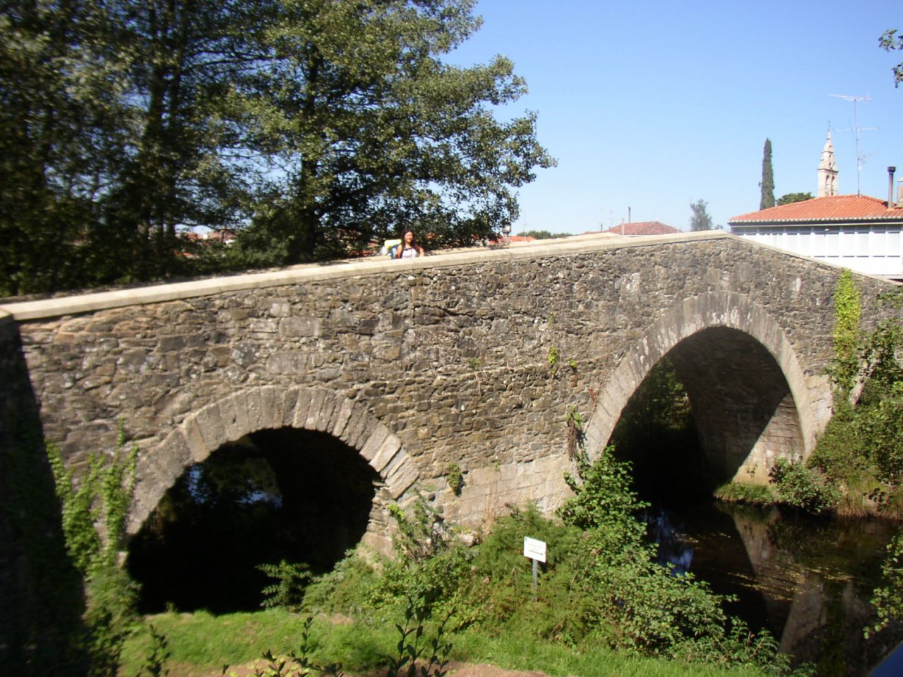
The slope leaves us on a paved road that, in only 200 meters leads to a bridge. A Ponte da Áspera was built in medieval times, when Vilanova de Sarria emerged, to help the pilgrims leave the village across the River Celeiro. The current factory retains much of the old one, with three arches of half point in granite ashlar and the upper part of masonry in slate slabs, among which an enormous amount of weeds and vegetation is drained – what gives a very picturesque touch but difficult the conservation of the monument.
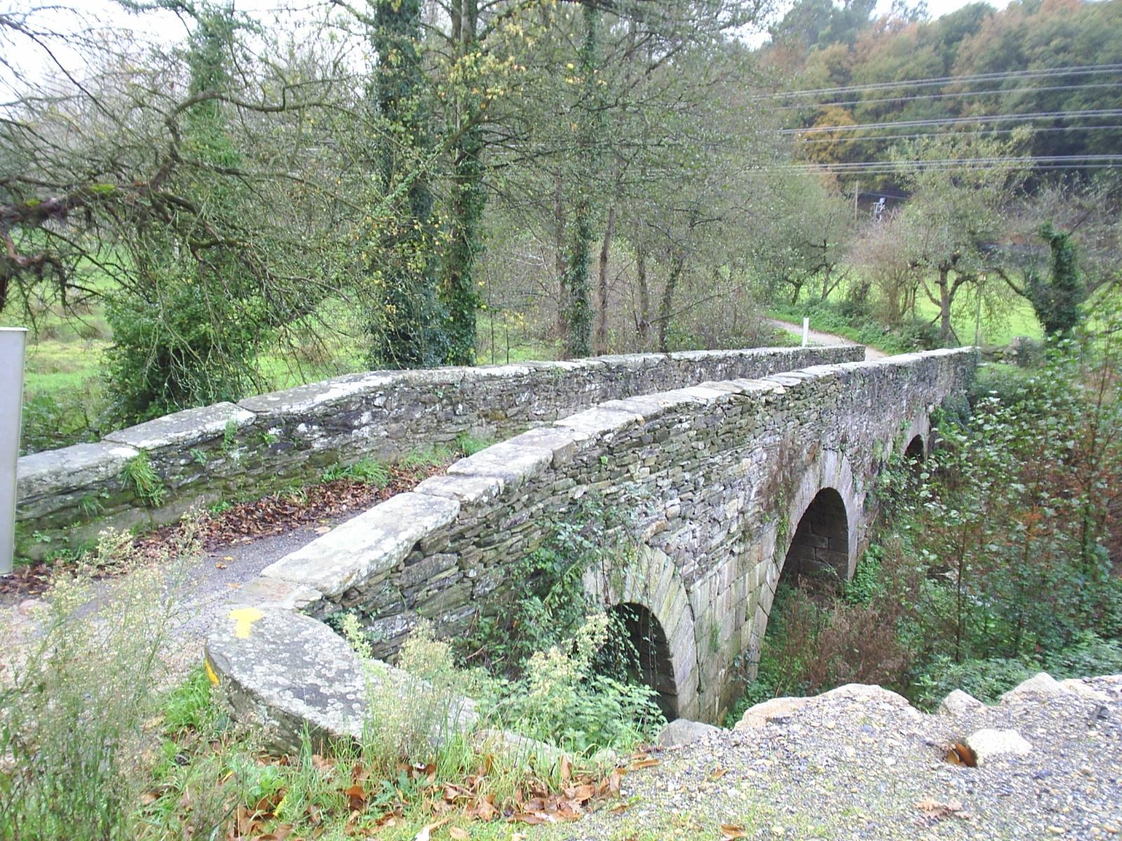
The bridge takes us to a dirt path with some stones that circulates by the side of the tracks of the train. In about 500 meters the path crosses the rails, which will surely force us to get off the bike.
After crossing the tracks of the train we find ourselves immersed in a huge carballeira (oak forest), where we must face the most demanding ascent of the whole day: a ramp of 600 meters with an average slope of 10%, with road surface with loose stones. The great roots of the trees, which arise from the earth claiming their space, will also dull our way. If it has rained, the rise will be more complicated, as they form pools and the road surface is muddy.
After a vertiginous final curve the trees disappear and we can return to glimpse the sky on our head, previously hidden behind the great leaves of the carballos. We cross by a dirt path between pastures, by which we reach As Paredes and Vilei (km 3,7). In Vilei we will find all the services, so it can become a good place for those who have not eating anything, to have a good breakfast. Surely the initial ramp has whetted our appetite!
We leave Vilei by a paved path on a slight vertical slope that, at 450 meters, turns at a practically straight right angle. At this point there is a path that leads to the church of Santiago de Barbadelo, declared a “Good of Cultural Interest”.
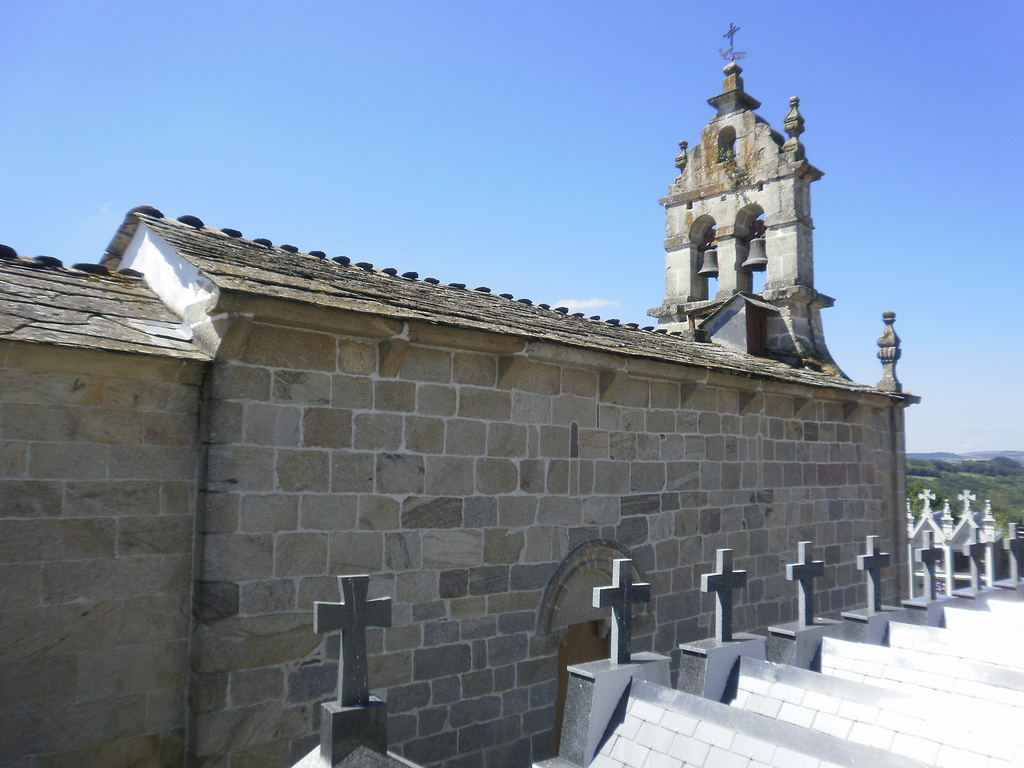
The Santiago’s church is a jewel of the romanic among great forests and grassy areas. It is part of the immense romanic rural patrimony that Galicia possesses. In fact, the greatest concentration of romanic architecture all over Europe is very close to where we are, in the Ribeira Sacra. To understand why it is here, precisely, we have to go back to 7th century, when many monks settled in the canyons of Miño and Sil in search of an ascetic and contemplative life in an impregnable natural place. They formed communities that grew and, during the Romanic boom in the 12th and 13th centuries, they built huge monasteries and churches that still marvel the visitor.
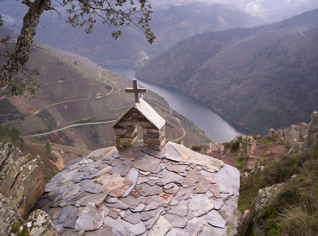
During today’s route we will have the opportunity to see many examples of Romanic architecture that, like this church in Barbadelo, have endured impassively the passage of centuries, despite the fact that historical development or little attention to its conservation have threatened them – and still continue to do so – to destroy many of them.
Originally the church of Barbadelo was part of a monastery dependent on Samos, of which today only remains ruins. The church was made in the 12th century but currently it is not in its original form, since in the 18th century the apse was changed. Among the more remarkable parts of the temple are: its tower – which some people think was made as a lantern to guide the pilgrims – and, above all, its curious iconography.
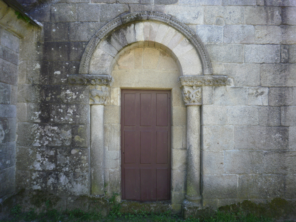
From its Romanic beginnings what is best preserved is the north wall and the western facade – the main one -, which still show their original decoration carved on chapiters and constructive elements.
In the Middle Ages there existed a sort of anthropomorphic or fantastic beings, full of negative meanings and related to the darkest part of the human being, with the Earthly baseness. Their relationship formed the bestiary, which included basilisks, centaurs, or dragons. In the churches they often put themselves as a “reminder” – or, rather, a threat – of how important it was to follow God’s way in life to be rewarded with paradise afterwards. That is why in this church of Santiago we see, for example, a dragon in the chapiter of the north gate and the main gate. The dragons were the most well-known enemies of the Good and in this time they did not imagine them exactly like today, but their body was similar to the one of a serpent – animal that is related to the sin-.
It is necessary to take into account that, although today we see these images and understand them as a representation of evil, for medieval society these animals really existed . Many appeared in the Bible, the book that for them represented all the Truth – in capital letters – and others animals were said to exist but lived in distant parts of the East. They were a real threat to what they thought they might have to face, hence an iconography so effective to control social life in the peasantry by the Church.
There are also animals or beasts that were considered protective, like the eagle or the lion, which were related to the strength and the nobility. These animals were also carved in the entrances to the temples, as guardians, warning that it was going from a profane to a sacred place. In the north gate of the church of Barbadelo, faced with the dragons, we also find a fierce lion.
AMONG GRANARIES WE CROSS THE JACOBEAN KILOMETER NUMBER 100
After this curious visit we continue our way, by a paved road that takes us to Rente in less than 1 km and, a few meters, crosses the LU-5709 in Mercado da Serra, where there is a tavern on the road. The name of the town derives from a great trade fair that was made in the same place in the Middle Ages, which is said that attracted even Santiago’s hoteliers to buy and sell products.
After crossing the road we follow a dirt road among trees and, after turning left, we find a precarious stream crossing. Slabs were placed so that the walkers could pass over the water, but it will be difficult for us to pass without getting wet, even more so in the rainy season when the terrain is muddy!
In half a kilometer we cross another road, this time the LU-633 and by a paved track that goes straight ahead we passed by A Pena (km 8.5) and then by Peruscallo (km 9,2). In this area there are many granaries built on the track, a construction that usually draws much attention to foreigners.
The granary is a storage structure elevated from the ground, conceived to save the grain. In Galicia they began to acquire much importance starting from the conquest of America, when two aliments came that revolutionized the life of the peasants: the potato and the corn. These aliments can last a long time until they are consumed, but they need to be in a suitable place, without excessive moisture, ventilated and safeguarded from animals or rodents. The Galician rural houses did not have such a site and that is why the granaries were built.
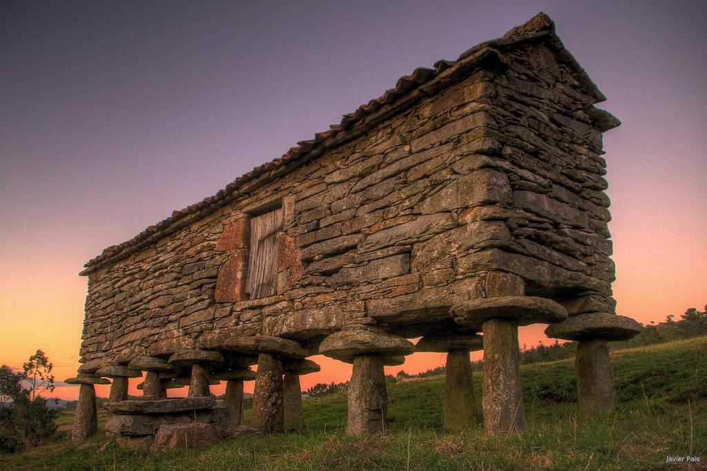
The granaries always have three parts. The feet (pés or pies, in Galician) raise a top box where food is stored, to avoid soil moisture. The box is not closed, but usually has grilles to run the air and ventilate the interior. The round piece that lies between the legs and the box, like a large stone disc, is called tornarrato. Translated becomes “reverse mouse”, a name that clearly explains its function. To go up to the box and pick up food were used either an auxiliary stairs or an endless staircase, to prevent the mice from reaching the food.
The construction of the granaries became increasingly important since the sixteenth century and ended up developing a whole social symbolism around them. The reasoning is very simple: if there is a place that serves to save food, the bigger and beautiful, the easier it will be for people to realize that someone is rich and has large food reserves – with the subtlety that this Rich person does not have to tell you anything, you just take it for granted. The same was true of the chimneys, whose number in a house suggested how many rooms were heated, so that they were crenellated and decorated at the top to attract attention. The granaries, for their part, went from being made of wood to granite ashlar masonry, decorated with the Christian cross and, in many cases, becoming enormous. Generally the largest were of nobles or belonged to monasteries. In Galicia there are some of them that are more than 35 meters long!
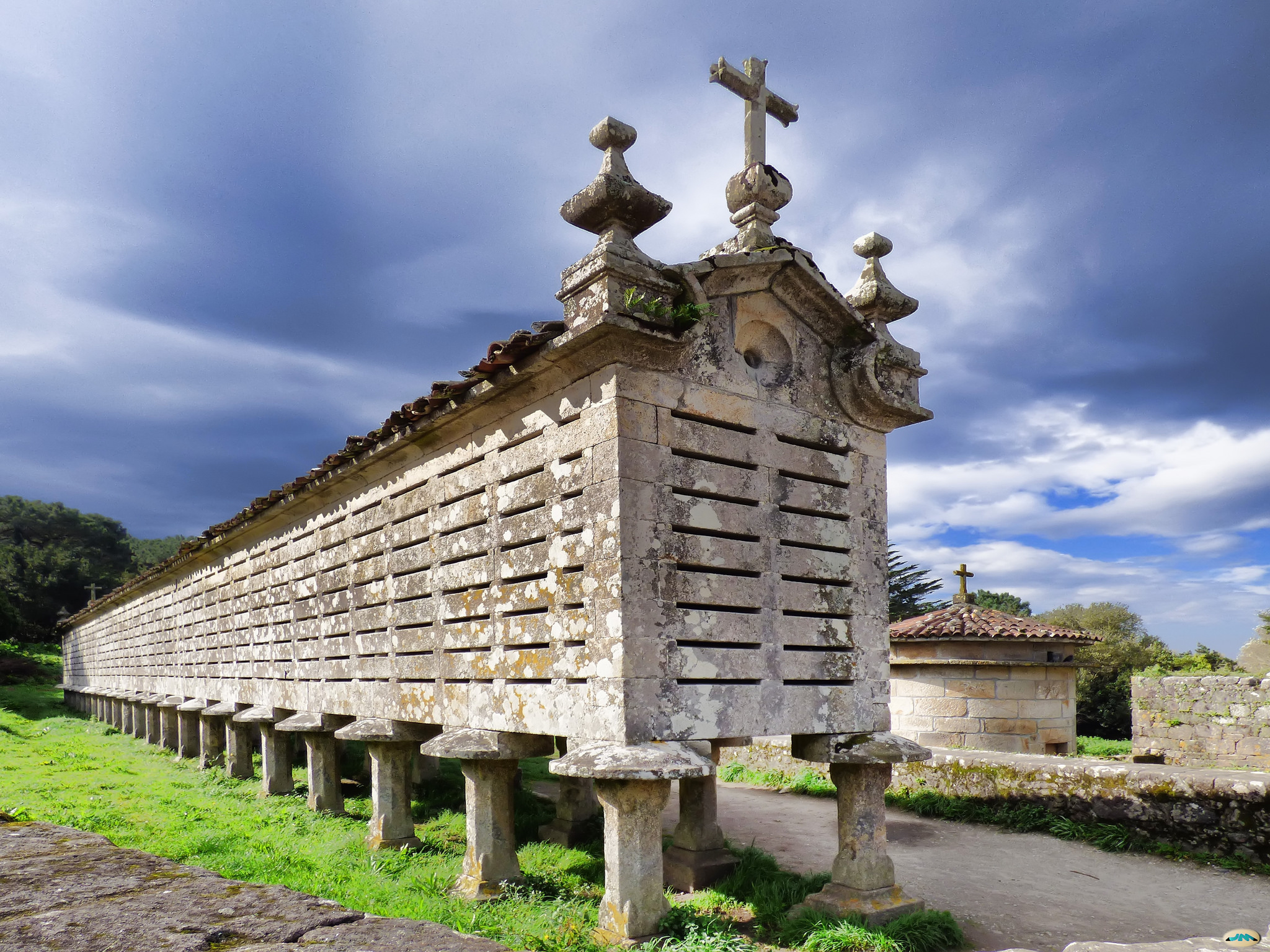
In addition, according to the culture and climatology of the different zones of Galicia, the granaries acquired a different form. In the area of the Ancares and Courel are round, wooden and thatch roof, as the pallozas. In the rest of Galicia there are L-shaped, which mix stone and wood, with pairs or trios of feet, etc. On our way we will see many different forms of hórreo, so from Tournride we recommend that you open your eyes to discover this curious form of popular Galician architecture. In Asturias and parts of northern Portugal there are also granaries, but the place in which they are most concentrated is, without a doubt, Galicia.
When we leave Peruscallo we enter a corredoira that, after a few meters, narrows to become a path that runs alongside a stream. At some sections the road surface has a lot of stones and in others it’s a dirt road, but in general it is very narrow. At times when there is a large influx of pilgrims, crossing by here can be eternal, since we will have to ask for permission to go ahead or stop continuously. That is why in Tournride we propose an alternative on our stage map You can deviate to the left before entering Peruscallo and make all this section by a paved and dirt track further to the south, returning to the route Jacobean in A Brea. If we go here, we can also visit two rather well preserved Romanic temples: the church of Santa María de Belante and the church of San Miguel de Biville.
If we go by the proper Jacobean route we will pass by Lavandeira and we will continue alternating sections of corredoiras with sidewalks parallel to the stream until arriving at A Brea. In this town we will see a milestone that indicates that they are only 100 km to Santiago, but this milestone is false. We will see the real 100 km’s milestone a little later, on a paved track between A Brea and Morgade. This place is symbolically important because from here the Church considers that a hiker or rider has pilgrimed as such to Santiago and can obtain the Compostela.
WE CROSS THE MUNICIPALITY OF PARADELA: WE DRINK FROM DEMONIAC SOURCES, WE KNOW THE RIBEIRA SACRA WINE AND WE UNDERSTAND THE GALICIAN RURAL LANDSCAPE
After this section of track we arrive at Morgade (km 12), where there is a nice bar serving meals. A white painting with the Pelegrín – the 1993’s Xacobeo mascot – tells us that we should leave the locality by a path, next to which there is a fountain. Legend has it that this Fountain of the Devil or Fonte do Demo ceased to flow water if someone who was free from sin came to drink, because it was ruled by the devil and the devil only gave drink to sinners.
The corredoira by which we leave Morgade narrows and is invaded in some parts by a stream, sprinkled with stone slabs to aid the passage. All quite precarious for cyclists, so we must have patience and get grounded if necessary.
This difficult section is short, about 800 meters, after which we arrive at Ferreiros (km 13.1). This town is called so because in the old days there were many ferrerías (smithies) in which Jacobean artisans arranged the horses’ horseshoes and also repaired the footwear of the pilgrims. The town is a sort of boundary between the municipality of Sarria and Paradela.
The municipality of Paradela runs along the eastern shore of the Miño. We will continue for about 9 km by it in a westerly direction, until reaching the river side and crossing it entering the municipality of Chantada by Portomarín.
These two areas next to the Miño are part of the Ribeira Sacra (“sacred shore”), that area where we told you that communities of monks were settled and in which there is the highest concentration of Romanic throughout Europe. When they arrived there the monks began to produce wine in terraces on the slopes of the river’s canyons, as the Romans had done before. This wine is still produced today under the D.O. Ribeira Sacra and its producers are known as the “heroic winemakers” for the hardness of cultivation and harvesting of the vineyards in lands with slopes of more than 60%.
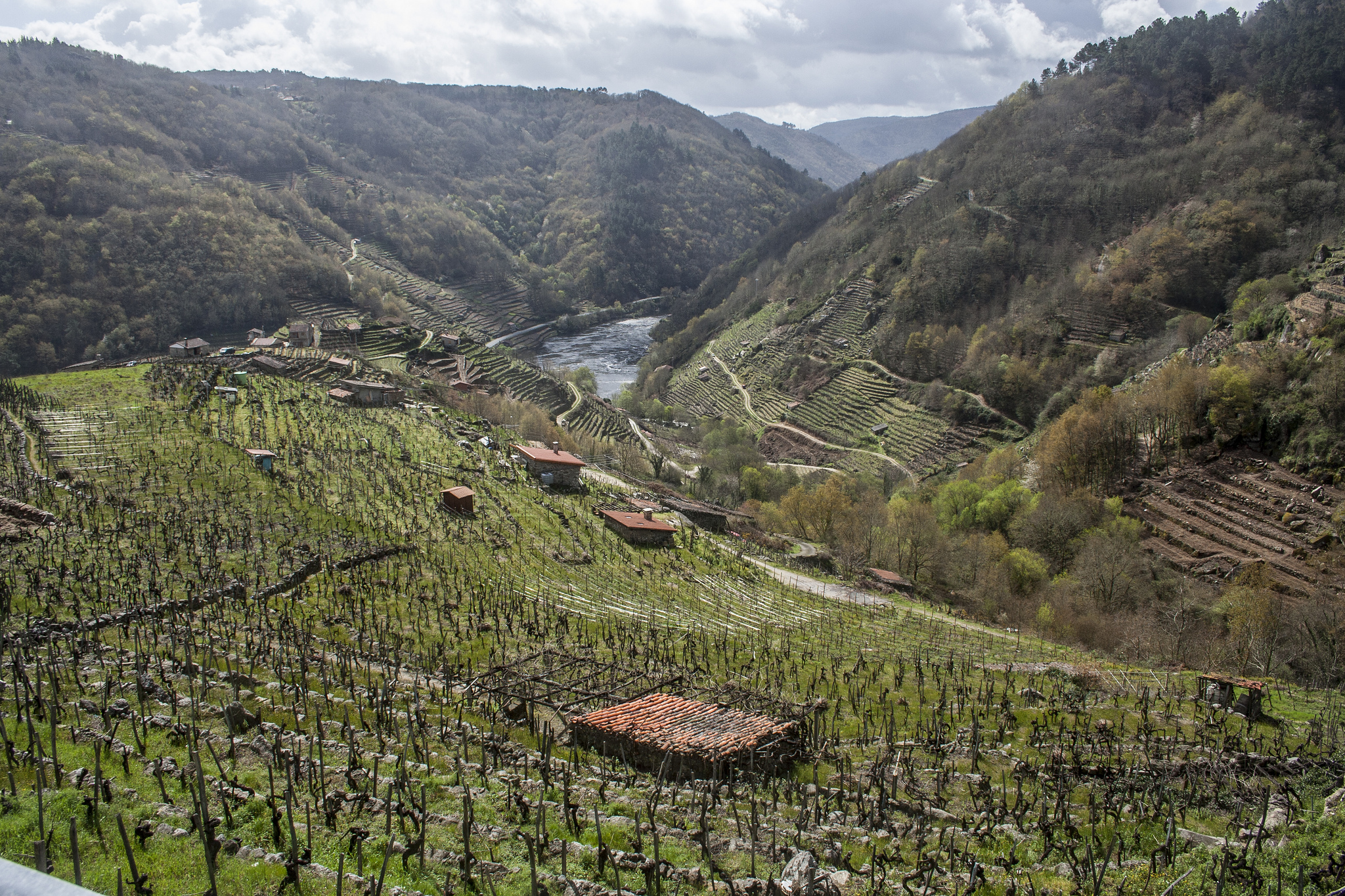
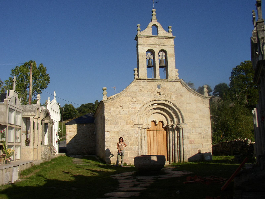
We will have the opportunity to see these canyons in Portomarín, but for now we have to leave Ferreiros descending a steep slope along a paved track of 300 m. We arrived at the church of Santa Maria de Ferreiros, a simple but very well preserved Romanic temple that was moved stone by stone from a nearby point to place it in the margin of the French Way, because they wanted it to function like a pilgrims hospital. The bulrush with the bells is baroque.
To get to the church you have to cross a path by the local cemetery. In Galicia the union of the church with the cemetery is the most normal in the rural area. This configuration is a legacy of medieval times, when the church was the most important social gathering place and, after Mass, people stayed in the vicinity of the temple, honoring their dead and caring for their burial. Then the taverns appeared and customs changed a little!
After passing the church, the yellow arrows indicate the detour to a dirt path with rocks that descends a little abruptly and then go up again at the end until A Pena. Through the paved track where we go we can also reach the town and the road surface is more favorable.
Once in A Pena (km 14), we continue along an paved track until As Rozas (14.5), where the track is lost to the south and a few milestones with the yellow arrows indicate that we are in a corredoira between the trees.
The corredoira 1.5 km long corredoira that runs from As Rozas to Moimentos is impracticable during rainy season. The soil becomes a quagmire in which large stones are embedded. Walkers avoid it by going through a higher meadow, but it will be harder for us to avoid it. That is why in Tournride we suggest you, if it has rained, that you continue straight down the paved road and turn on the first turning to the right, to get to Moimentos by the LU-4203.
From Moimentos (km 16) to Vilachá we will go through paths that alternate continuously the road surface such as dirt, gravel or asphalt road in a soft descent profile, with some jumps. We will pass by Mercadoiro (km 16,8), A Parrocha (km 18,7) and finally by Vilachá (km 20).
Circling along this section we can appreciate the large number of small farms we passed through, many of forest, others of pasture and some cultivated as an orchard. They are divided by low stone walls or even sometimes limited only by sticks nailed to the ground, which in Galicia are called marcos –– although this method is the least used because they have traditionally been the object of a neighborhood dispute, since they mysteriously moved “alone” at night, suddenly losing ground to an owner in favor of the neighbor. Nothing has to do with these small plots with the huge cereal farms that we found in Castile or the large plantations of vegetables and wine from Navarra and La Rioja.
This land division indicates another of the Galician social characteristics: the agrarian minifundismo. Traditionally in Galicia there existed – and still exists – a great attachment to land ownership, which was divided among all the children at the death of the owner, instead of being inherited by the first-born, as it happened in other parts of Spain. If we add the population dispersion, reflected in the number of towns we are going through, we understand the mosaic of small plots before us.
This fragmentation complicates the mechanization of agrarian activity, preventing industrialization, but also fosters a much more sustainable type of agriculture at the environmental and social levels. The soil is taken care of much more and the product is less exposed to contaminants.
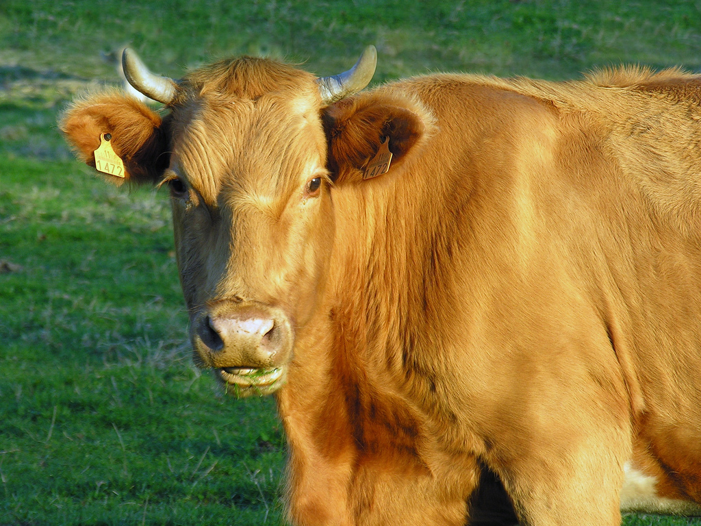
Even so, we will also realize that what we see most in this area are not orchards, but the farms are occupied by calm cows that watch us pass from their peaceful pastures. Formerly livestock was a complement to agriculture – cows were used to pull cars or use their fertilizer – but gradually became a more profitable activity and ended up displacing agriculture. The two races we will see the most are black and white, called “Frisonas” and that give milk and also the “Rubia gallega”, whose meat is marketed under the Protected Geographical Indication “Ternera Gallega”.
At this point we are in Vilachá (km 20), from where we begin a quite abrupt descent by asphalt that ends up leaving us on the banks of the Miño river. A bridge rises above its great volume and, on the opposite shore; we see the town of Portomarín, located at a higher elevation on the side of the canyons of the best known Galician river.
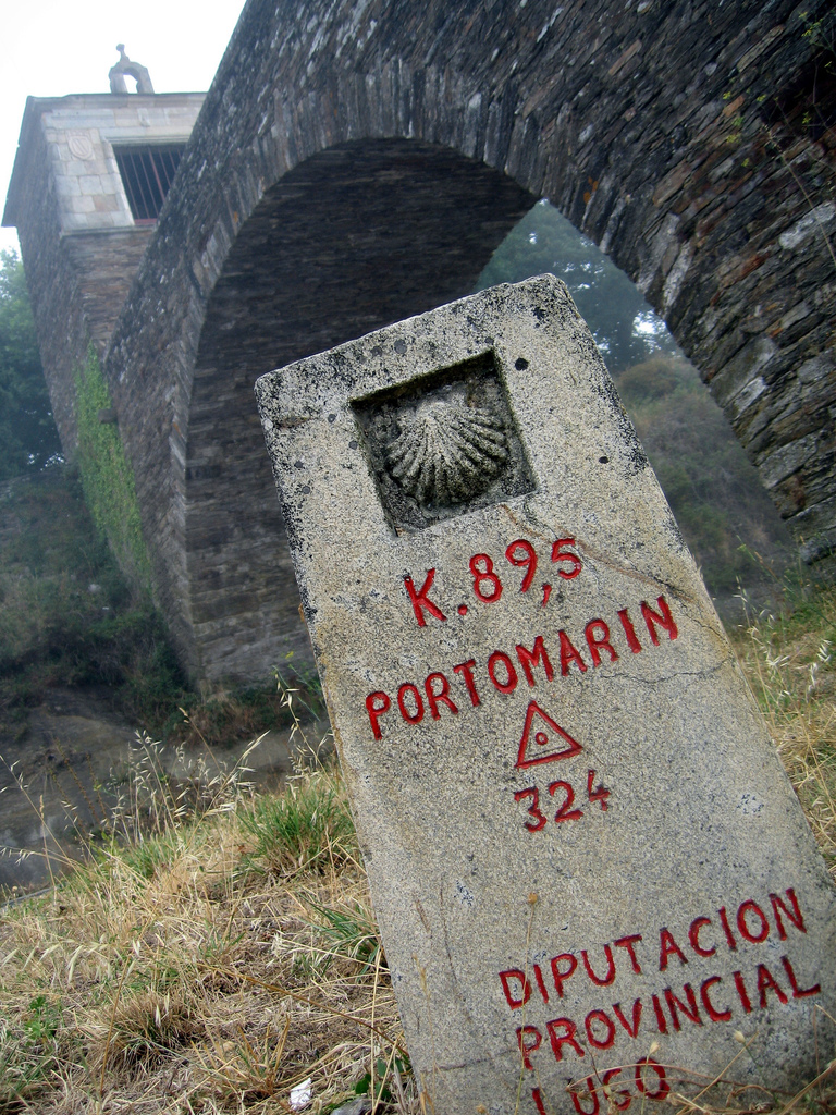
FROM PORTOMARÍN TO CASTROMAIOR, OR WHAT IS THE SAME, FROM GREAT ENGINEERING WORKS OF 20th CENTURY TO CASTREÑA ARCHITECTURE OF 6th CENTURY B.C.
The river Miño is the longest river in Galicia and, from its union with the Sil up to its mouth in the Atlantic Ocean, the most abundant. The great length of kilometers through it flows has made that, since the birth of the pilgrimage it is necessary to cross it.
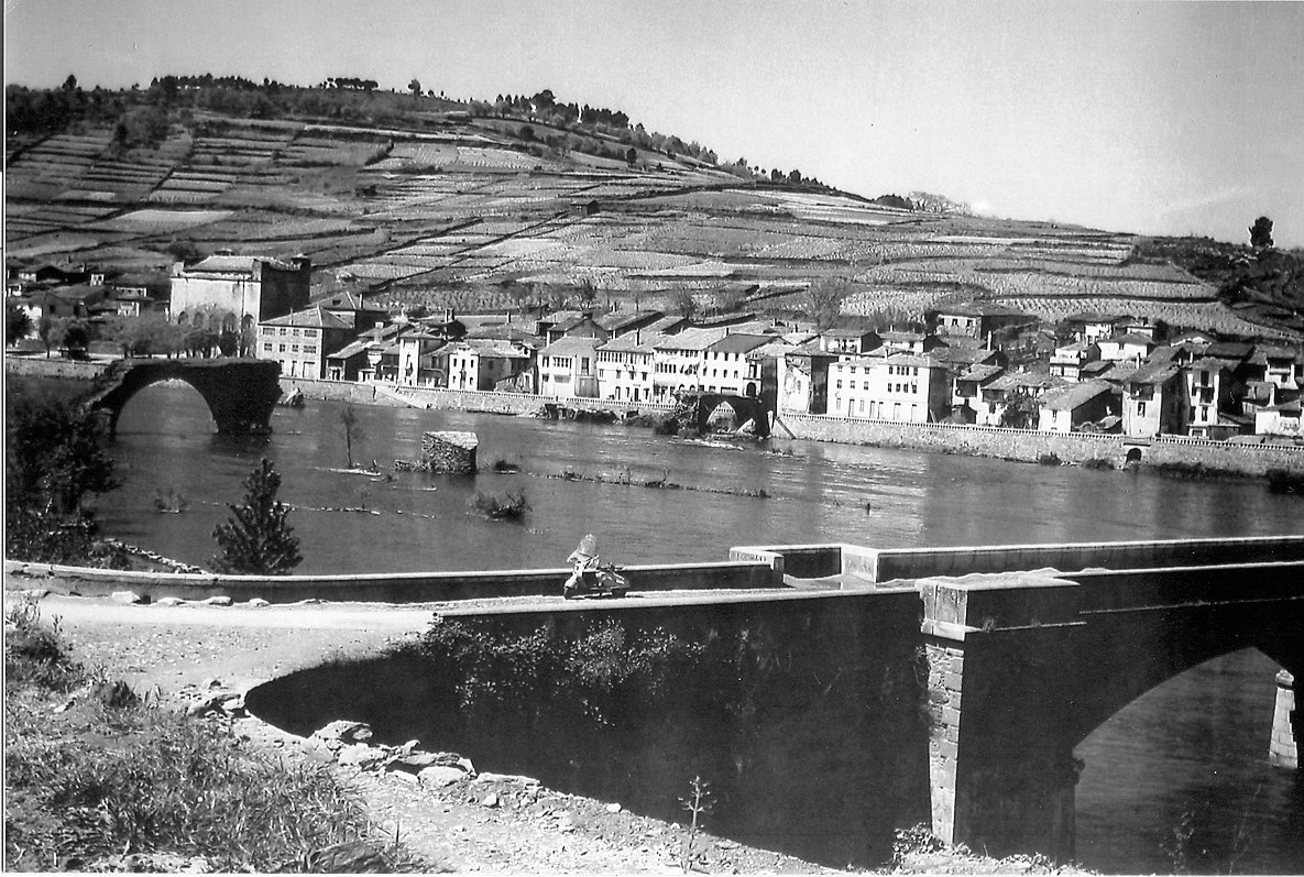
This need to overcome the flow made the Romans in 2nd century AD., decided to build a primitive bridge at the point where we are now. When the pilgrimage to Santiago arose, Doña Urraca ordered in the 11th century to build a larger bridge in the same place, to help the Jacobean walkers.
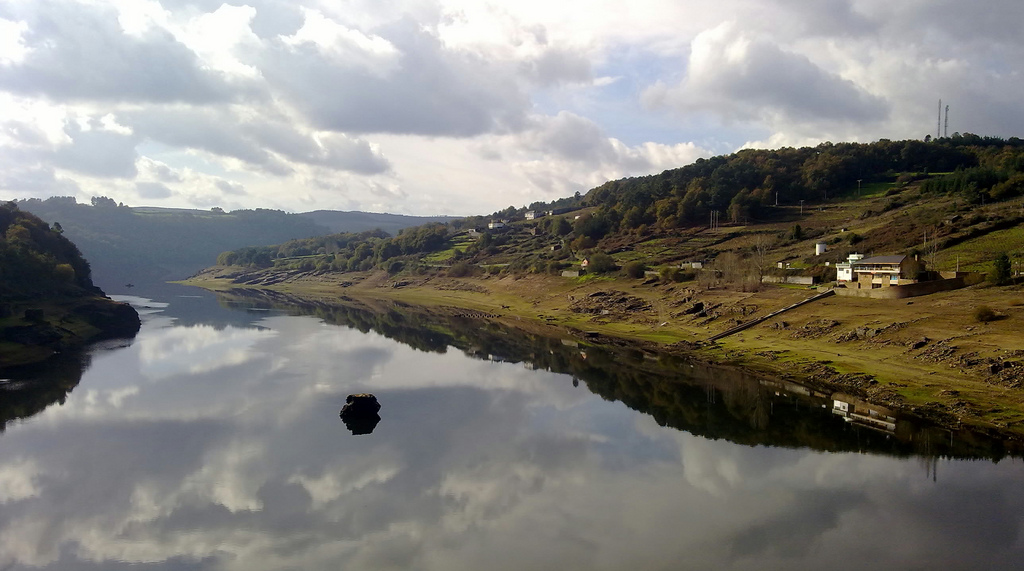
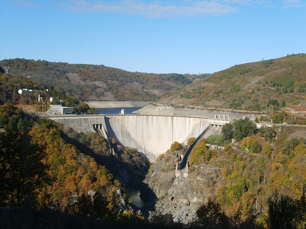
That bridge survived the passing of the centuries until one day in 1963, Franco ordered to build what is still today the largest reservoir Galicia: the Belesar reservoir, from which a great amount of hydroelectric energy is obtained. A concrete wall 135 meters high and 350 meters long contained the river Miño 32 km south of Portomarín, creating a gigantic reservoir that flooded everything that used to be on the banks of the river. The Castros of pre-Roman culture, vineyards, mills, wineries and entire villages now lie beneath the Miño waters.
In Portomarín, which at that time was a town with an important medieval patrimony on the banks of the river, the neighbors decided to move to a higher elevation on the west bank, taking with them – stone by stone marked with patience – their most important monuments. That is the Portomarín that we see today, that after crossing the modern bridge receives us with an arch where stairs have been installed, which is nothing more than a section of the old medieval bridge. But, some days, we can also see the old Portomarín, in the form of stone structures that protrude from the water claiming the natural space that was taken from them.
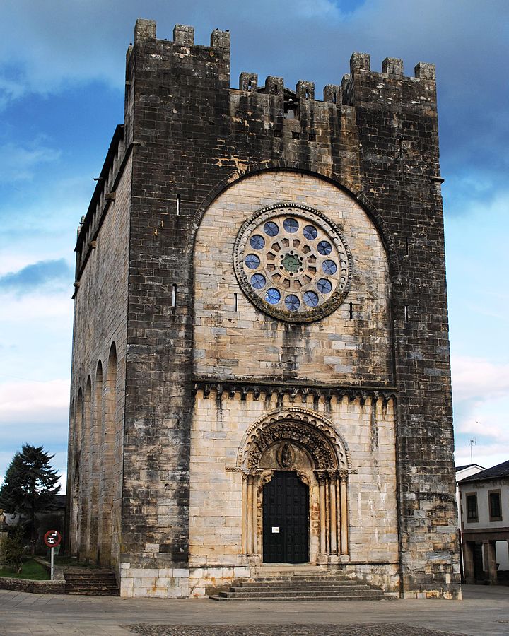
In the upper part of the town we find the church of San Nicolás, a Romanic temple promoted by the order of San Juan, armed knights who protected the pilgrims. It is one of the most important Romanic monuments of Galicia, with a very special configuration by the height of its thick walls with battlements in the upper part; A robustness that contrasts with the delicacy of the sculpture in its gates and its imposing rosette.
At first the temple was located near the old bridge, in the first Portomarín. Hence the appearance of military fort, it was a meeting place of an order that defended the bridge and the pilgrims. When the town was flooded by the construction of the reservoir, the stones were marked with red ink one by one and moved to the top of the village, also undertaking a restoration of the church. Even today you can see the red marks on the stones, next to the stonecutters that carved the ashlars in the 12th century.
After the visit to Portomarín, we left the village by the same Avenue Chantada by which we enter to it. The road diverges to the right, but a vertical Jacobean sign indicates that we cross the bridge over the river to enter a path that crosses the road again in 2 km. In this section the road surface is very irregular, with many jumps and loose stones, so it is worth considering the possibility of going directly on the LU-633 without crossing the river.
From the junction of the path to the road -2 km after leaving Portomarín- to Hospital da Cruz (km 34), the pedestrian path runs parallel to the LU-633 in the form of a dirt track. After going ahead 3 km we arrive to Toxibó (km 27) and in three more to Gonzar (km 30), where we can see the church of Santa Maria de Gonzar, in baroque style. On the main altar of the church is the tomb of a woman who, according to local legend, spent about 30 years without eating anything.
After Gonzar crosses the Jacobean path, he moves away from the side of the road to Castromaior. We recommend to follow the pedestrian path, since after passing the town we will pass through a very special place of the French Way, one of the best preserved castros of Galicia.
On a paved track and dark ground we began to gain slope and, in 600 meters, crowned the hill of Castromaior. To our right we have a breathtaking view of the surroundings and, to our left, one of the most important archaeological sites of the peninsula, which was inhabited since 6th century B. C. to the 1st century AD. It had a complex urban configuration, with a circular enclosure walled in the top of the hill. Around it, on platforms bounded by walls and moats, were other settlements. Since nothing was built in this place since its abandonment, everything was buried under the hill in a good state of conservation.
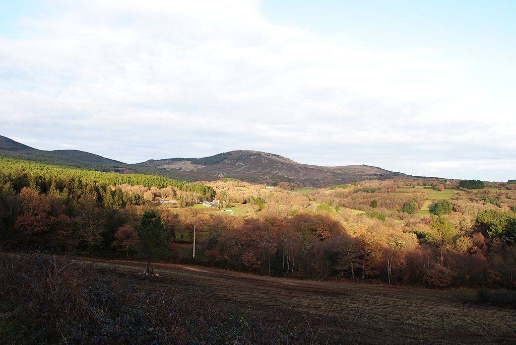
Although for many centuries it was thought that the arrival of the Romans to Galicia had ended in a violent and fulminating way with the culture of Celtic roots that lived in this territory –finding the maximum expression of this oppression in the mythical battle of Monte Medulio, which included the suicide of the last Galician warriors before the need to surrender to the conqueror, the archaeological reality shows that when the Romans arrived in the 2nd century B. C., there was a cultural synergy, as well as a religious syncretism. This settlement was inhabited for more than two centuries after the conquest and there were others that were populated until the 3rd century or 4th century AD., so the lifestyle was maintained prior to the Roman invasion.
The descent of the hill leaves us again in the course of the LU-633 and, in just 1.5 km we arrive at Hospital da Cruz. Named in this way because it once housed a place of attention for the pilgrim, today it is at the junction with the N-540, which we must cross by an overpass.
WE UNDERSTAND THE HIDDEN MEANING OF THE CRUCEIROS AND ARRIVE TO PALAS DE REI
During the next 11 km, from Hospital da Cruz to A Brea, where the N-547 intersects, we will drive permanently along a paved road with few traffic, in which pilgrims on foot have their own sidewalk space in the Shoulder. The profile will continue to rise, as it had been doing from Portomarín, to Vendas de Narón. From there it will be downhill with jumps.
After crossing the N-540 we face a last paved slope and we arrive at Vendas de Narón (km 35,3), from where we begin to descend to reach A Prebisa (km 37,3). After passing A Prebisa we see on the left side of the road a wall with stairs and, at the top, the most famous Cruceiro of the French Way: the Cruceiro de Lameiro.
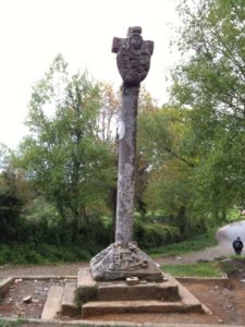
The cruceiro is, along with the granary, one of the most typical manifestations of popular architecture of Galicia. Its origin comes from the pre-Roman times, from that Castroite culture that was polytheistic and lived in towns like the one we have just been in Castromaior. For the Castro culture the roads and their crosses were very important places. They believed that once you died, your soul wandered along the roads and that, at their intersections, there were a series of gods who could “buy” it. For this reason, the relatives of the deceased performed at the crossroads a series of rituals, leaving also offerings to the gods. Sometimes these offerings were stones, which gave rise to the denominated milladoiros – accumulations of stones-, like the one that we saw in the Iron Cross of Foncebadón.
When the Romans conquered this territory, there was a syncretism that fused the gods of both cultures. Rituals at crossroads continued to be made, but instead of asking Lugh (Celtic) for protection, Mercury (Roman) was spoken. In addition, the Romans saw the crossings of roads as representations between the ordered (logos) and nature as chaos, so they were symbolically very important. That is why in many Roman mills found in what was Gallaecia there are inscriptions dedicated to those gods of the roads, called vials. In fact, among the 36 mills that were found with epigraphy of vials lares, throughout the territory of the Roman Empire, 28 were found in this area. It’s almost 77%!
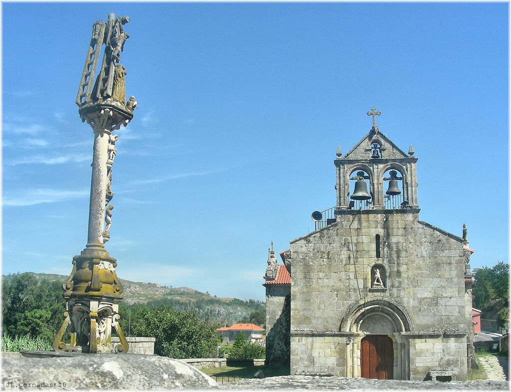
When Christianity was established as an official religion, the traditions that had been perpetuated for centuries did not change overnight – history has shown that the popular tradition is not changed by decree!. For consternation of the Church, the people continued to go to the crosses to do their “pagan” rituals. There were only two options, to prohibit and punish or, as was done, to adopt a solution that today can remind the contrary formulation of political catastrophe: “If we want everything to change, we need it to continue as it is. ” Pagan points were Christianized with a cross and the rituals were still allowed, but little by little they left to dedicate themselves or their children to Mercury, to pray for the Virgin or Jesus.
Today it is estimated that in Galicia there are more than 12,000 cruceiros. Generally they are formed by a base, a column and a cross at the top. Most of the time is carved Jesus on the cross. In fishermen’s villages, the Virgin is also often placed on the side of the cross looking at the sea, because she is the protector of the sailors.
Although the majority of the cruceiros are from the 18th to the 20th century, there are some that belong to the 14th century and others that constitute a true work of art, with multiple representations. The cruceiro of Lameiros, which we see next to A Prebisa, dates from 1670 and shows Jesus crucified at the top. The wear of the stone has erased much of the sculptural detail, but on the other side of the cross was surely either the Virgin or a representation of motherhood. At the base were carved elements of the Passion of Christ: pincers, nails, a ladder, the crown of thorns and, finally, a skull with bones representing the eternal triumph over death. Next to the cruceiro there is an old cemetery of pilgrims.
After passing the cross we arrive at Ligonde (km 38,5), which is a larger population than the previous ones. After that, the paved track makes a double curve a little abrupt and the yellow arrows indicate to cut through an inner path to the curve. This shortcut is a steep ramp of 100 m and the road surface is somewhat irregular. In Tournride we recommend going down the road if it has rained.
After the curve we cross a stream and arrive at Airexe (km 39,4) and, by the same track, to Portos (km 41). We enter the municipality of Palas de Rei, where we will follow Lestedo (km 42), Os Valos (42.6) and A Brea (km 44). At A Brea you cross the N-547, which passes through Palas de Rei. The Jacobean road runs a little more than 1 km along a path on the left shoulder of the road and then it diverts to enter Palas further south, by an uncomfortable track with many stones for cyclists which then becomes gravel.
Once in Palas de Rei (km 47) we can decide to make a last stop before starting the last 13 km to Melide. This locality was the last stop that Aymeric Picaud reflected in its Codex Calixtino before arriving at Santiago and it is said that its name comes from the Visigothic era, since the “palace” of the Visigoth king Witiza was here. With the arrival of the Jacobean pilgrimage, the village began to become more important and became during the Medieval and Modern Age in an important place for the nobility, who built great fortresses and pazos (palaces) in the area.
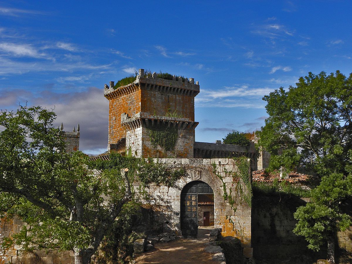
In fact, in the vicinity of Palas de Rei is the Pambre castle, one of the few castles that survived the Irmandiño Revolt of 1467 in which Galician peasants rose up against their masters and destroyed their castles. It was built in the fourteenth century and one of its functions was to serve as a point to preserve security on the Camino de Santiago. It has a huge tower of three floors, surrounded by a thick wall with four towers at the sides. Although it was about to become ruins, in the last years a great investment has been made to restore it and today it is possible to visit it – although the visit schedule varies according to the time. Going by bike we will arrive in half an hour (8.5 km) to the castle, in favorable way. In the map of stage we mark you where is the castle.
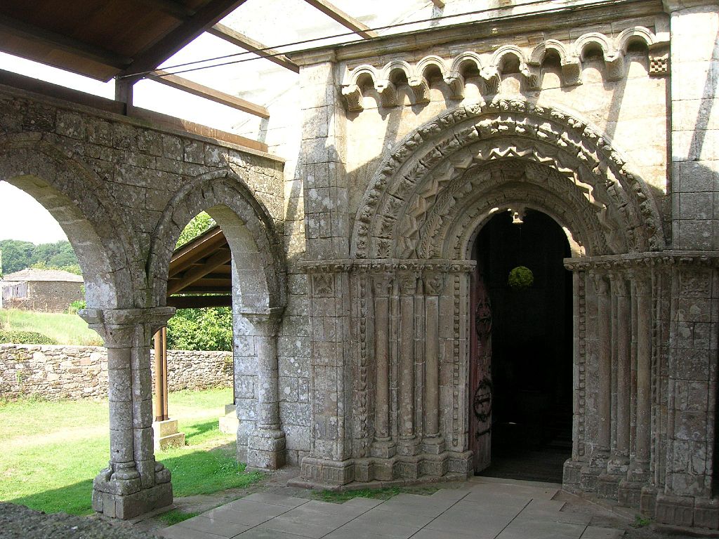
In Palas there is also another great example of Romanic architecture, which adds to the long list of those we have seen today, the church of Vilar de Donas. It is said that it could be part of a monastic group founded by women and later related more to the Order of Santiago. Some of his most important knights are buried here.
We leave Palas by an uncomfortable track with many stones, which may force us to rise from the saddle to safeguard the integrity of our buttocks. After crossing the N-547 by a crosswalk we continue along an paved track near the road, which leads again to the road after a few meters. From there the pedestrian path runs along a sidewalk or some paved track near the road that is shortly diverted to enter to the Carballal village. At the exit, the Jacobean signs indicate the crossing of the national road to pass to a gravel path on the left shoulder, which after a few meters leaves the national road to enter into the forest.
If from Carballal we continue by the N-547 we will go direct to O Coto (km 55,5), the provincial limit between Lugo and Coruña. In case it has rained we will avoid a section that can be quite cumbersome due to its road surface is muddy or natural stone (quite slippery), but which is one of the most beautiful of this stage.
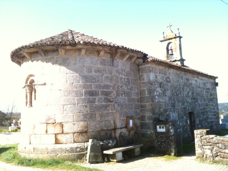
The paths lead first to San Xulián do Camiño (km 50), where you can see a Romanic church with a single nave and a large semicircular apse without divisions. By the asphalt we cross the Pambre river and then we enter to Pontecampaña (km 51), from where begins a nice section in which we follow paths between trees and sections of natural rocks, which we must face with patience since we may have to get off to prevent falls.
We will arrive at Casanova (km 52) and shortly afterwards to Porto de Bois, from where the path joins the small road LU-4001 to go to O Coto, where also the N-547 passes. At this point we change from province to enter to the last one that we will visit in the Camino de Santiago, A Coruña.
The footpath again distances itself from the national road to pass through Leboreiro, a village mentioned in the Codex Calixtino with the name Campus Leporaruis (“Hill of hares”). It has a great Jacobean tradition and in the 12th century it had a hospital for pilgrims. From the nucleus, it draws the attention its church, dedicated to X, and the cabazo that is conserved in front of it.
A cabazo is a granary – depending on the area of Galicia the granaries have different names, such as piorno, cabana o paneira– less elaborated. Since they are made with wicker and straw, there are not many nowadays that are too old and this one is an exception –although it’s rehabilitated-.
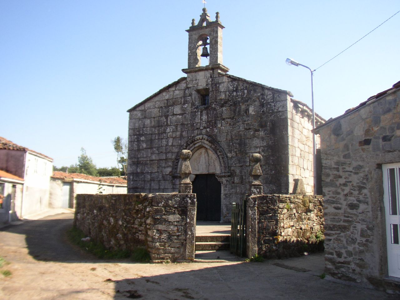
Church Santa María in Leboreiro (Picture given by José Antonio Gil Martinez on Flickr under the following conditions)
The church of Santa María de Leboreiro is of Romanic-Gothic transition. On the main gate there is a carving of the Virgin holding the Child, which is related to a legend of the locality. It is said that the sculpture of the Virgin that is kept inside the temple was found by a miracle in a nearby fountain, reason why this church was constructed to safeguard it. Every night the sculpture moved to other places and returned to the fountain where it had been found, until a local sculptor carved this image in the tympanum of the door and the sculpture of the Virgin remained forever in its place. If you have the opportunity to enter to the church, in Tournride we recommend you to do it, since in addition to the carving, you can see the impressive colorful murals that are preserved in the north wall.
After leaving Leboreiro you pass by Disicabo and then enter to an industrial estate that belongs to Melide, where it has been tried to make the route more pleasant to the pilgrims building a park with trees in their honor – although the image is still not completely inspiring -.
After crossing the industrial estate, the road and the pedestrian path separate each other again to visit the last village of this stage, the picturesque village of Furelos (km 58.5) on the banks of the homonymous river. The road up there is by mountain that, as in previous sections, will be a big quagmire if it has rained that day.
The entrance to Furelos is made by a medieval dromedary bridge, with four large arches. It is the largest and the best preserved of the Middle Ages on the French Way in Galicia. After crossing it, the village is crossed by its main cobblestone street, which passes next to a church dedicated to San Juan. Although its origin is medieval, it is clear that it has enough later additions.
After passing Furelos it’s very little to reach our end of stage. We just have to follow a track that intercalates gravel and asphalt to reach Melide, where we can enjoy a good portion of pulpo á feira and rest for the great emotion that awaits us tomorrow: the arrival in Santiago de Compostela.
